Mount Rainier Area Hikes
27 trails in Mount Rainier Area, ranked by popularity. Each page shows current weather, road, and trail conditions.
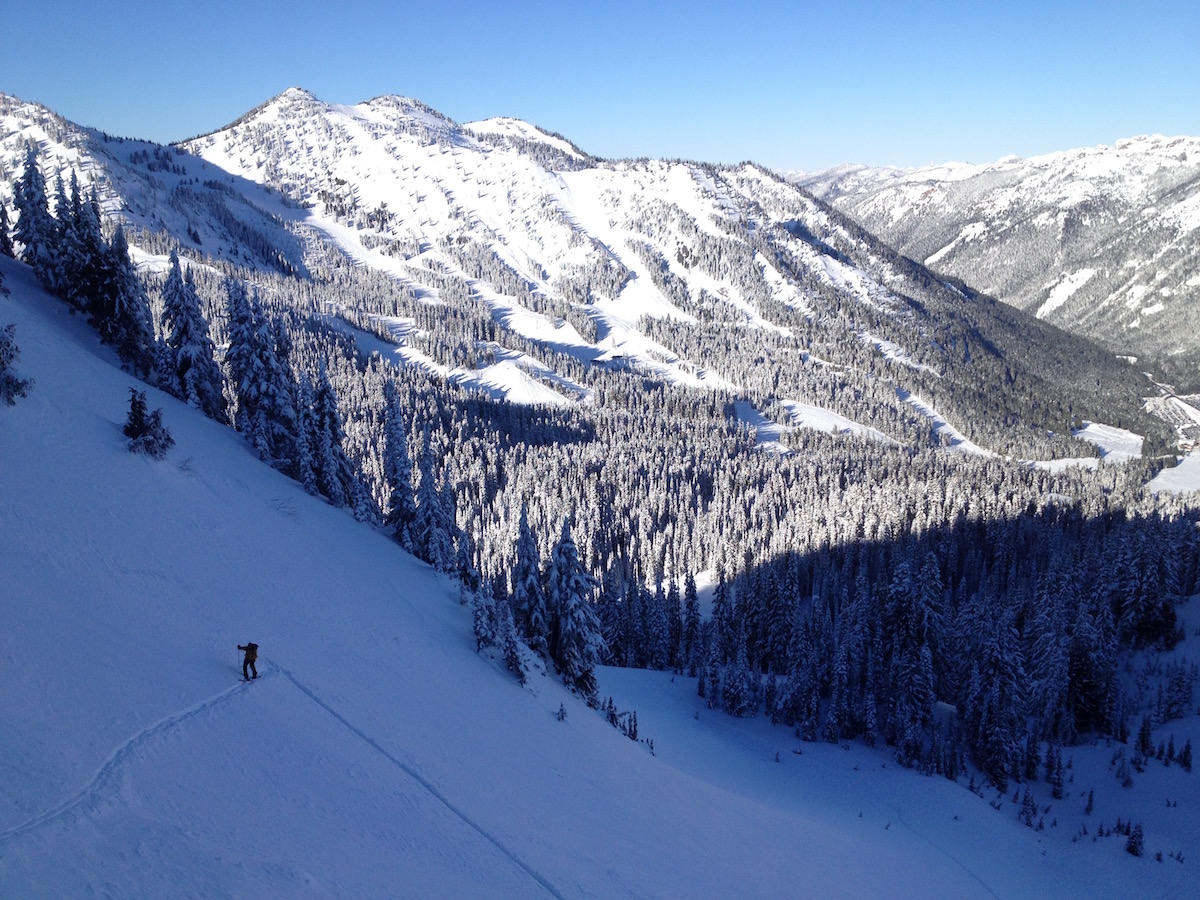
InterglacierOne of the longest ski descents on Mount Rainier, 4,000 vertical feet of open glacier skiing off Steamboat Prow.
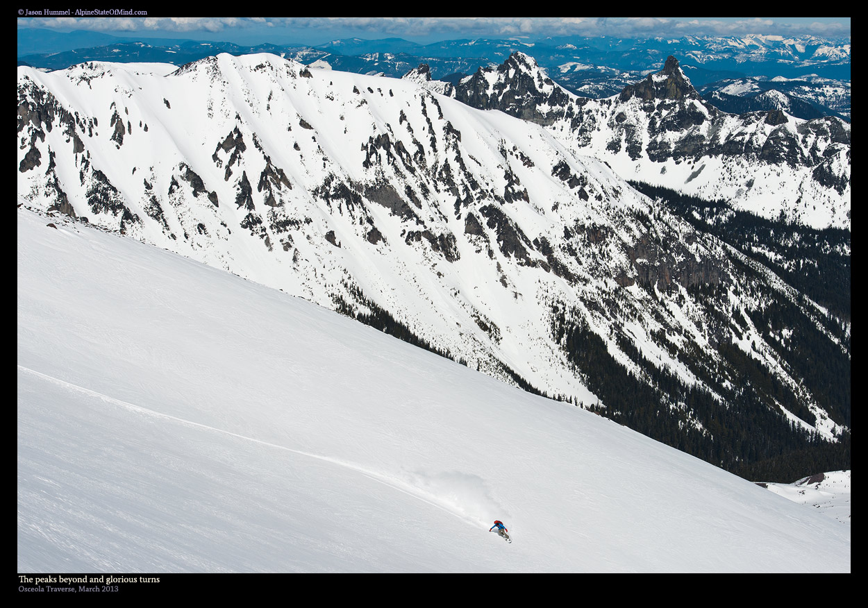
Osceola TraverseA four-day, 36-mile ski traverse of Rainier's north side, linking Carbon River to White River across three glaciers.
Scenic ViewsCamping
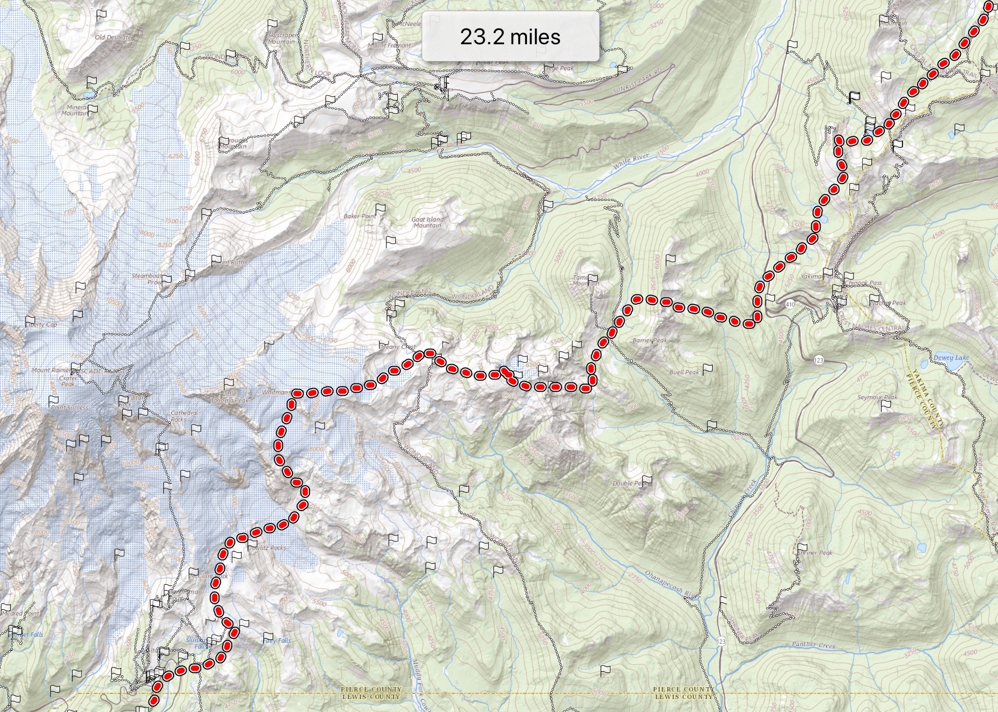
Paradise to Crystal Mountain TraverseA three-day ski traverse from Paradise to Crystal Mountain, crossing glaciers and couloirs on Rainier's east side.
Scenic ViewsCamping
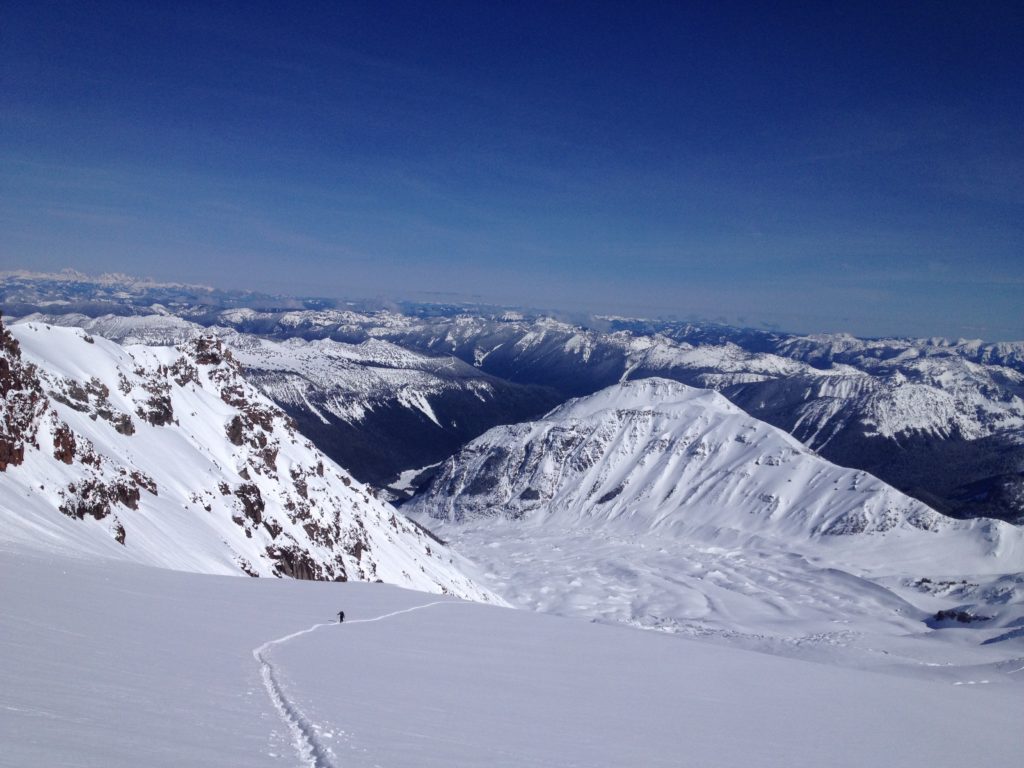
Sheep Lake CouloirA north-facing, 1,000-foot couloir off Shepherd Peak that holds powder when everything else has been scoured.
SummitLake
Dogleg PeakBase camp at Henskin Lake and lap Dogleg Peak's powder lines all day, 10 minutes from tent to summit.
Scenic ViewsCamping
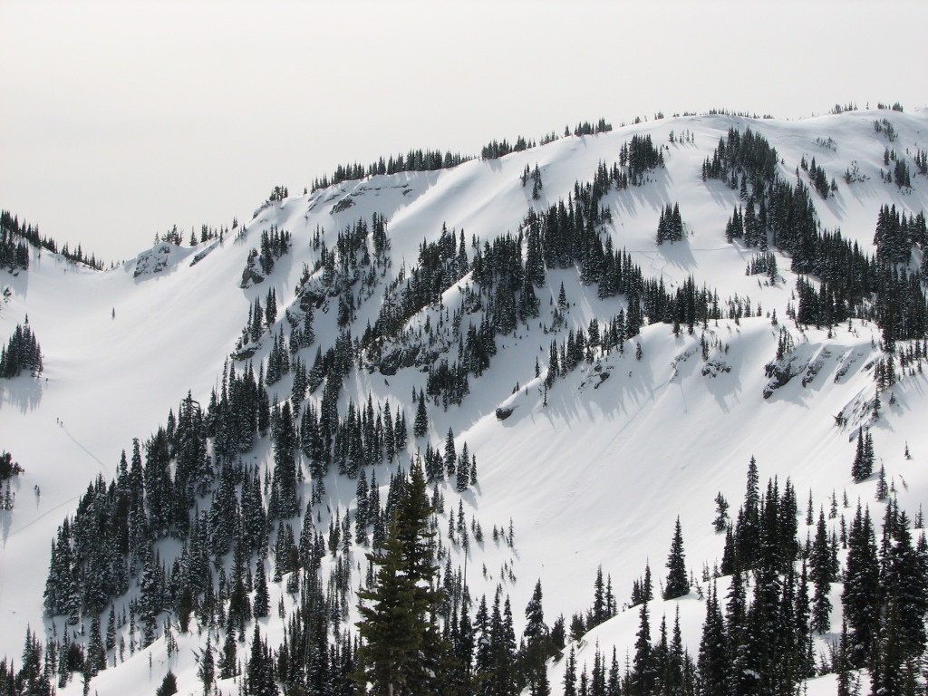
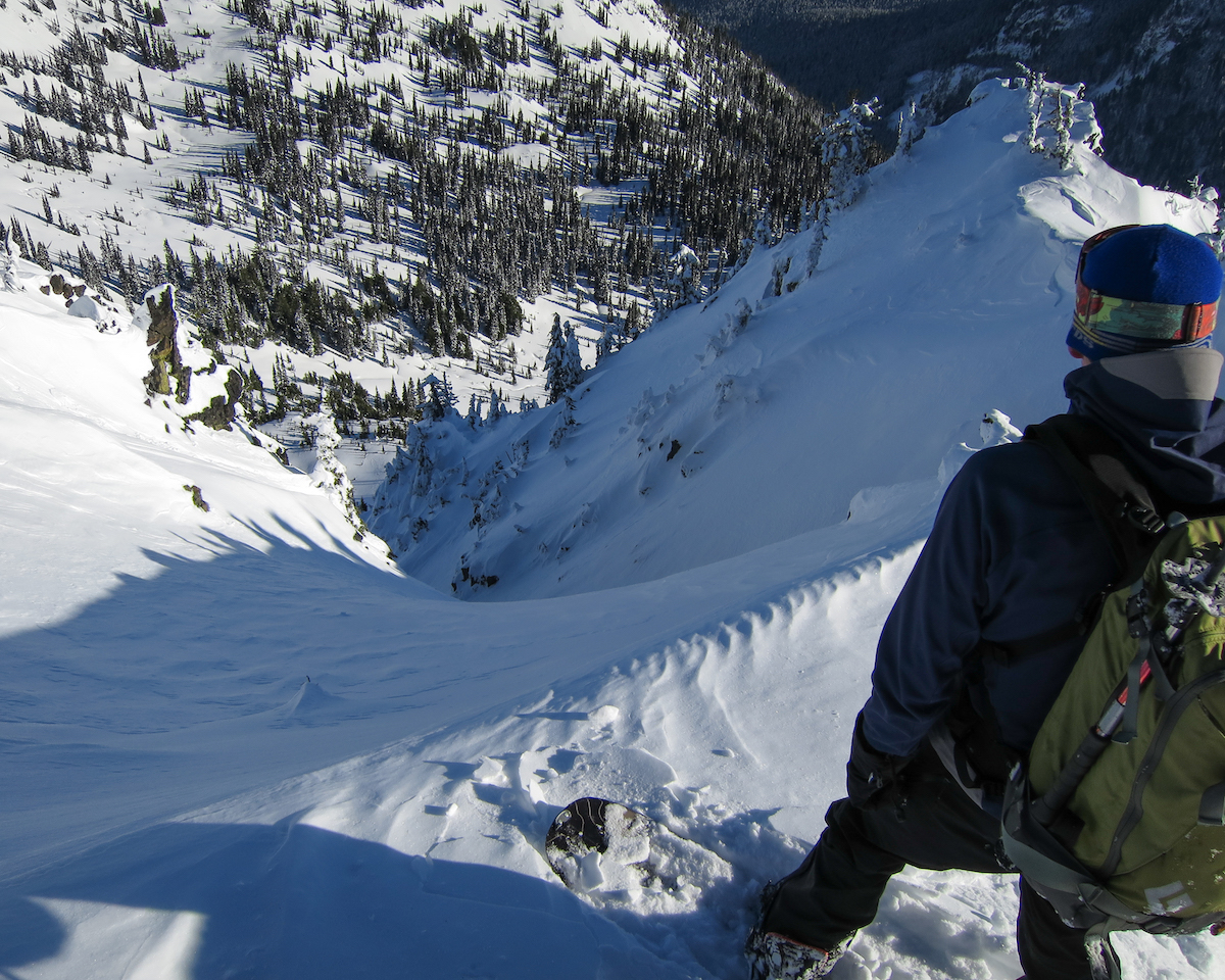
Lake Basin GulliesNortheast-facing gullies off Crystal's crest that hold neck-deep powder when everything else is wind-scoured.
Scenic Views

Eastside TrailA 26-mile traverse through every forest zone on Rainier's quiet eastern side, from subalpine meadows to ancient lowland groves.
LakeWildflowersWildlife

Silver Falls LoopOld-growth forest and a roaring river waterfall on one of Rainier's earliest snow-free trails.
RiverWaterfallCamping
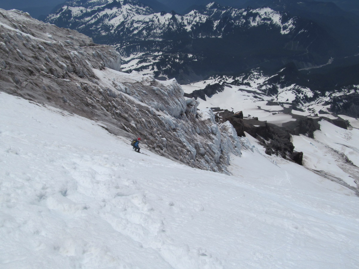
Kautz GlacierAn 11,200-foot vertical descent from Rainier's summit through glacier terrain to the valley floor, one of the longest ski runs in the Cascades.

Copper Creek Hut SnowshoeA gentle snowshoe through groomed winter trails to a cozy backcountry hut with Rainier views.
Scenic ViewsWildlifeKid Friendly

Snow Bowl Hut SnowshoeA steep winter climb to a beloved backcountry hut with Rainier views and community spirit.
Scenic ViewsDog Friendly

Yurt SnowshoeThe longest and most remote overnight in the MTTA hut system, reaching a secluded yurt through 10 kilometers of winter forest.
Scenic ViewsDog FriendlyCamping

High Hut SnowshoeA steep snowshoe climb through forest to a ridge-top alpine hut with panoramic views of Rainier, Adams, St. Helens, and the Olympics.
Scenic Views

Snoquera Falls LoopA short forest loop to a fantail cascade that rewards spring visits with thundering snowmelt and carpets of trillium.
WaterfallDog Friendly

Nisqually Vista Loop
Scenic ViewsWildflowersWildlife
Government MeadowsA short PCT walk to a wide subalpine meadow and the Mike Urich Cabin near Naches Pass.
Carbon River to Ipsut FallsA flat former road through Carbon River rainforest to Ipsut Falls and the toe of the Carbon Glacier — currently cut off by a closed bridge.
RiverWaterfallOld Growth
Union CreekThree waterfalls in two miles on a fire-recovering trail off Highway 410, with the burn scar still rewriting the landscape.
WaterfallRiver
Suntop LookoutA short ridge walk to a fire lookout with Rainier filling the southern horizon and the Olympics on a clear day.
Muir SnowfieldThe classic Mt. Rainier ski tour — Paradise to Camp Muir, 4,600 feet of vertical on the south flank of the volcano.
Whitman Crest via Fryingpan GlacierA summer ski tour up the Fryingpan Glacier on Mt. Rainier's east side, with the open crevasses and bare ice that come with August skiing.
Emmons Glacier to TerminusA continuous ski descent down the largest glacier in the lower 48 — Mt. Rainier's Emmons, top to terminus.
Mt. Rainier Tahoma GlacierA west-side ski descent of Mt. Rainier — summit via DC, twelve thousand feet down the Tahoma to Westside Road.
Paradise GlacierAn alternative ski descent on Mt. Rainier's south side — climb the Muir Snowfield, drop the smoother Paradise Glacier on the way down.
Edmunds HeadwallA steep northwest headwall on Mt. Rainier — Liberty Cap approach, plum sustained skiing down the Edmunds, exit via South Mowich and Puyallup.
Glacier Basin and InterglacierA spring ski tour from White River up Glacier Basin and the Interglacier to Steamboat Prow.
Mt. Rainier — The Finger via NisquallyA Mt. Rainier summit ski via Ingraham Direct, dropping the Finger between the Upper Nisqually and Wilson Glaciers.