Interglacier
Mount Rainier AreaBest Jan–May
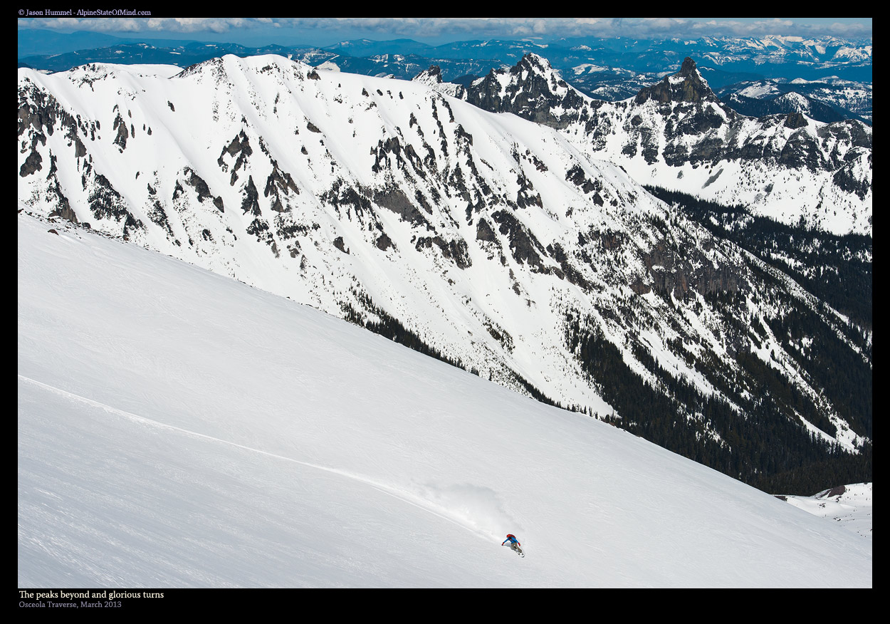
One of the longest ski descents on Mount Rainier, 4,000 vertical feet of open glacier skiing off Steamboat Prow.
About This Trail
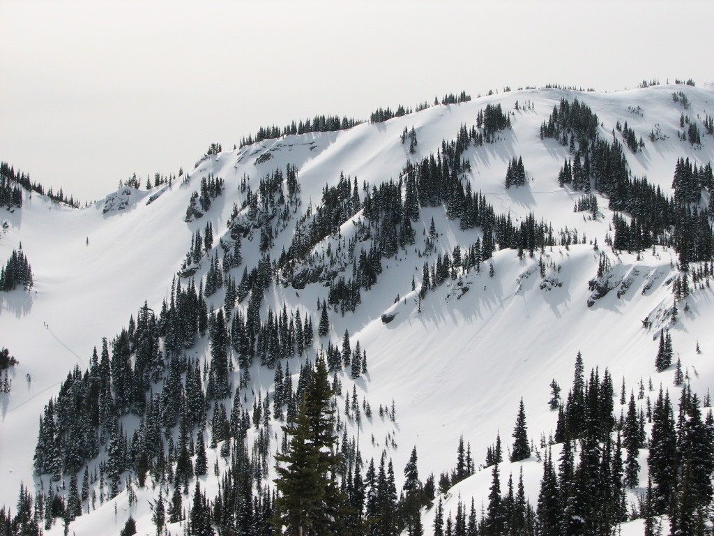
The Interglacier sits between Mount Ruth and Steamboat Prow on Mount Rainier's northeast flank, offering one of the longest continuous ski descents in the park. The route follows the Emmons Glacier approach from White River, climbing through glacial terrain to nearly 9,500 feet before dropping 4,000 vertical feet of open skiing.
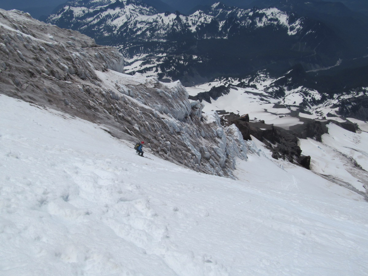
The approach begins at White River Campground at 4,400 feet. In winter, White River Road is unplowed, adding 9 miles of snowmobile or ski travel before the trailhead. From the road's end, the route follows Glacier Basin Trail for 2 miles, then departs to cross the White River and ascend the lower Emmons moraine. The skin track follows the north side of the Emmons Glacier, climbing steadily through expansive glacial terrain toward Camp Sherman at 10,200 feet. The final push reaches Steamboat Prow, where the Interglacier begins its northeast-facing plunge.
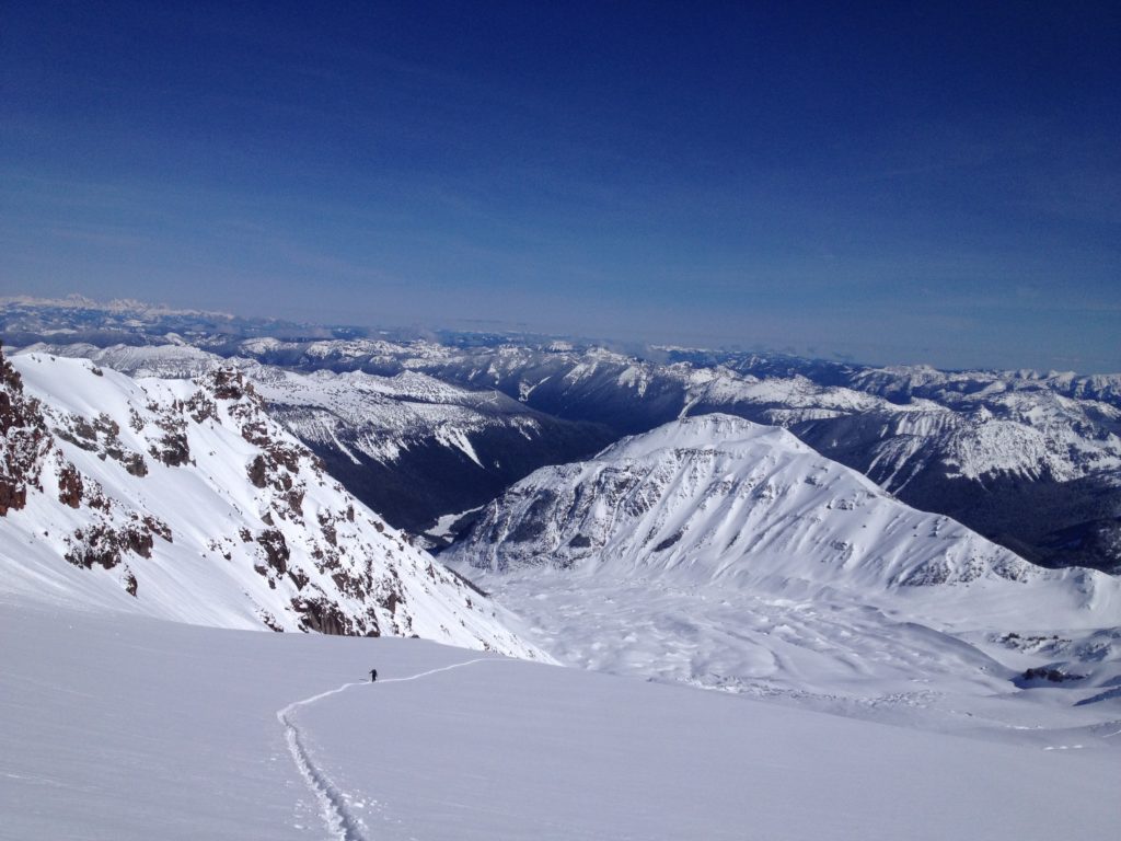
The descent is sustained and open, with 4,000 feet of uninterrupted skiing above treeline before the terrain narrows back toward Glacier Basin. Crevasses are minimal on the north side until the top 500 feet. Stay well clear of Mount Ruth's south face, which funnels avalanche debris across the approach. The exit through Glacier Basin involves bootpacking sections where snow coverage thins.
This is a midwinter objective requiring serious commitment. The 16-mile approach, glacial terrain, and remote setting demand self-sufficiency and good weather judgment. In return, the descent delivers some of the biggest, most open skiing on Rainier, with panoramic views of the Emmons Glacier and surrounding peaks in complete solitude.
Forecast
Astronomy
Trail Conditions
Scorecard
Safety & Considerations
Persistent Hazards
- ATES Complex: glacial terrain with crevasses in upper 500 feet
- Mount Ruth south face funnels avalanche debris across the approach
- 16-mile approach in winter; self-rescue capability essential
- Glacier travel required; rope, crevasse rescue gear mandatory above Camp Sherman
- Limited winter daylight constrains timing
- Bootpacking required on exit through Glacier Basin
Getting There

White River Campground parking area at 4,400 feet. In winter, access requires snowmobiling 9 miles of unplowed White River Road within the park, plus 7 miles outside the park boundary.
From White River Campground, follow Glacier Basin Trail for 2 miles, then cross White River and ascend the lower Emmons moraine. Skin up the north side of the Emmons Glacier toward Camp Sherman and Steamboat Prow. Stay well away from Mount Ruth's south face due to avalanche exposure.
Early start required given the 16-mile approach. Plan 6-7 hours for the ascent. Winter daylight is limited; turn around if timing falls behind.
Similar Hikes