Edmunds Headwall
Mount Rainier AreaBest May–Jul
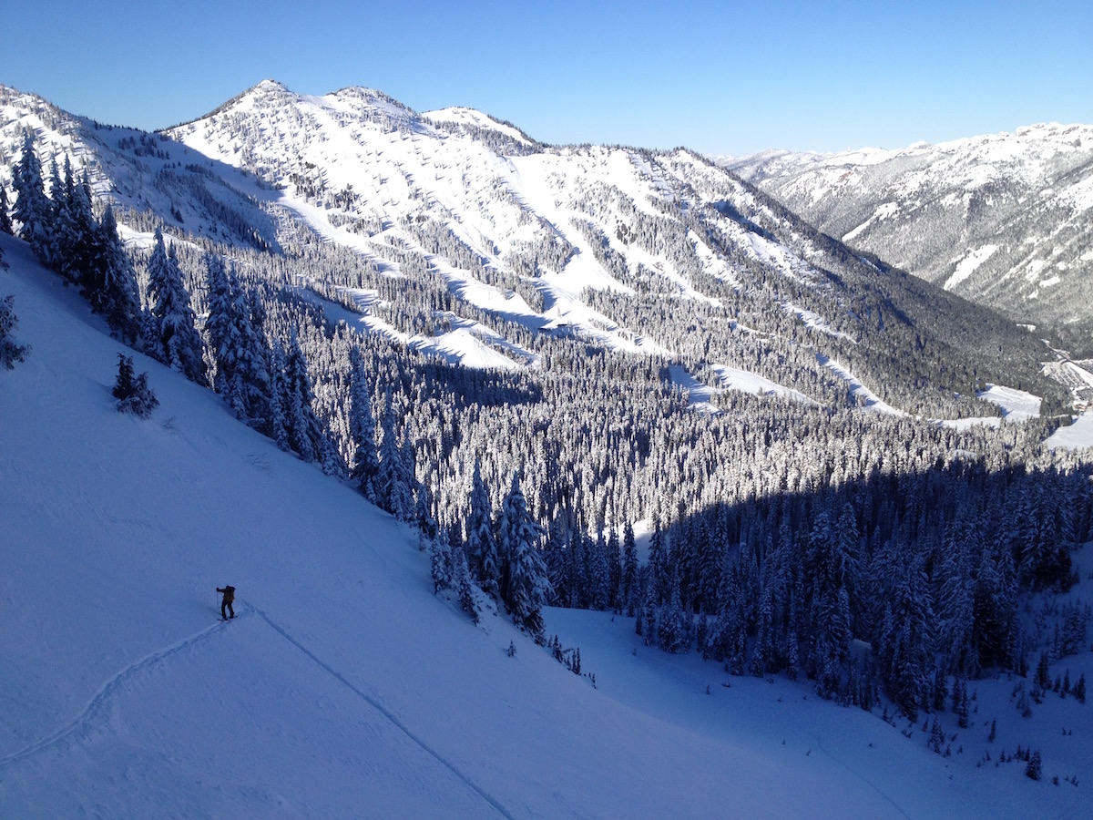
A steep northwest headwall on Mt. Rainier — Liberty Cap approach, plum sustained skiing down the Edmunds, exit via South Mowich and Puyallup.
About This Trail
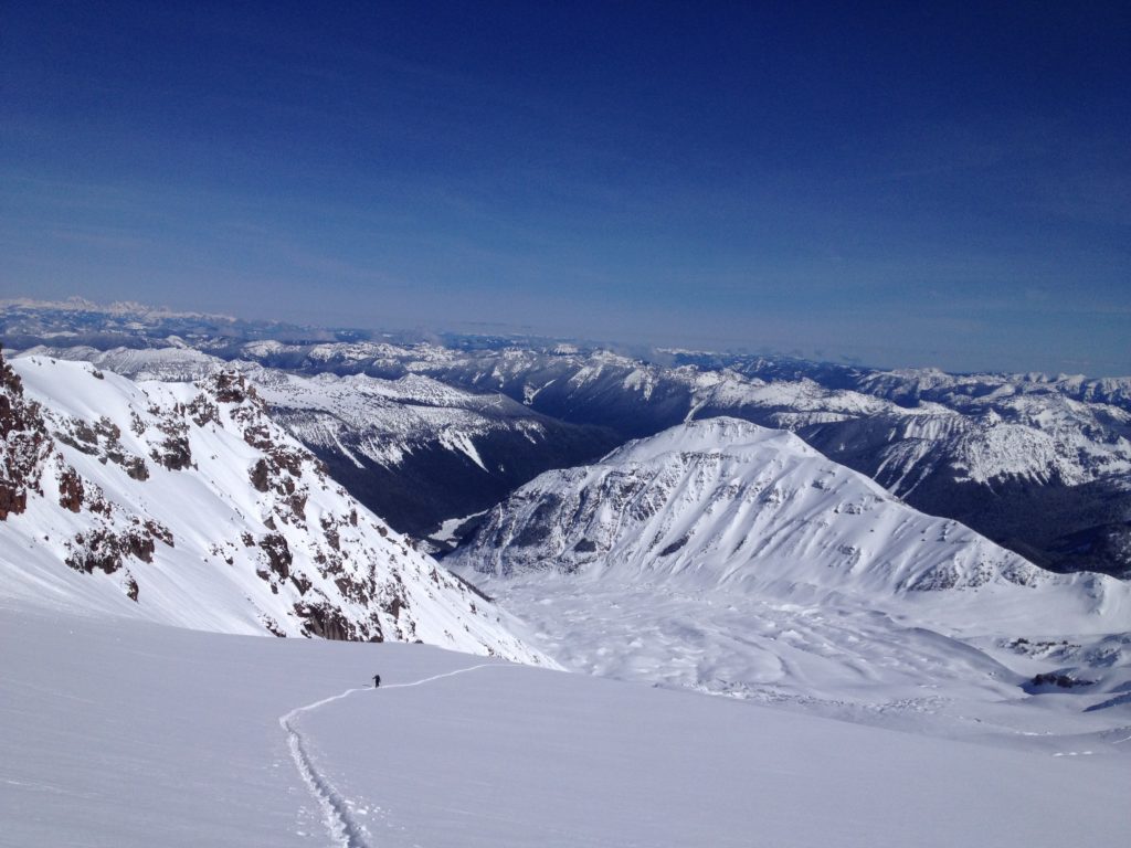
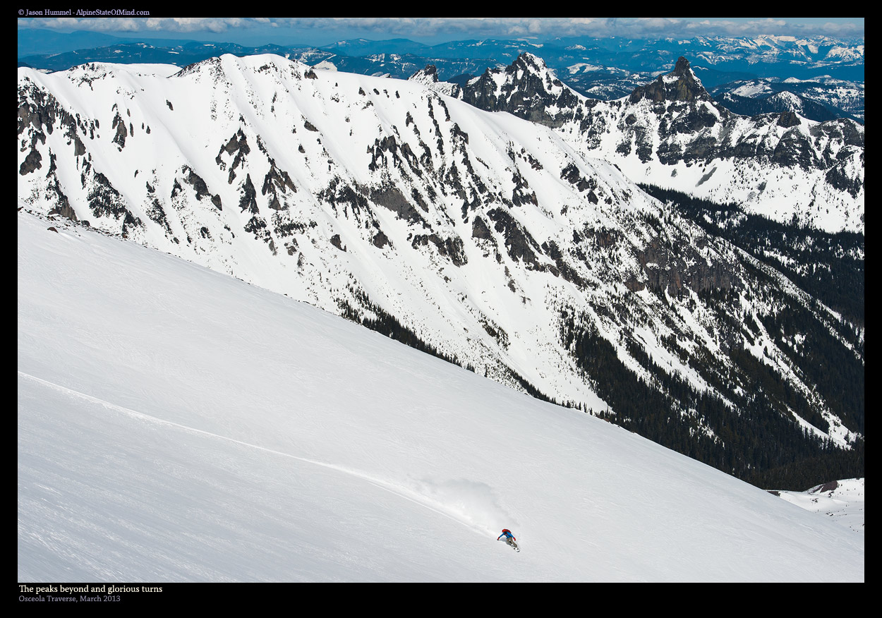
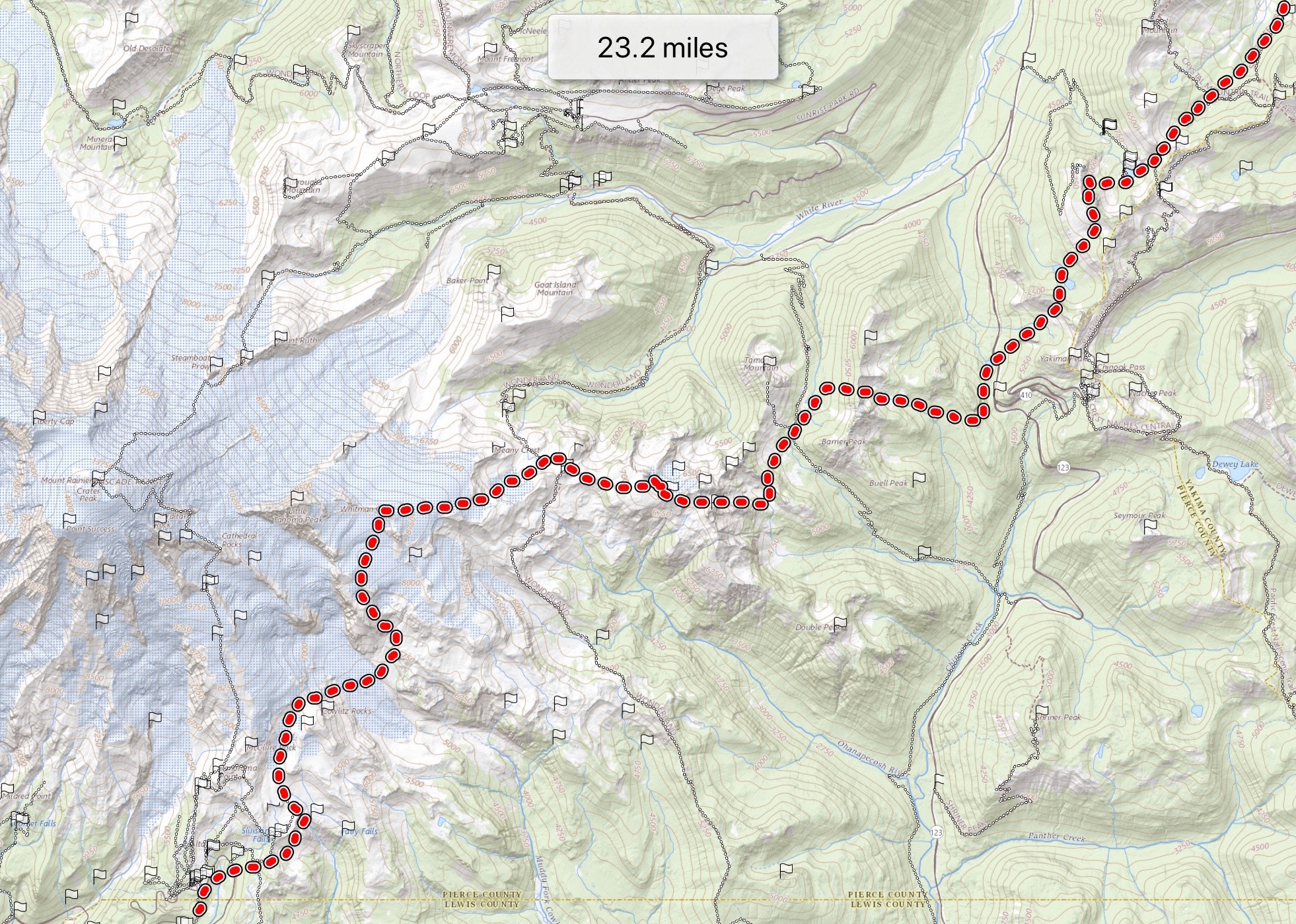
The Edmunds Headwall sits on Mt. Rainier's northwest face, dropping from the Liberty Cap area down a sustained steep snow line into the Edmunds Glacier and onward through the South Mowich and Puyallup Glaciers. Standard execution climbs the DC route from Paradise to Columbia Crest, traverses to Liberty Cap, then drops the headwall — three thousand five hundred feet of plum, sustained, and steep skiing on conditions that range from firm snice early to corn lower down.
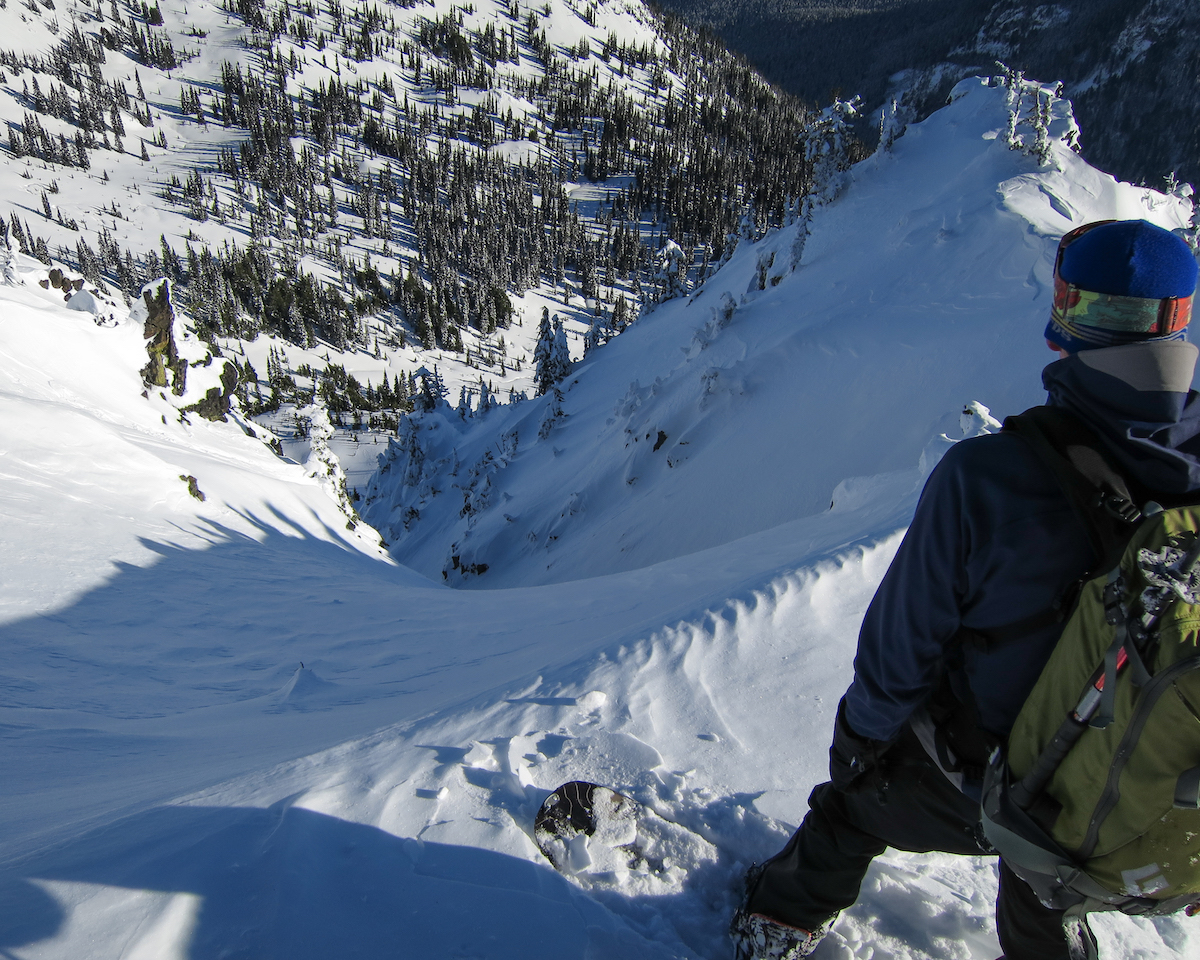
The route demands the full ski mountaineering toolkit. Glacier travel through the Columbia Crest, Liberty Cap, Edmunds, South Mowich, and Puyallup glaciers means rope team navigation, crevasse rescue gear, and constant attention to objective hazards from hanging ice. The exit slopes carry wet-slab avalanche risk through the descent, and whumphs in the lower snowpack signal unstable conditions.
Mowich Lake Road is currently closed, complicating the standard exit. Most parties now shuttle to Westside Road for pickup, adding miles to the trip. June and July deliver the best windows historically — corn cycles set up well, but objective hazards open as the season progresses. Climbing permit and wilderness permit required from Mt. Rainier National Park.
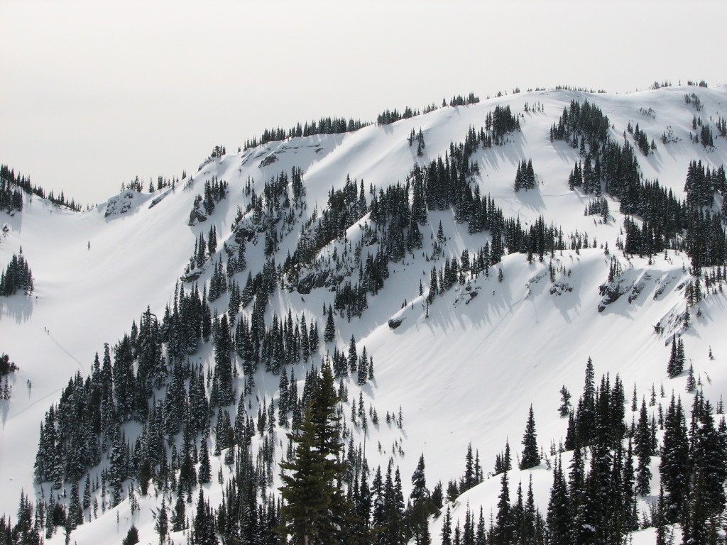
Steep northwest-facing headwall, sustained throughout, with firm snice early and corn lower in the Edmunds and Mowich glaciers. ~3,500 ft on the main headwall, more on the multi-glacier exit.
DC route skin track up to Columbia Crest set up by climbing parties. Trail-breaking on the Liberty Cap and headwall approach. Bootpack on the steepest sections.
Seasonal Highlights
Astronomy
Trail Conditions
Scorecard
Few parties attempt the Edmunds in any season. Most Rainier skiers stick to the standard south-side routes.
Safety & Considerations
Today's Hazard
- Strong sun — sunscreen, hat, and sunglasses recommended
Persistent Hazards
- Sustained steep skiing on the headwall — firm snice early, no-fall consequence
- Objective hazards from hanging ice and seracs above the route
- Wet slab avalanche risk on exit slopes after warm cycles
- Whumphing in lower snowpack signals unstable conditions — abort if seen
- Multi-glacier descent with rope-team work mandatory throughout
- Mowich Lake Road closure complicates exit — confirm shuttle options before driving
Getting There

Paradise lot for the start. Westside Road shuttle for exit (Mowich Lake Road currently closed). National Park Pass required.
Similar Hikes