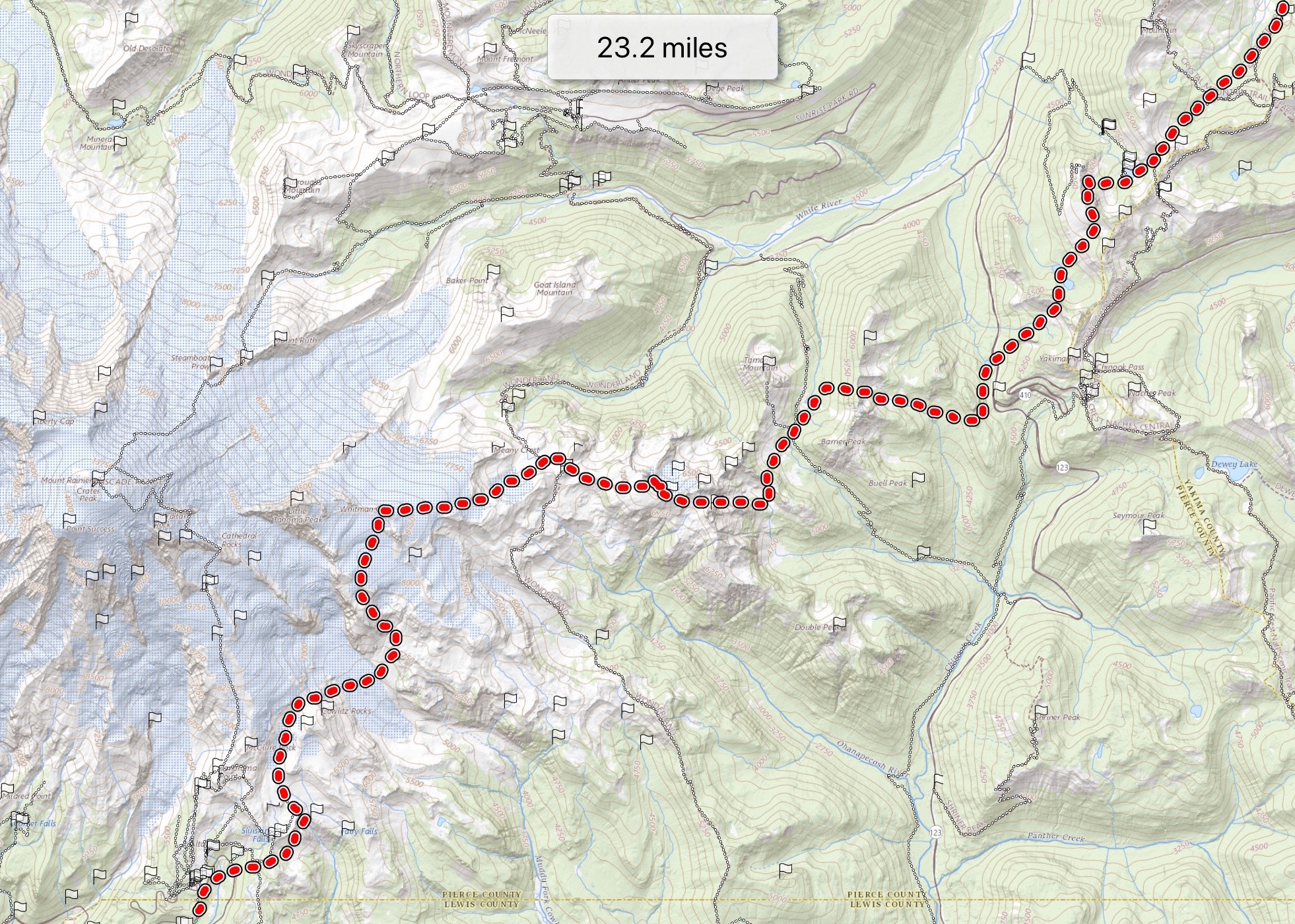
Emmons Glacier to Terminus
Mount Rainier AreaBest May–Jul
A continuous ski descent down the largest glacier in the lower 48 — Mt. Rainier's Emmons, top to terminus.
About This Trail
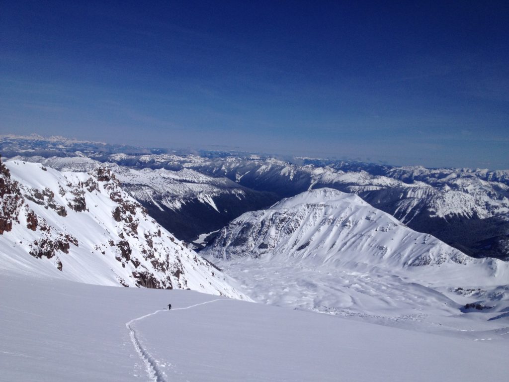
Skiing the Emmons Glacier from a high point near the summit down to the glacier's terminus is one of the longest continuous ski descents in the lower 48 — over nine thousand feet of vertical when conditions cooperate. The standard approach uses the Glacier Basin trail from White River campground in Mt. Rainier National Park, climbing the Emmons Moraine to set up the line. The standard high point sits near thirteen thousand five hundred feet, just below the true summit.
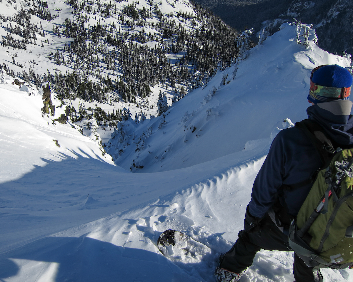
The route ascent threads the Emmons-Disappointment Cleaver ramp system, with rope team navigation through the upper crevasse fields and a serac passage near eleven thousand feet. The descent rolls through low-angle corn on the lower glacier, firm windboard above, and a series of crevasse and 'schrund navigation problems on the way down. Below the snowline at the terminus, the trip finishes with rock and moraine carries and a Glacier River crossing.
This is a serious ski mountaineering objective — full glacier travel, weather exposure at altitude, and a brushy alder bash on the exit. June is the standard window — colder freezing levels keep the upper snow stable, and the Emmons is at its best before midsummer opens the crevasse fields. Wilderness permit required from Mt. Rainier National Park for upper mountain travel.
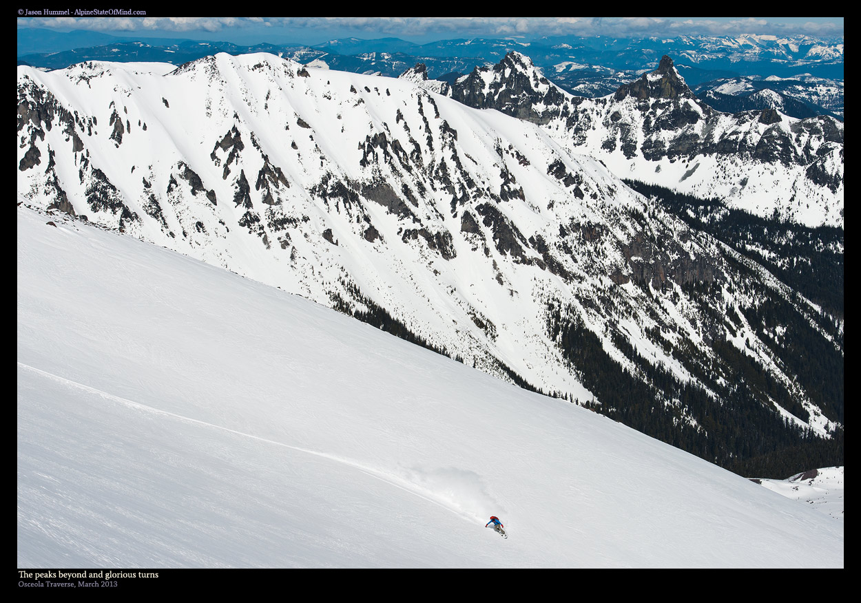
Continuous glacier skiing top-to-bottom on the Emmons. Firm windboard above 12,000 ft, low-angle corn on the lower glacier. Crevasse field navigation throughout. 9,500+ ft vertical descent.
Skin track on the standard Emmons-DC ramp set up by climbing parties through May-July. Bootpack above the upper transitions.
Seasonal Highlights
Astronomy
Trail Conditions
Scorecard
Few parties attempt the full top-to-terminus run in any season. Most Emmons skiers stop high or turn around at Camp Schurman.
Safety & Considerations
Today's Hazard
- Strong sun — sunscreen, hat, and sunglasses recommended
Persistent Hazards
- Glacier travel with crevasse rescue gear and rope team mandatory throughout
- Serac passage near 10,900 ft — timing matters for stability
- 'Schrunds and bergschrunds at lower transitions — line choice critical
- Wind exposure at altitude — 30-35 mph events shut down the upper mountain
- Glacier River crossing on the exit
- Brush and alder bash through lower exit
- Wilderness permit required from Mt. Rainier NP for upper mountain
Getting There

White River campground / Glacier Basin trailhead. National Park Pass required. White River road closes seasonally — check NPS for opening dates.
Similar Hikes