Eastern Washington Hikes
60 trails in Eastern Washington, ranked by popularity. Each page shows current weather, road, and trail conditions.

Dishman Hills Conservation Area - Flying L TrailPonderosa pine savanna and early-season wildflowers on the eastern edge of Spokane Valley.
Forest TrailWildflowersWildlife

Big Tree Botanical AreaA short interpretive walk past 900-year-old western larch trees in the Colville National Forest.
Forest TrailLakeDog Friendly

South Hill BluffA sprawling network of bluff trails above Hangman Creek with spring wildflower displays and city-edge solitude.
WildflowersWildlifeDog Friendly

Riverside State Park - Trail 25Twenty-five miles of singletrack winding through Spokane's biggest park along the Spokane River.
Forest TrailRiverScenic Views

Noisy CreekA rugged Selkirk creek trail that rewards persistence with old-growth forest and mountain views above Sullivan Lake.
LakeOld GrowthScenic Views

Mount Spokane State Park - Trail 110The backbone trail of Mount Spokane State Park, climbing through old growth to a high junction where three peaks fan out.
Forest TrailOld GrowthWildflowers

Mount Spokane - Trail 100Shaded forest walking with logging-era history, 30 minutes from Spokane.
Forest TrailOld GrowthWildflowers
Mount Spokane State Park - Trail 260 (Snowshoe)
WildlifeDog Friendly

Trautman Ranch Conservation Area

Dishman Hills Conservation Area - GlenroseA steady climb through Spokane's South Hill wildlands to panoramic valley views.
Forest TrailScenic ViewsWildflowers

Antoine Peak Conservation Area - Emerald Necklace
WildlifeDog Friendly

Antoine Peak Conservation Area
Forest TrailSummitScenic Views

Liberty Lake Regional Park - Split Creek LoopA gentle creek-side loop through forest and cascades at the edge of Spokane's best regional park.
Forest TrailWildflowersWildlife

West Butte Creek
Forest TrailOld GrowthRiver

East Butte Creek
Forest TrailOld GrowthRiver

Mount Spokane State Park - Trail 130
Forest TrailOld GrowthScenic Views

Panjab TrailWildflower ridges and creek-bottom shade on the classic Blue Mountains loop connector.
RiverScenic ViewsWildflowers

Umatilla Rim Trail
Wildflowers

Saltese Uplands

Kettle Crest TrailEastern Washington's premier long-distance ridge walk, 44 miles along the spine of the Kettle River Range with views from the Cascades to the Rockies.
SummitWildflowersWildlife

Kettle Crest NorthTwenty-nine miles of high ridgeline through twelve named peaks in Washington's least crowded mountain range.
Forest TrailOld GrowthSummit

Roundup Park
RiverWildlifeDog Friendly

Steptoe ButteA 400-million-year-old quartzite summit rising from the Palouse, with the best panoramic view of rolling wheat country in the state.
SummitScenic ViewsWildlife

Little Spokane Wildlife Area: Rustler's Gulch - Holly Road Loop
Forest TrailWildflowersWildlife

Mica PeakSpokane's backyard summit, with ponderosa forest giving way to sub-alpine brush and Palouse views.
Forest TrailSummitScenic Views

Snow PeakFive easy miles along the Kettle Crest to a rentable summit cabin with wood stove and mountain views.
Forest TrailScenic ViewsWildflowers

Geophysical Trails
Dog Friendly

Antoine Peak Conservation Area - Summit Loop
SummitScenic ViewsDog Friendly

Mount Spokane State Park - Middle Trail 140
Forest TrailOld GrowthSummit

Mount Spokane State Park - Lower Trail 140
Forest TrailOld GrowthSummit

Mount Spokane State Park - Upper Trail 140
Forest TrailOld GrowthSummit

Kamiak ButteA forested island rising from the Palouse wheat fields, with a summit picnic table and 360-degree views of rolling farmland.
SummitScenic ViewsWildflowers

Mount Spokane State Park - Entrance Loop
Forest TrailOld GrowthWildflowers

St. George's Trail (Trail 503)
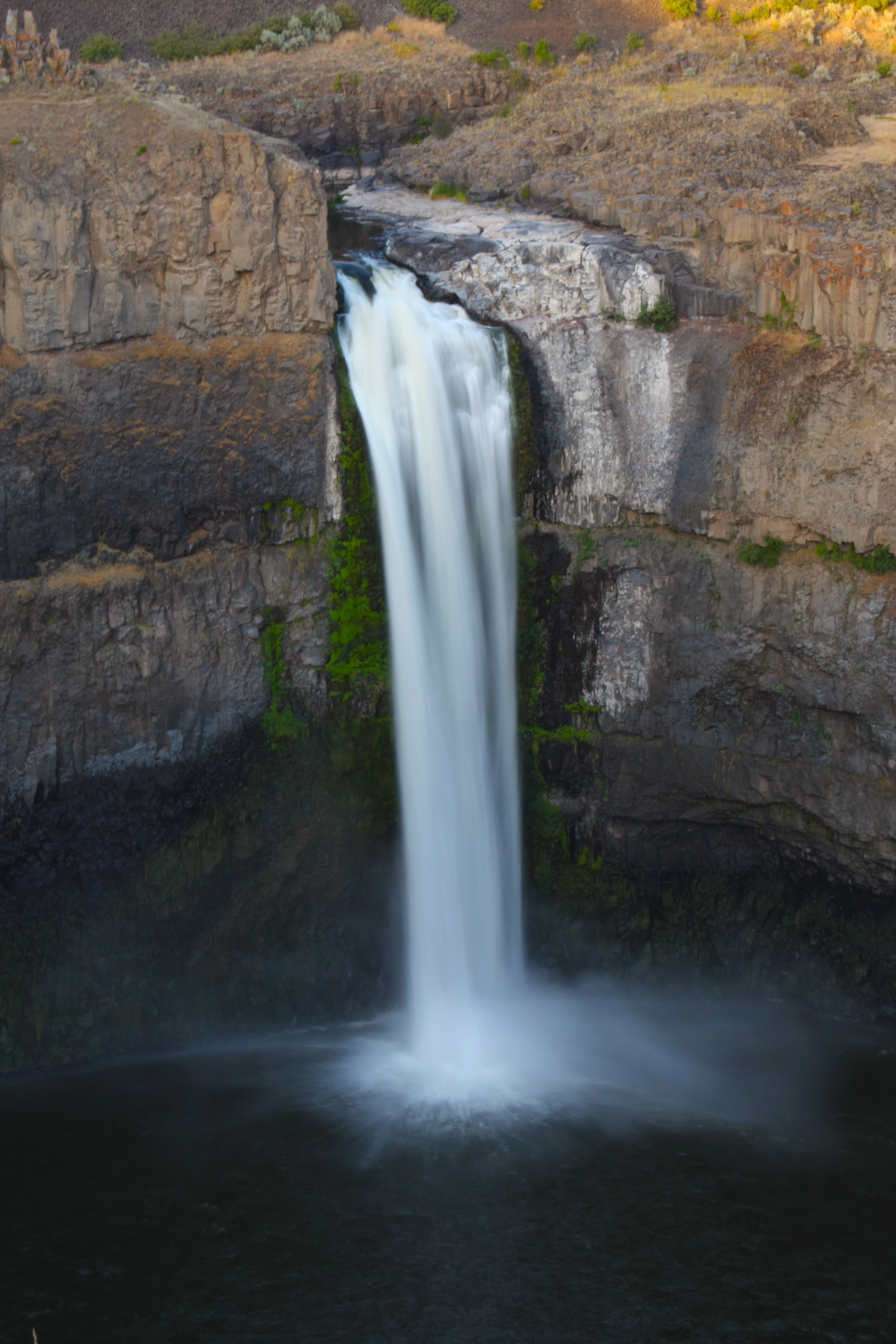
Palouse FallsWashington's official state waterfall drops 200 feet into a basalt amphitheater carved by the Missoula Floods.
RiverWaterfallWildflowers

Turnbull National Wildlife RefugeFlat, paved loop through ice-age scablands with 200-plus bird species, elk, and moose, just 30 minutes from Spokane.
Forest TrailLakeWildflowers

South Fork Silver Creek Trail to Gunsight Pass
Forest TrailOld GrowthScenic Views

Slavin Pond Loop
LakeWildlifeDog Friendly

Sherlock Peak
Forest TrailSummitRiver

Shedroof DivideTwenty-three miles of ridge walking through eastern Washington's only designated wilderness, tagging summit after summit.
Forest TrailOld GrowthSummit

Salmo-Priest LoopWashington's wildest corner: old-growth cedar groves, ridgeline traverses, and the state's only habitat for grizzly bears and woodland caribou.
Old GrowthSummitRiver

Rattlesnake TrailA relentless climb out of the Tucannon canyon into wildflower ridges and deep Blue Mountains solitude.
SummitScenic ViewsWildflowers

Palisades ParkBasalt rimrock above a hidden canyon with seasonal waterfalls, right inside Spokane city limits.
Forest TrailScenic ViewsWildflowers

North Fork Sullivan CreekA relentless Selkirk climb to Crowell Ridge through the least-visited corner of the Salmo-Priest Wilderness.
Forest TrailSummitScenic Views

North Fork Silver Creek TrailThe scenic long route to Abercrombie Mountain through larch forest and high meadows.
Forest TrailOld GrowthSummit

Mount Spokane State Park - Trail 131
Forest TrailOld GrowthScenic Views

Mount Spokane State Park - Three Peaks LoopWashington's largest state park packed into one ambitious loop that tags three summits and a century of backcountry history.
Forest TrailOld GrowthSummit

Little Pend Oreille National Wildlife Refuge - Mill Butte
Old GrowthSummitRiver

McKenzie Conservation Area
Forest TrailLakeScenic Views

Waikiki Springs Nature Preserve
Forest TrailRiverWildflowers
Little Spokane River Natural Area - Knothead Loop
Forest TrailSummitRiver

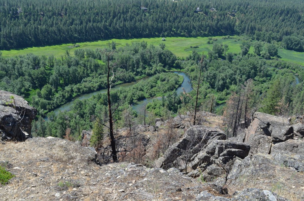
Jackson CreekOld-growth creek corridor linking two states through the heart of the Salmo-Priest Wilderness.
Forest TrailOld GrowthScenic Views

Indian Creek Community Forest - Arboretum Loop Trail
Forest TrailWildflowersWildlife
Hauser Lake Conservation Area
Forest TrailWildflowersWildlife

HallidayA steep, quiet climb through the Selkirk foothills to meadow views and the rare Halliday Fen.
Forest TrailScenic ViewsWildflowers

Fishtrap Lake - North and South Loop
Forest TrailLakeWildflowers

Edds MountainOld-growth larch, fire-sculpted ridges, and Kettle River Valley views on one of the quietest summits in Eastern Washington.
Forest TrailSummitScenic Views

Dishman Hills Natural Area - Nimbus Knob Loop
Scenic ViewsWildflowersWildlife

Crowell RidgeA Selkirk ridgeline visible from the valley but walked by almost nobody, with a former fire lookout perch and deep wilderness in every direction.
Old GrowthSummitScenic Views

Crooked Creek
Old GrowthRiverScenic Views