Wynoochee Lake
Olympic PeninsulaBest May–Oct
A long, solitary lakeshore loop through remote Olympic forest with waterfalls and optional river fording.
About This Trail
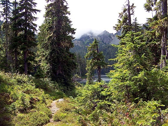
Wynoochee Lake offers a long, quiet loop through second-growth forest on the remote western Olympic Peninsula. Despite the name, the trail spends most of its distance away from the lakeshore, winding through lush understory vegetation with occasional glimpses of water through the trees. Creek crossings punctuate the route, some requiring wet feet in early season.
The western shore section passes Maidenhair Falls, the highlight of the loop. A gorge viewpoint near the falls adds a sense of depth to an otherwise gentle, rolling trail. The northern end of the lake presents an optional ford of the Wynoochee River, which can be impassable during high water. Hikers who skip the ford can still complete a substantial out-and-back on either shore.
This trail sees very little traffic. Trip reports consistently describe empty parking lots and solitary hiking. The drive in on FR-22 takes commitment, about 35 miles from Montesano, but the remoteness is the point. Coho Campground at the trailhead has facilities and makes a good base for combining the hike with paddling on the lake.
Astronomy
Trail Conditions
Scorecard
Safety & Considerations
Persistent Hazards
- Creek crossings may require wading in early season
- Wynoochee River ford at north end can be dangerous during high water
- Trail overgrown in sections
- Remote location with limited cell service
Getting There
Free parking at the Coho Campground day use area by the boat launch at the north end of the lake. Toilet facilities available.
From Montesano, take Devonshire Road exit off Highway 12. Follow Wynoochee Valley Road (FR-22) approximately 35 miles to the lake. The trailhead sits at the north end of the lakeside day use area by the boat launch. Long drive on forest road, but paved.
Start early to complete the full 19 km loop in daylight. The western shore to Maidenhair Falls makes a good shorter objective if time is limited. Check river levels before planning to ford at the north end.
Similar Hikes