Mount Walker
Olympic PeninsulaBest Apr–Oct
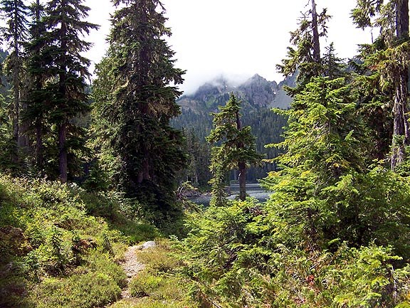
A steep, direct climb to dual summit lookouts spanning Hood Canal, the Cascades, and the Olympic Range.
About This Trail
Mount Walker packs a serious workout into a short distance. The trail climbs 610 meters over just 3.2 kilometers one way, maintaining a relentless 20% average grade through second-growth forest. Rhododendrons line the route and peak in late May and June, adding color to an otherwise heads-down ascent.
Two separate lookout points crown the summit. The north lookout faces Hood Canal Bridge, Mount Baker, and the Cascade Range. The south lookout opens up to Hood Canal, the Seattle and Tacoma skylines, and on clear days, Mount Rainier and Mount St. Helens. Benches and privies sit at both viewpoints.
Winter changes the approach slightly. The road gate closes, adding about 400 meters of road walking to the trailhead. Microspikes or snowshoes may be needed near the summit depending on conditions. The trail runs year-round and draws steady traffic, so early arrival helps with the small parking pullout.
Forecast
Astronomy
Trail Conditions
“Got to the Trailhead at 11:30am on Easter Sunday, there were still a few spots left.”
Last report: Apr 5, 2026
Scorecard
Safety & Considerations
Today's Hazards
- Strong sun — sunscreen, hat, and sunglasses recommended
- Trees Down
Persistent Hazards
- Steep sustained grade with no flat sections for rest
- No water sources on trail
Getting There
Small pullover lot on the left about a quarter mile up Mount Walker Road from US 101. No fee. Fills quickly on weekends, especially spring and summer. Winter road gate closure adds a short walk to the trailhead.
From Quilcene, drive 4.6 miles south on US 101. Turn left at Mount Walker View Point signs onto Mount Walker Road. Trailhead parking is a quarter mile up on the left. The trail climbs steadily with no junctions to worry about.
Early starts recommended on weekends for parking. The climb takes most hikers 1.5 to 2 hours up. Allow time to visit both north and south lookouts at the summit.
Recent Reports
Got to the Trailhead at 11:30am on Easter Sunday, there were still a few spots left. Beautiful views at the top and the trail was in great shape - looks like the tree across the trail has been cleared.
What a fantastic trail! My wife described it as “relentless” as we climbed up.
Mt Walker trail is in excellent shape - no snow, no mud and clear except for on tree down across the trail about 1/4 mile from the trailhead but is very easy to step over. Quite a sunny day and at the top I took a couple of pictures looking West towards Mt.
Similar Hikes