Colonel Bob Peak
Olympic PeninsulaBest Jun–Oct
A punishing climb through Quinault rainforest to a summit with ocean, Olympus, and Rainier on the same horizon.
About This Trail
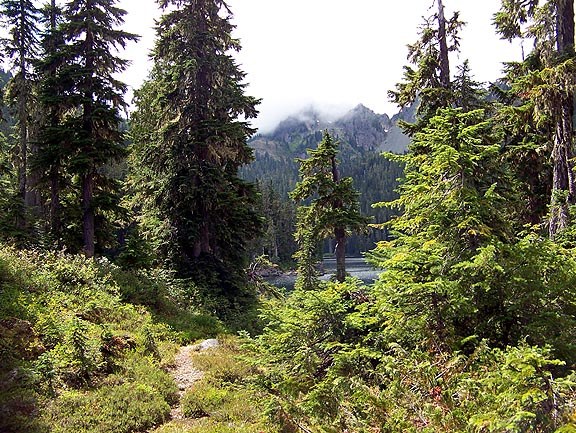
Colonel Bob is the high point of the Quinault rainforest — a bare summit at forty-five hundred feet, lifted out of the dense lower canopy and exposed to weather coming off the Pacific. The trail leaves a quiet trailhead off the South Shore Road of Lake Quinault and gains over four thousand feet across seven miles. The grade is unrelenting from the start and never lets up; the first mile sets the tone with steep tread on loose rock.
The lower forest is the Olympic Peninsula at its wettest. Western hemlock, Sitka spruce, and Pacific silver fir dominate, with sword fern and oxalis thick on the floor. The trail climbs through old-growth corridors and switchbacks up the ridge, with one reliable water source near mile six and dry country above. The final mile turns technical — exposed rock, occasional scrambling, and weather that hits hard from the southwest.
The summit pays the cost. On a clear day Lake Quinault sits below, the Quinault River cuts west toward the coast, Mount Olympus rises north, Rainier appears on the southeast horizon, and the Pacific stretches west to the haze. Few summits in Washington combine ocean and high-Cascade views in one panorama. Carry water for a long day; weather changes without warning at the top.
Seasonal Highlights
Astronomy
Trail Conditions
Scorecard
The mileage and gain filter out casual hikers. Weekends see modest traffic; weekdays often empty.
Safety & Considerations
Persistent Hazards
- Sustained 4,000+ ft climb with steep grades from the start
- Loose rock and technical scrambling on the final mile
- Last reliable water at mile 6 — carry the day's supply
- Summit fully exposed to Pacific weather — storms arrive fast
- Blowdowns and brush past mile 1.5 in some seasons
Getting There
Free trailhead lot off the South Shore Road of Lake Quinault. No pass required.
Similar Hikes