Rock Mountain
Snoqualmie RegionBest Apr–May
A burly ridge climb above Highway 2 that rewards strong legs with corn snow descents and Chiwaukum Range views.
About This Trail
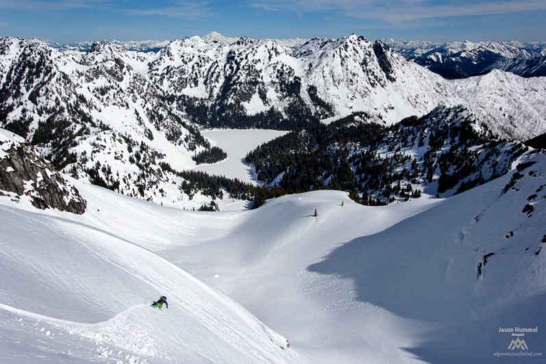
Rock Mountain rises above the Highway 2 corridor east of the Cascade crest, offering a straightforward but demanding spring ski tour with big views of the Chiwaukum Range. The route climbs roughly 5,400 feet over 9 miles round trip, starting from roadside pullouts along the highway and ascending through forest before gaining the exposed ridge that connects the south and north summits at 6,835 feet.
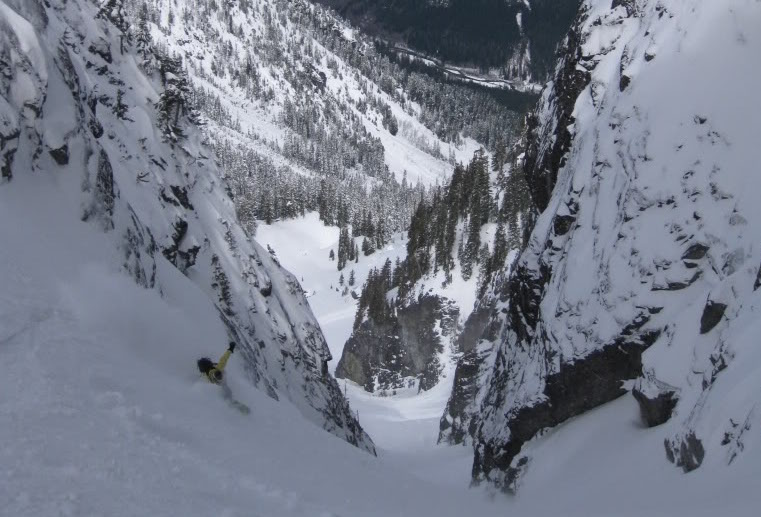
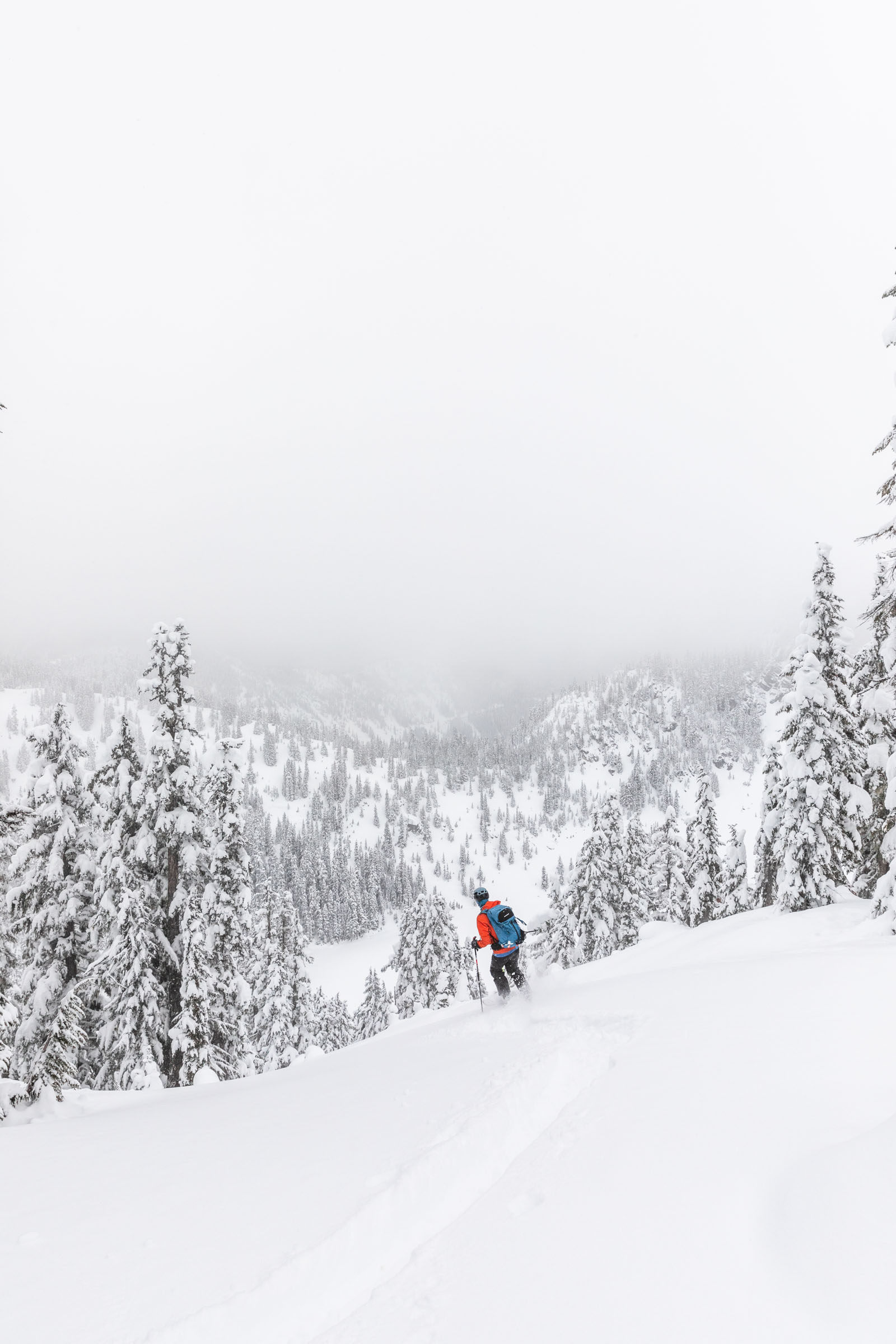
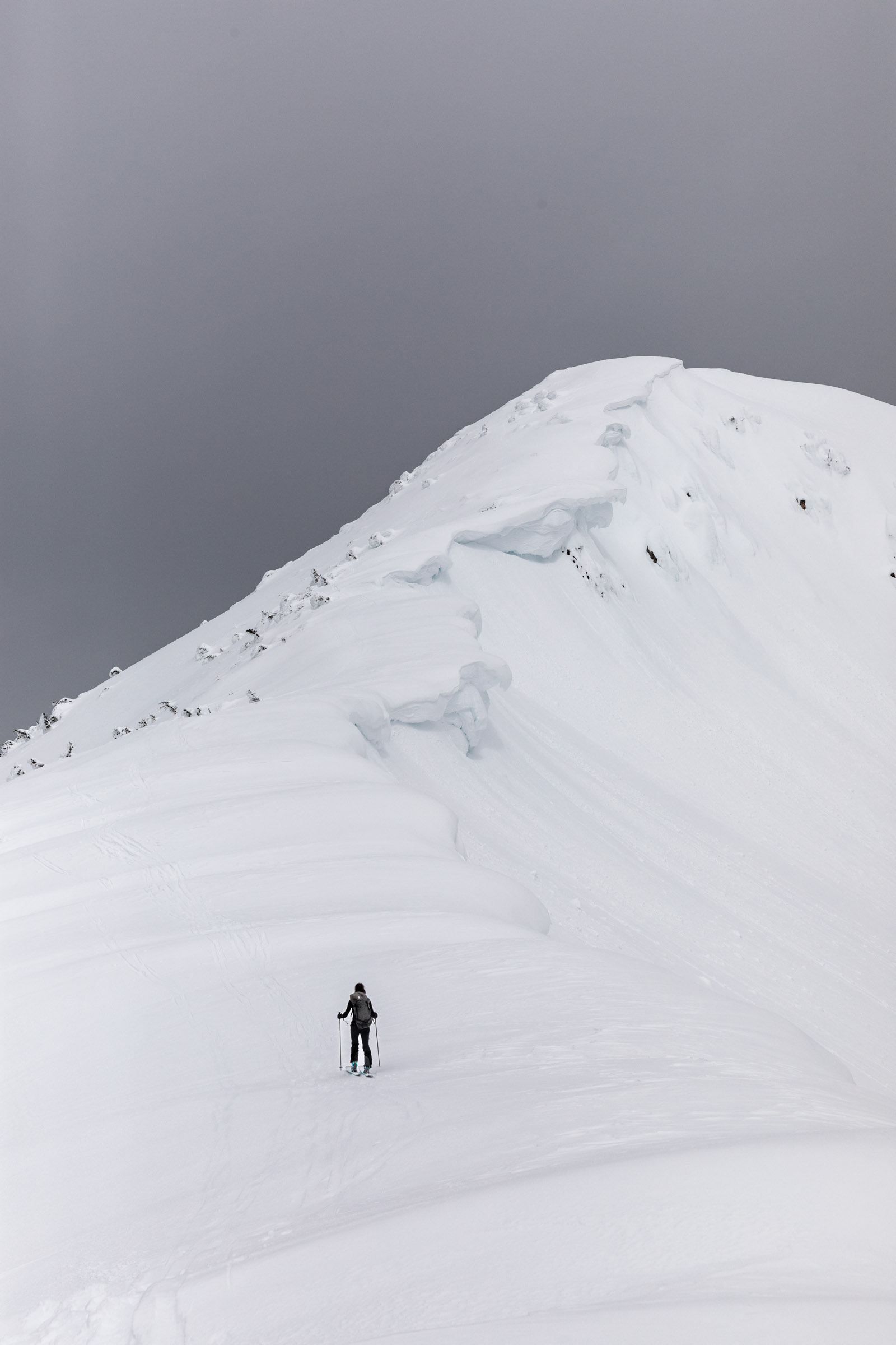
The lower 2,000 feet typically require boot packing through inconsistent spring snowpack mixed with bare ground, leaves, and debris. Once skinning begins around 5,000 feet, the terrain opens onto ridgeline travel with cornices and steep drop-offs demanding careful navigation. The final 300 feet to the summit involve steep boot packing that tests kick-turn skills on firm snow. Descending the east ridge rewards the effort with roughly 1,000 feet of quality wind-deposited corn snow before the skiing deteriorates in the lower forest.
This tour delivers a high ratio of physical effort to skiable terrain, making it a classic "earn your turns" outing. The ridge itself is the main attraction: dramatic cornice formations, rime ice sculptures, and sweeping views across the central Cascades. Expect to work hard for relatively short but satisfying descents.
Forecast
Astronomy
Trail Conditions
Scorecard
Safety & Considerations
Today's Hazard
- Strong sun — sunscreen, hat, and sunglasses recommended
Persistent Hazards
- Cornices along the summit ridge
- Steep cliff drop-offs on both sides of the ridge
- Inconsistent snow coverage requiring boot packing on lower slopes
- Blind corners at highway parking pullouts
Getting There
Multiple roadside pullouts along Highway 2 near the trailhead, on both east and west sides. Use caution with blind corners and leave adequate space between vehicles and the road. No fee required.
The first 2,000 feet of elevation gain involve boot packing through patchy snow, exposed ground, and forest. Skinning becomes viable around 5,000 feet. The ridge traverse between south and north summits has steep cliff drop-offs on both sides and cornice hazards. The final 300 feet to the true summit require boot packing on steep, firm snow. Strong kick-turn technique is essential.
Start early to hit upper slopes during the corn snow window. Expect roughly 5 hours of uphill travel at 1,000 feet per hour. Plan for 2-3 hours of descent including the lower boot pack sections.
Similar Hikes