Alpine Lakes Ski Traverse
Snoqualmie RegionBest May–Jul
A seven-day, 70-mile ski traverse across the Alpine Lakes Wilderness, linking Daniel, Hinman, Overcoat, and Chikamin.
About This Trail
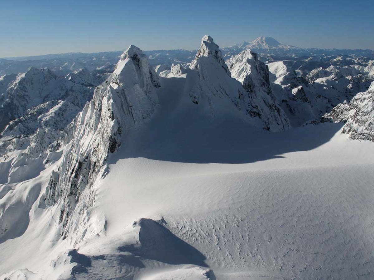
The Alpine Lakes Ski Traverse covers 70 miles across the Alpine Lakes Wilderness over seven days, linking Hyas Lake trailhead near Salmon La Sac to Gold Creek at Interstate 90. The route strings together the major peaks of the wilderness, including Mount Daniel, Mount Hinman, Overcoat Peak, and Chikamin Peak, crossing glaciers, ridgelines, and turquoise lake basins along the way.
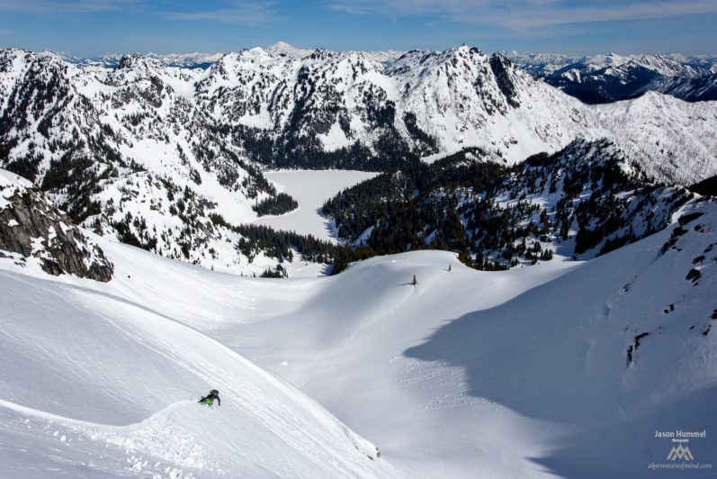
From Hyas Lake, the route climbs Mount Daniel as its first summit, then trends southwest through Peggy's Pond and Pea Soup Lake toward Mount Hinman and the Lynch Glacier. The middle section traverses through Foss Lake, La Bon Lakes, Chain Lakes, and Lake Williams before dropping to the Middle Fork of the Snoqualmie River. The final push crosses Overcoat Peak and Chikamin Peak, navigating the Chimney Rock col to reach Gold Creek.
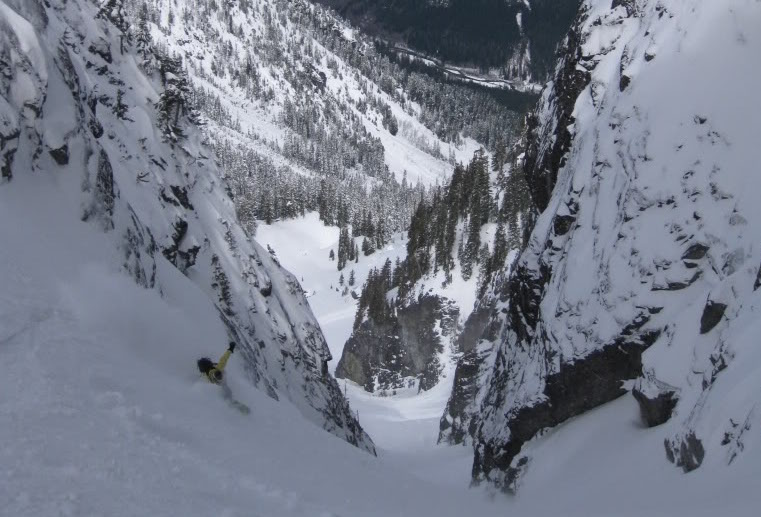
The terrain is relentlessly varied: glaciated slopes, cliff bands that require scouting, exposed ridge traverses, and river valley crossings at the low points between peaks. Whiteout conditions on the glaciers make navigation difficult; cliff sections demand careful route-finding since the terrain below is riddled with drop-offs. Seven days of food, fuel, and camping gear mean heavy packs on every climb.
This is one of the defining ski traverses of the Washington Cascades. It demands advanced navigation, glacier travel skills, and the physical capacity to sustain a week of loaded climbing across complex alpine terrain. The reward is a continuous high route through the most iconic peaks and lakes in the Alpine Lakes Wilderness, from a perspective that summer hikers on valley trails never see.
Forecast
Astronomy
Trail Conditions
Scorecard
Safety & Considerations
Persistent Hazards
- ATES Challenging: avalanche terrain on multiple passes and glacier crossings
- Glacier travel required on Lynch Glacier and others; crevasse rescue gear mandatory
- Cliff bands require careful route-finding; 'terrain below was riddled in cliffs'
- Whiteout conditions on glaciers make navigation dangerous
- Seven days of loaded packs; self-rescue and full self-sufficiency required
- River valley crossings between peaks may involve stream fords
- No bailout options on much of the high route
Getting There
Car shuttle required. Start at Hyas Lake trailhead near Salmon La Sac. Finish at Gold Creek off Interstate 90. Both trailheads accessible by car in spring.
Begin at Hyas Lake trailhead and climb Mount Daniel on day one. The route trends southwest through the wilderness, following a high route between major peaks. Navigation skills are essential; the route is unmarked and crosses cliff-riddled terrain.
Seven-day commitment. Requires a stable extended weather window. Late spring to early summer (May-July) timing balances snow coverage with longer days and warmer temperatures. Plan food and fuel for full self-sufficiency.
Similar Hikes