Hex Mountain
Stevens Pass AreaBest Dec–Mar
A low-angle ridge tour east of Snoqualmie Pass for early-season shakedown days and avalanche-conscious skiing.
About This Trail
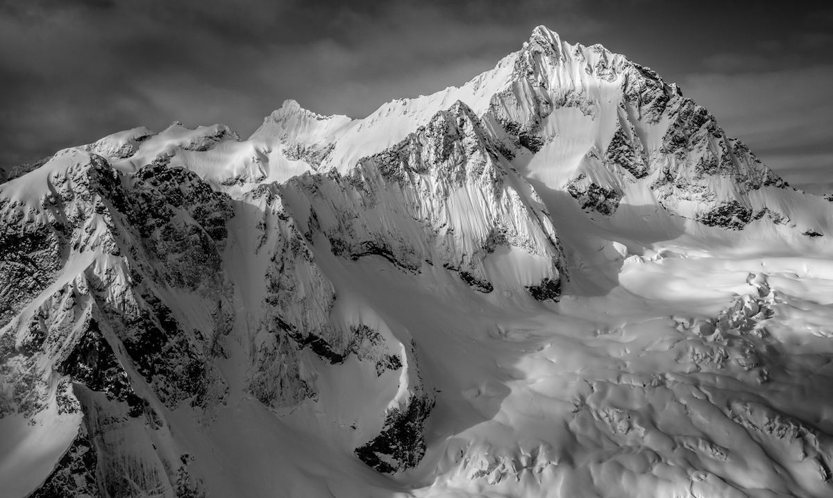
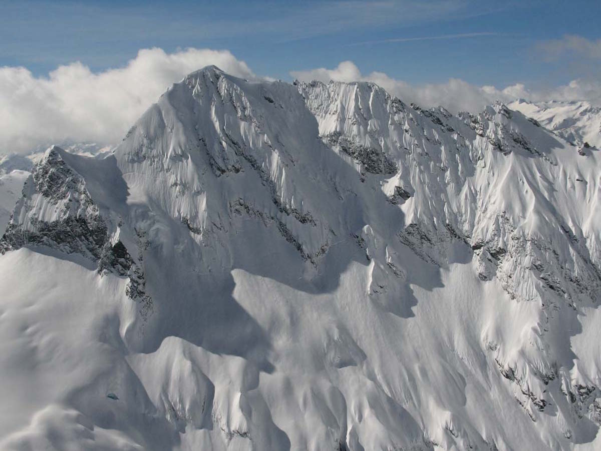
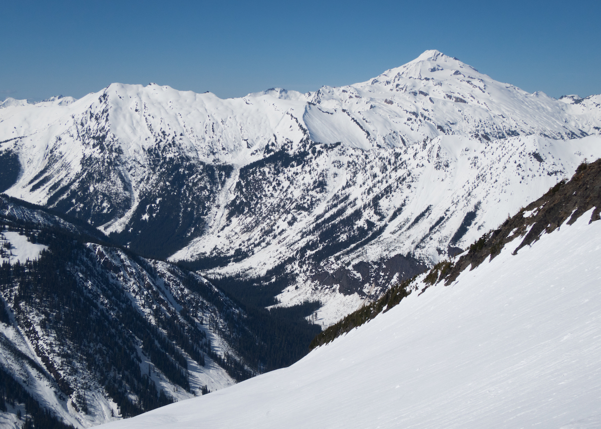
Hex Mountain rises to 5,050 feet in the Okanogan-Wenatchee National Forest, accessed via the Salmon La Sac road east of Snoqualmie Pass. The tour follows a ridge route through low-angle terrain, making it a reasonable choice for early-season shakedown days when higher objectives carry too much avalanche risk.
The approach begins from a pullout just below the trailhead, climbing at a mellow grade that requires few switchbacks. The ridge route stays on lower-angle terrain, avoiding the steeper 35-degree slopes that flank either side. Snow coverage thins at lower elevations where bushes poke through, so timing matters: too early in the season and the base is incomplete, too late and the snowpack has consolidated above.
The descent follows the ridge for the best snow quality, though the low angle limits the thrill. Creek crossings in the valley below make loop options unreliable; plan for an out-and-back along the ridge. The skiing is mellow, the vertical is modest, and the terrain forgives mistakes. That is exactly the point. Hex Mountain is where you go to shake the rust off your skins and remember how your edges work before committing to bigger lines.
A Sno-Park pass is required. The road is typically plowed to the trailhead, with parking for roughly ten cars at the pullout.
Forecast
Astronomy
Trail Conditions
Scorecard
Safety & Considerations
Today's Hazard
- Strong sun — sunscreen, hat, and sunglasses recommended
Persistent Hazards
- ATES Challenging: flanking slopes reach 35 degrees with avalanche exposure
- Creek crossings in the valley are unreliable; avoid loop routes
- Lower elevation snowpack can be thin or variable early season
- Bushes and obstacles at lower elevations when snow coverage is incomplete
Getting There
Pullout just below the trailhead on Salmon La Sac Road, space for roughly 10 cars. Sno-Park pass required ($25/day or $50/season). Road is typically plowed to the parking area.
Skin from the pullout up the ridge at a mellow grade. Minimal switchbacks needed. Stay on the ridge to avoid steeper avalanche-prone slopes on either side.
Half-day tour. No special timing requirements beyond normal avalanche assessment. Early season conditions can be variable; check the snowpack forecast for the Snoqualmie zone.
Similar Hikes