 David Hagen.jpeg)
Manastash Ridge - Westberg Trail
Central WashingtonBest Mar–Jun, Sep–Nov
Short, steep fitness climb to Stuart Range views above the Kittitas Valley.
About This Trail
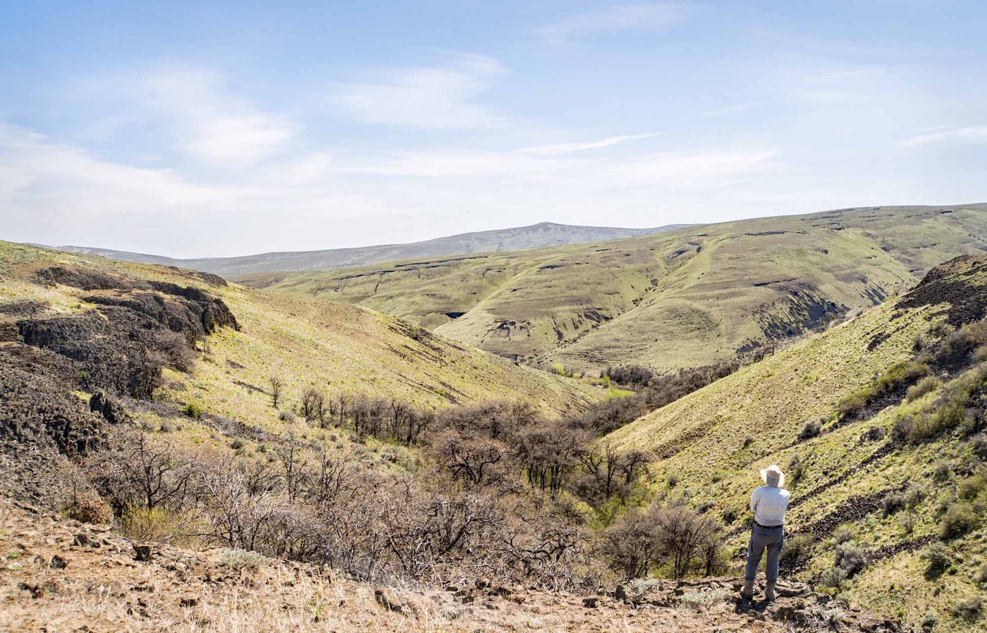
The Westberg Trail climbs Manastash Ridge in a relentless 2-mile ascent from the Kittitas Valley floor near Ellensburg. Named in honor of a local wrestling coach, this trail earns every foot of its 1,800 feet of gain with a steep, direct route through open shrub-steppe. Halfway up, a lone pine tree offers a natural rest stop with views across the valley to the Stuart Range.
The summit area, marked by a memorial called "The Book," opens up to panoramic views of the Kittitas Valley and the Cascades beyond. Spring is the prime season, when lupine, balsamroot, phlox, paintbrush, and wild buckwheat color the hillsides. Late spring into early summer catches the wildflower peak. Fall works well too, with cooler temperatures and golden grasses. Summer is best avoided unless you start at dawn; there is no shade and no water on the entire route, and direct sun on the south-facing slope turns this into a furnace.
Locals treat this as an after-work fitness hike, and for good reason. It delivers a solid workout with genuine mountain views in under two hours, right off the highway. The trail splits at 0.3 miles; stay left for the Westberg proper. The right fork leads to the Boy Scout Trail, which connects higher on the ridge.
Astronomy
Trail Conditions
“Afternoon arrival and no issues with parking.”
Last report: May 17, 2026
Scorecard
Safety & Considerations
Today's Hazard
- Strong sun — sunscreen, hat, and sunglasses recommended
Persistent Hazards
- rattlesnakes
- extreme-heat
- no-water
Getting There
Large parking area at the end of Cove Road. No restroom, no fee. Accessible from I-90 exit 109 (east) or exit 101/Thorp (west).
From I-90 exit 109, north on Canyon Road 0.5 mile, left on Umtanum Road 1.7 miles, right on Manastash Road 3.6 miles, left on Cove Road to parking. Trail splits at 0.3 miles: left fork is the Westberg Trail, right fork is the Boy Scout Trail. Both reach the ridge.
Early morning is essential in warm months. This is a south-facing slope with no shade. Locals favor late afternoon in spring and fall. Carry all the water you need.
Recent Reports
First time here and first time finding ticks hitched a ride home on me vs my dog (who wasn’t with me today due to my concerns regarding ticks and rattlesnakes). Afternoon arrival and no issues with parking.
This morning was a perfect time to hike Manastash Ridge. I hiked up Westberg and came down on the Boy Scout Trail.
Hiked here with our three kids, 12, 10, and 6, as I wanted a wildflower hike with views for Mother’s Day and this one checked every single box! Flowers are at peak now, we saw so many.
Similar Hikes


.jpg)