
Cleman Mountain - Waterworks Canyon Loop
Central WashingtonBest Mar–May, Oct–Nov
A steep canyon-to-ridge loop through basalt formations and wildflower slopes on the dry side of the Cascades, with bighorn sheep and volcano views.
About This Trail
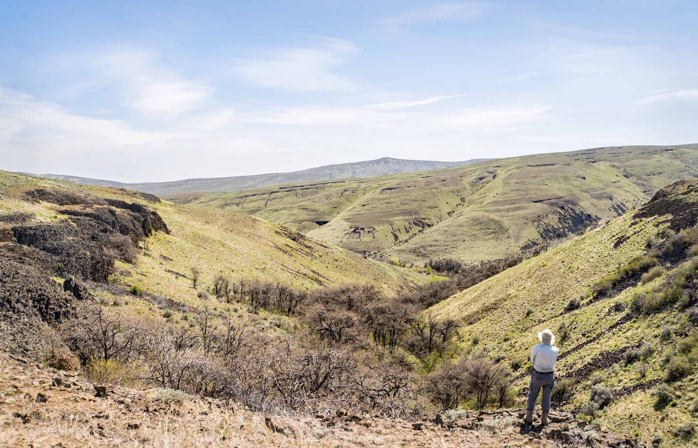
Cleman Mountain rises abruptly from the Naches River valley east of the Cascades, delivering ridge walking and canyon scenery more typical of the American Southwest than western Washington. The Waterworks Canyon Loop climbs through a narrow basalt canyon lined with weathered cliffs, buttresses, and pinnacles before reaching an open ridgeline with views of Mount Adams, Mount Rainier, and the Yakima Valley. Bighorn sheep inhabit the upper slopes and hikers regularly spot them on the east ridge.
The loop gains 2,000 feet in just 6 miles, with the steepest sections on loose, gravelly terrain. Counter-clockwise travel (ascending the canyon, descending the ridge) is strongly recommended because the east ridge descent involves steep, loose footing that catches people off guard. Spring brings exceptional wildflower displays across the south-facing slopes, and the dry east-side climate means this trail melts out weeks before Cascade trails at similar elevation. Late spring and early fall are prime windows; summer heat makes midday travel punishing.
Ticks are present in the valley from spring through early summer, and mosquitoes concentrate near the trailhead parking area in June. The trail follows a volunteer-maintained boot path that is well-defined but unsigned. Carry more water than expected because there are no reliable sources on the route.
Forecast
Astronomy
Trail Conditions
“This is a great time to go - lots of flowers, not too hot and snow/ice free.”
Last report: May 17, 2026
Scorecard
Safety & Considerations
Today's Hazard
- Strong sun — sunscreen, hat, and sunglasses recommended
Persistent Hazards
- Steep loose gravel on ridge sections
- Ticks in valley from spring through early summer
- No water sources on route
- Extreme heat exposure in summer months
- Unsigned volunteer-maintained boot path
Getting There
Small pullout off State Route 410 near Naches, accessed by crossing a small bridge. Discover Pass required. Limited spaces so arrive early on spring weekends. The trailhead begins through an elk fence gate.
From Seattle, take I-90 east to exit 110, then US-82 East/US-97 South toward Yakima. Continue south 30 miles, take exit 31A toward Naches, follow Route 12 West for about 17 miles past Old Naches Road junction, then turn right onto Route 410. Parking pullout on the right after crossing a small bridge. The boot trail starts through a gate in the elk fence.
Start early in warm months to avoid exposed ridge walking in midday heat. Counter-clockwise direction (canyon first, ridge descent second) is easier on the knees despite the steep canyon ascent. Allow 3-5 hours depending on fitness.
Recent Reports
*My hiking buddy James lost his wallet somewhere on this trail on 5/17. Message me at Alan.
Mother Nature chased us east of the mountains again this weekend, but Yakima is often a safe bet for sunny weather. We arrived at the trailhead just after 10:00am, with about 5 other vehicles there.
Nice and sunny day, great hike, very steep climb going anti clockwise. Amazing views.
Similar Hikes


.jpg)
