
Frenchman Coulee
Central WashingtonBest Mar–May, Oct–Nov
A short desert walk through towering basalt columns to a seasonal waterfall carved by Ice Age floods.
About This Trail
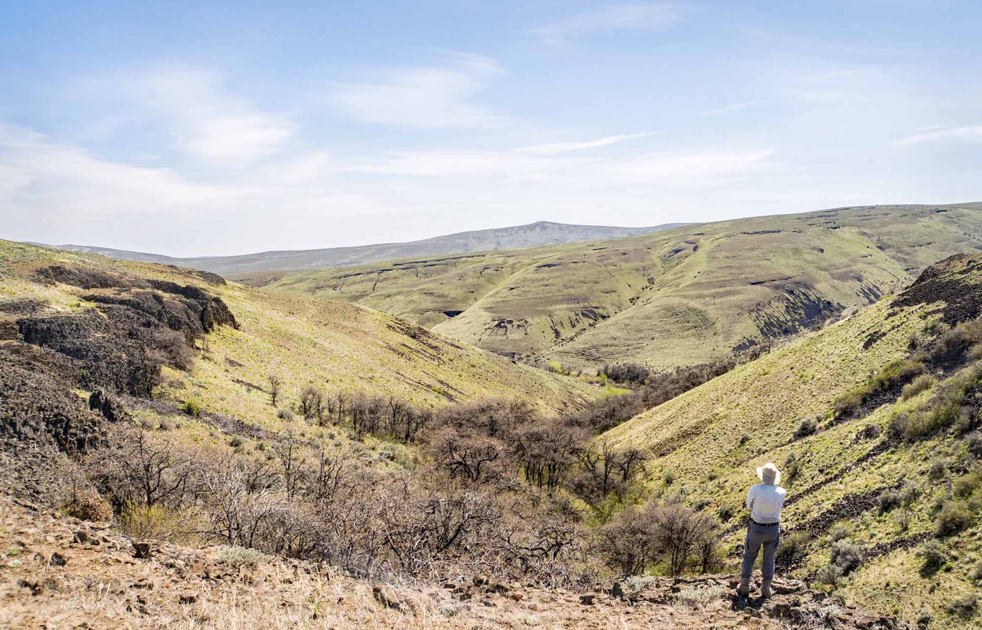
Frenchman Coulee cuts through the basalt desert east of Vantage, where Ice Age floods carved deep channels through volcanic rock thousands of years ago. The trail follows the coulee floor between towering columnar basalt walls toward a seasonal waterfall visible from the trailhead. Rock climbers dot the cliff faces on busy days, and the geometric columns themselves tell a geological story that goes back millions of years.
The hike is short and nearly flat, gaining only 61 meters over about 3.2 km one way. A traverse trail climbs to road level above the coulee for the best overhead views of the valley before dropping back to the waterfall. Spring brings wildflowers to the desert floor and the waterfall runs strongest with snowmelt from March through May. By midsummer, the waterfall dries up and temperatures regularly exceed 38 degrees C, making this a poor choice from June through September.
This is eastern Washington desert country managed by Washington Department of Fish and Wildlife. The landscape feels completely different from the Cascades, with sagebrush, exposed rock, and open sky in every direction. The same area that draws climbers to The Feathers and Sunshine Wall gives hikers a front-row seat to some of the most dramatic basalt formations in the Columbia Basin.
Forecast
Astronomy
Trail Conditions
“Vantage road is closed due to a rock slide.”
Last report: May 17, 2026
Scorecard
Safety & Considerations
Today's Hazard
- Strong sun — sunscreen, hat, and sunglasses recommended; water reflection adds glare near the lake
Persistent Hazards
- Extreme heat in summer months (regularly above 38C)
- No shade or water along the trail
- Rattlesnakes present in warm months
- Loose rock near cliff edges and on traverse trail
- No cell service in parts of the coulee
Getting There
From I-90, take exit 143 (Silica Road/The Gorge Amphitheater). Go left under the freeway for 0.7 miles, then turn left on Vantage Road SW. Drive 2.6 miles to a small gravel parking lot on the right surrounded by concrete barriers. Two pit toilets available. Discover Pass required. Lot fills on spring weekends and climbing days.
From the lower trailhead, the trail heads up the coulee floor directly toward the waterfall, which stays visible the entire way. The terrain is flat with minor rocky sections. A traverse trail branches up to road level for overhead views of the valley. Multiple informal paths exist; the main route stays on the coulee floor.
Start early in spring and fall to catch good light on the basalt walls. In warm weather, morning is essential to avoid heat. The waterfall runs strongest after rain or during snowmelt season (March through May).
Recent Reports
Vantage road is closed due to a rock slide. Reopening date is unknown.
Discovering Central Washington! Why isn’t it more popular?
This is well worth the effort on that long drive across the state. It's short, easy and just a few minutes off the freeway and has impressive views both from the trail itself and from the rim on the way in on both sides of the road.
Similar Hikes


.jpg)
