
Lenore Lake Caves
Central WashingtonBest Mar–May, Sep–Nov
Ice Age flood caves in columnar basalt above the Grand Coulee, a geology lesson in every footstep.
About This Trail
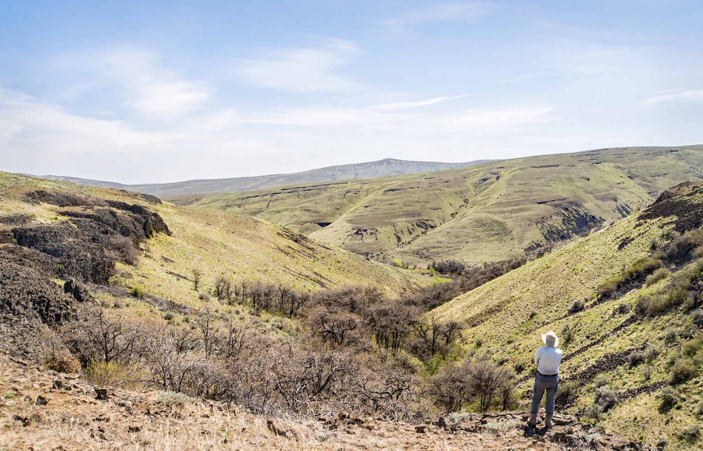
Seven basalt caves line the east wall of the Grand Coulee above Lenore Lake, carved by the Missoula Floods roughly 15,000 years ago. The floodwaters, released repeatedly from glacial Lake Missoula, tore chunks of columnar basalt from the coulee walls, leaving alcoves and shallow chambers in the cliff face. These are not deep caves. Most extend only 10 to 20 feet into the rock, and a headlamp is unnecessary for all but the deepest.
The trail climbs 200 feet from the parking area on loose, rocky terrain to reach the cave level. The path is short but uneven, with sections of talus and a few steep drop-offs that require attention. Early Native Americans used these shelters for thousands of years, and the area remains culturally significant to the Sinkayuse, Sanpoil, and Nespelem people.
Lenore Lake sits in the Channeled Scablands, a landscape shaped entirely by catastrophic flooding. Dry Falls, the largest waterfall the continent has ever seen (now dry), lies just a few miles south. The surrounding steppe supports raptors, prairie falcons, and migrating waterfowl on the lake below. Rattlesnakes inhabit the talus slopes. Give them space and watch where you place your hands when scrambling near the caves. Spring wildflowers bloom on the basalt ledges, and the sage-steppe is most pleasant in spring and fall before summer heat sets in.
Forecast
Astronomy
Trail Conditions
“Went to the right after the stairs, easy enough for a first timer!”
Last report: May 3, 2026
Scorecard
Safety & Considerations
Today's Hazard
- Strong sun — sunscreen, hat, and sunglasses recommended
Persistent Hazards
- Rattlesnakes inhabit the talus slopes; watch hand placements near caves and give snakes wide berth
- Loose, rocky trail with steep drop-offs in sections
- No shade or water; summer temperatures regularly exceed 100°F
Getting There
Small gravel lot off Lenore Lake Road with approximately 10 spaces. Restroom available. Discover Pass required.
Spring mornings and fall afternoons are ideal. Avoid midday in summer when temperatures in the coulee are extreme. Pair with a visit to Dry Falls Interpretive Center a few miles south.
Recent Reports
Went to the right after the stairs, easy enough for a first timer! Lots of larger rocks but didn’t feel unsafe personally as we were just in tennis shoes!
A great place to see the awesome power of the ice age floods up close and just a few miles from the macro visuals of Dry Falls, the legacy left behind in Soap Lake and the unique oddity that is the Blue Lake Rhino along the flood path down Grand Coulee. This is a short and relatively mild trail right off the highway, but there are a few stretches of loose rocks and steep drops to be mindful of for those less accustomed to hiking.
Good, 7 month pregnant wife, 7 year old son and 4 year old daughter made it the whole way with no issues.
Similar Hikes


.jpg)
