
Umtanum Creek Canyon
Central WashingtonBest Mar–May, Oct–Nov
Cross a swinging bridge over the Yakima River and follow a narrowing basalt canyon where bighorn sheep scramble the cliffs above.
About This Trail
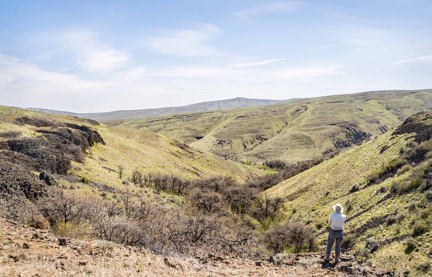
The hike starts with a swinging suspension bridge over the Yakima River, which sets the tone for a trail that feels wilder than its proximity to Ellensburg and Yakima suggests. Beyond the bridge, the route follows Umtanum Creek upstream into a narrowing basalt canyon. Towering rock walls close in as the trail threads between the creek and steep slopes. Bighorn sheep are regularly spotted on the cliffs above.
The first 1.5 miles follow a reasonably clear path through cottonwood groves and open meadows. Beyond that, the trail becomes less defined and requires creek crossings that can be tricky during spring runoff. Trip reports consistently warn about route-finding challenges deeper in the canyon. Bring a GPS track and expect to get your feet wet.
Spring wildflowers are exceptional here: balsamroot, larkspur, lupine, and wild geraniums. Fall brings vivid color from the cottonwoods and aspens. The canyon sits in the rain shadow, delivering sunshine when western Washington is gray. The BLM parking lot charges $5 per vehicle (self-service), and cell service drops out quickly once in the canyon.
Astronomy
Trail Conditions
“The wildflowers and birds are spectacular, the valley lined with basalt cliffs is dramatic, and the number of other people is minimal.”
Last report: Jul 3, 2026
Scorecard
Safety & Considerations
Today's Hazard
- Strong sun — sunscreen, hat, and sunglasses recommended; water reflection adds glare near the lake
Persistent Hazards
- creek crossings (potentially difficult in spring)
- trail disappears beyond 1.5 miles
- rattlesnakes
- no cell service in canyon
- loose scree on side slopes
Getting There
BLM parking lot with $5 per vehicle fee (self-service payment station). Federal land passes may apply. Year-round access.
From I-90 exit 110, take I-82 east about 3.5 miles to Exit 3 (Thrall Road). Turn right onto SR 821, left at the next stop sign, then southeast along SR 821 for 8 miles through the Yakima Canyon to the Umtanum Recreation Area parking lot on the right. Save directions before departure as cell service is unreliable.
Afternoon light in the canyon fades early due to the steep walls. Start by mid-morning to get good light deeper in. Spring creek crossings are easier by late morning when the water has dropped slightly from overnight.
Recent Reports
Beautiful yet frustrating & unobtainable. First two miles picturesque, including two water crossings.
This is one of my favorite early season hikes. The wildflowers and birds are spectacular, the valley lined with basalt cliffs is dramatic, and the number of other people is minimal.
Started at the trailhead at 6:30 am and spent 6 hours in the area “birding”. The key to this trail is always pick the route that takes you to the RIGHT.
Similar Hikes


.jpg)