Yacolt Burn State Forest - Tarbell Trail
Southwest WashingtonBest May–Oct
A 25-mile forest loop through the Yacolt Burn with waterfalls, mountain views, wildflower meadows, and multiple trailhead options.
About This Trail
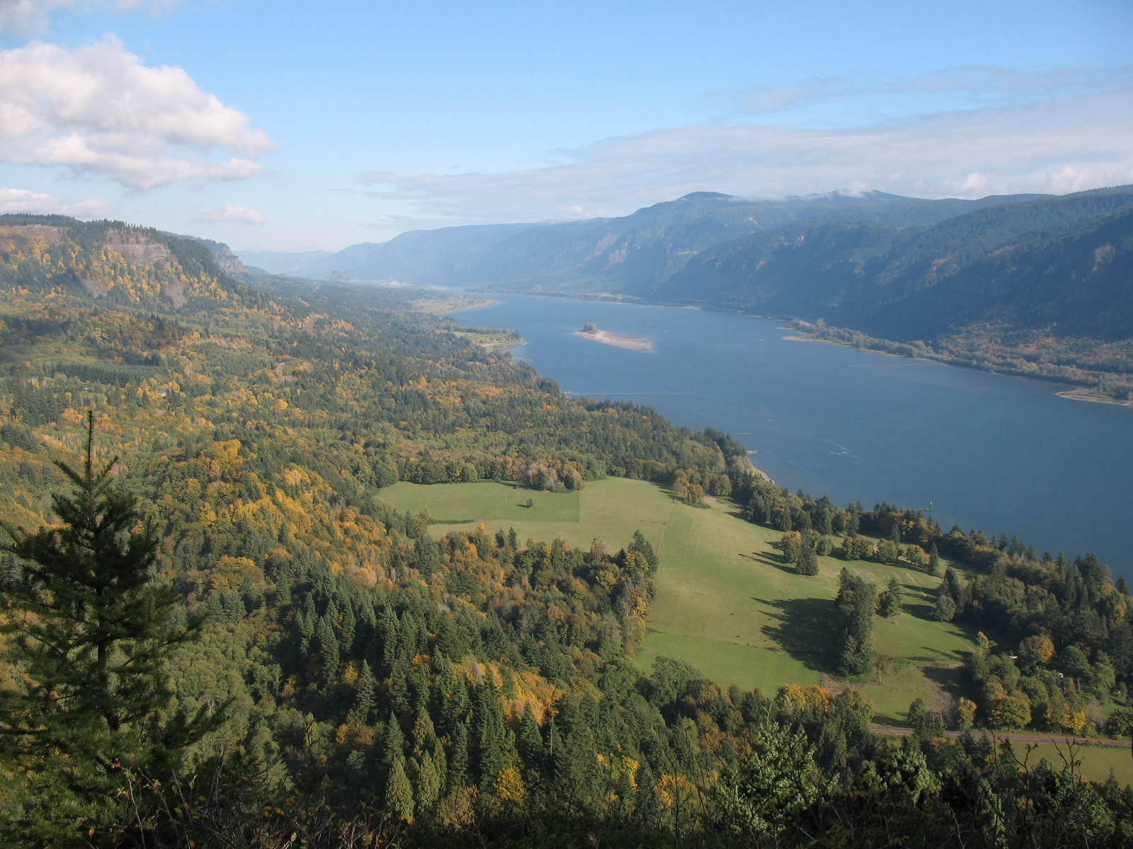
The Tarbell Trail is the big loop through the Yacolt Burn State Forest, a 25-mile circuit with nearly 4,800 feet of cumulative elevation gain that connects four trailheads and passes through the full range of what this recovering landscape has to offer. This is the backbone of the trail system here, and doing the full loop is a proper long day or a relaxed overnighter.
The recommended direction is counter-clockwise from the Yacolt Burn Trailhead. You start with a gentler climb along Cold Creek for 7 miles to Grouse Vista, then push 5 miles further to Hidden Falls on Coyote Creek, the best rest stop on the route. From the falls, the trail climbs to the Silver Star trail junction before descending through second-growth forest to Rock Creek Campground, then 2.2 miles back to close the loop.
The variety here is the real selling point. You move through dense creek-bottom forest, open ridges with mountain views, wildflower meadows, and the recovering burn landscape that gives the forest its name. Hidden Falls is worth the trip all by itself. Multiple access points (Yacolt Burn, Grouse Vista, Rock Creek Campground) let you break this into manageable sections. The Appaloosa Trail cuts across the middle, creating a shorter loop option. Trail maintenance is strong, with WTA work parties active every year.
Astronomy
Trail Conditions
Scorecard
Safety & Considerations
Today's Hazard
- Strong sun — sunscreen, hat, and sunglasses recommended
Persistent Hazards
- Brush encroachment in summer (thimbleberry)
- Some snow at higher elevations through spring
- Long route with limited bailout options on the east side
Getting There
Primary trailhead is the Yacolt Burn Trailhead off road L-1000N. Discover Pass required. Restrooms available. Alternative access at Rock Creek Campground (restrooms) or Grouse Vista Trailhead.
Counter-clockwise from Yacolt Burn Trailhead is the standard direction. Follow Cold Creek north for 7 miles to Grouse Vista, continue 5.1 miles to Hidden Falls, climb to the Silver Star junction, then descend to Rock Creek Campground and back. The Appaloosa Trail at roughly the midpoint creates a shorter loop option. All junctions are signed.
Start early. The full loop takes most hikers 8 to 12 hours. Carrying headlamps is smart. For an overnight, Cold Creek and Hidden Falls areas work as camp spots. Breaking the loop at Grouse Vista or Rock Creek Campground with a car shuttle is a solid alternative.
Similar Hikes