Cape Horn
Southwest WashingtonBest Jan, Mar–May, Aug–Nov
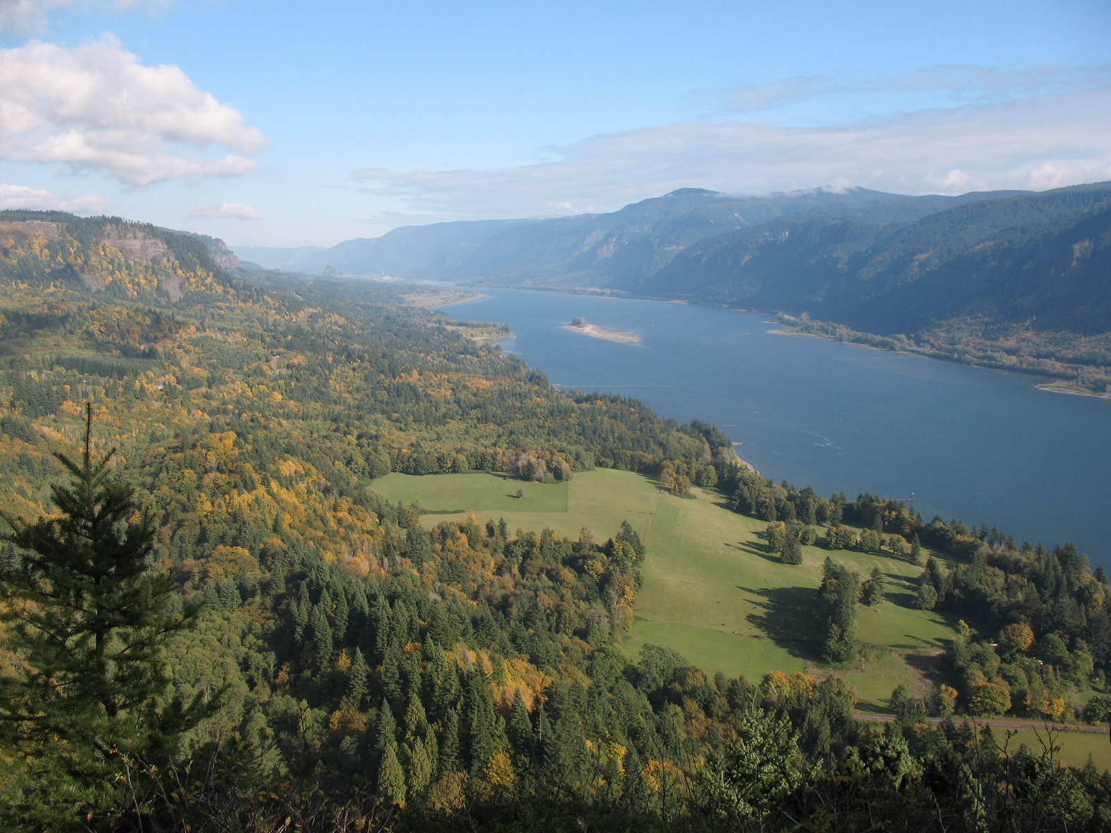
Cliff-edge Gorge panoramas and a hidden waterfall on Washington's quieter side of the Columbia.
About This Trail
Cape Horn delivers Columbia River Gorge views that rival anything on the Oregon side, but with a fraction of the crowds. The trail climbs through old-growth forest and along exposed basalt cliffs high above the river, reaching Nancy Russell Overlook where the entire Gorge spreads out below. Spring wildflowers carpet the rocky slopes, and Cape Horn Falls drops through a mossy slot canyon partway along the route.
The full loop crosses Highway 14 and traverses both upper cliff sections and a lower riverside stretch. From February through mid-July, the lower trail closes to protect nesting peregrine falcons, so plan on an out-and-back to the upper viewpoints during that window. Outside the closure, the complete loop adds river-level perspectives and a walk past Cigar Rock's basalt pillars.
Trail conditions vary by section. The upper route follows narrow, rocky singletrack with some exposure along cliff edges. Hiking poles help on the steeper pitches. The lower trail passes through forest on gentler terrain. Wind along the Gorge can be fierce, especially in spring and fall, so bring a layer even on sunny days.
Forecast
Astronomy
Trail Conditions
“Didn't encounter any mosquitoes, though.”
Last report: May 19, 2026
Scorecard
Safety & Considerations
Today's Hazard
- Strong sun — sunscreen, hat, and sunglasses recommended; water reflection adds glare near the lake
Persistent Hazards
- Exposed cliff edges with steep drop-offs on upper trail
- Narrow rocky tread requires careful footing
- Strong Gorge winds, especially spring and fall
- Broken footbridge below falls requires detour
- Peregrine falcon closure Feb 1 through Jul 15 restricts loop access
Getting There
Free parking at the Skamania County Park and Ride at milepost 26.4 on Highway 14. No pass required. The lot fills by mid-morning on weekends. West End Transit (WET) bus makes four daily stops at the trailhead.
From Vancouver, WA, drive Highway 14 east through Camas and Washougal for about 40 minutes. The trailhead is on the left at the Park and Ride. The trail starts uphill immediately from the parking area. During the peregrine falcon closure (Feb 1 through Jul 15), only the upper out-and-back is accessible.
Arrive by 8 AM on weekends to secure parking and beat the afternoon wind. Weekday mornings see very few hikers. The full loop takes 3 to 4 hours at a moderate pace.
Recent Reports
We planned to do an out-and-back hike to the point where the trail is seasonally closed due to nesting peregrine falcons, but ended up turning back soon after we reached the top due to the hot, humid weather. Didn't encounter any mosquitoes, though.
We did about 2/3 of the upper part of the trail. The trail was in overall good condition, but there were a few places where the trail was a little overgrown.
This hike was beautiful! Got out at 8am on a Sunday and didn't see any other hikers until we were on our way back.
Similar Hikes


