Beacon Rock State Park - Hardy Ridge
Southwest WashingtonBest Apr–Oct
A long ridgeline traverse above the Gorge with wildflower meadows and almost no company.
About This Trail
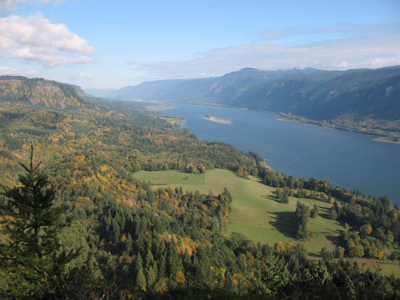
Hardy Ridge delivers a proper backcountry ridge walk within Beacon Rock State Park, climbing from the equestrian campground on Kueffler Road through second-growth forest to open ridgeline with sweeping Gorge panoramas. The trail follows old logging roads for the first mile before hitting WTA-built singletrack that traverses the ridge crest.
The recommended route runs counter-clockwise via East Hardy Ridge for the best views on the ascent. At the ridge top, a 4-way intersection opens options: continue to the summit, detour to Phlox Point for wildflower meadows, or extend via the Bridge Trail and Upper Hardy Creek Trail for a longer loop. Spring and early summer bring balsamroot and phlox across the open slopes.
This is the big-effort sibling to Beacon Rock, sharing the same state park but trading tourist-friendly catwalks for a quiet, sustained climb. The west arm of the loop gets overgrown by late season but remains followable. Snow lingers on the upper ridge into January. Expect solitude most days.
Astronomy
Trail Conditions
Scorecard
Safety & Considerations
Today's Hazard
- Strong sun — sunscreen, hat, and sunglasses recommended
Persistent Hazards
- Overgrown trail sections on the west arm
- No water sources on the ridge
Getting There
Large gravel lot at the equestrian trailhead on Kueffler Road, designed for horse trailers so plenty of space. Restrooms, picnic tables, and hitching posts on site. Discover Pass required.
From the equestrian campground, follow logging roads uphill for about a mile to the first junction. Go counter-clockwise via East Hardy Ridge for views on the way up. At the 4-way intersection on the ridge crest, the main trail continues to the summit. Side trails lead to Phlox Point and connect to Bridge Trail.
Allow 4 to 6 hours for the full loop. Start early for the best light on the east-facing slopes. Bring plenty of water since there are no reliable sources on the ridge.
Similar Hikes