
Moses Coulee Preserve and Dutch Henry Falls
Central WashingtonBest Mar–May, Oct–Nov
Ice Age flood canyon with seasonal waterfalls and intact shrub-steppe, managed by The Nature Conservancy.
About This Trail
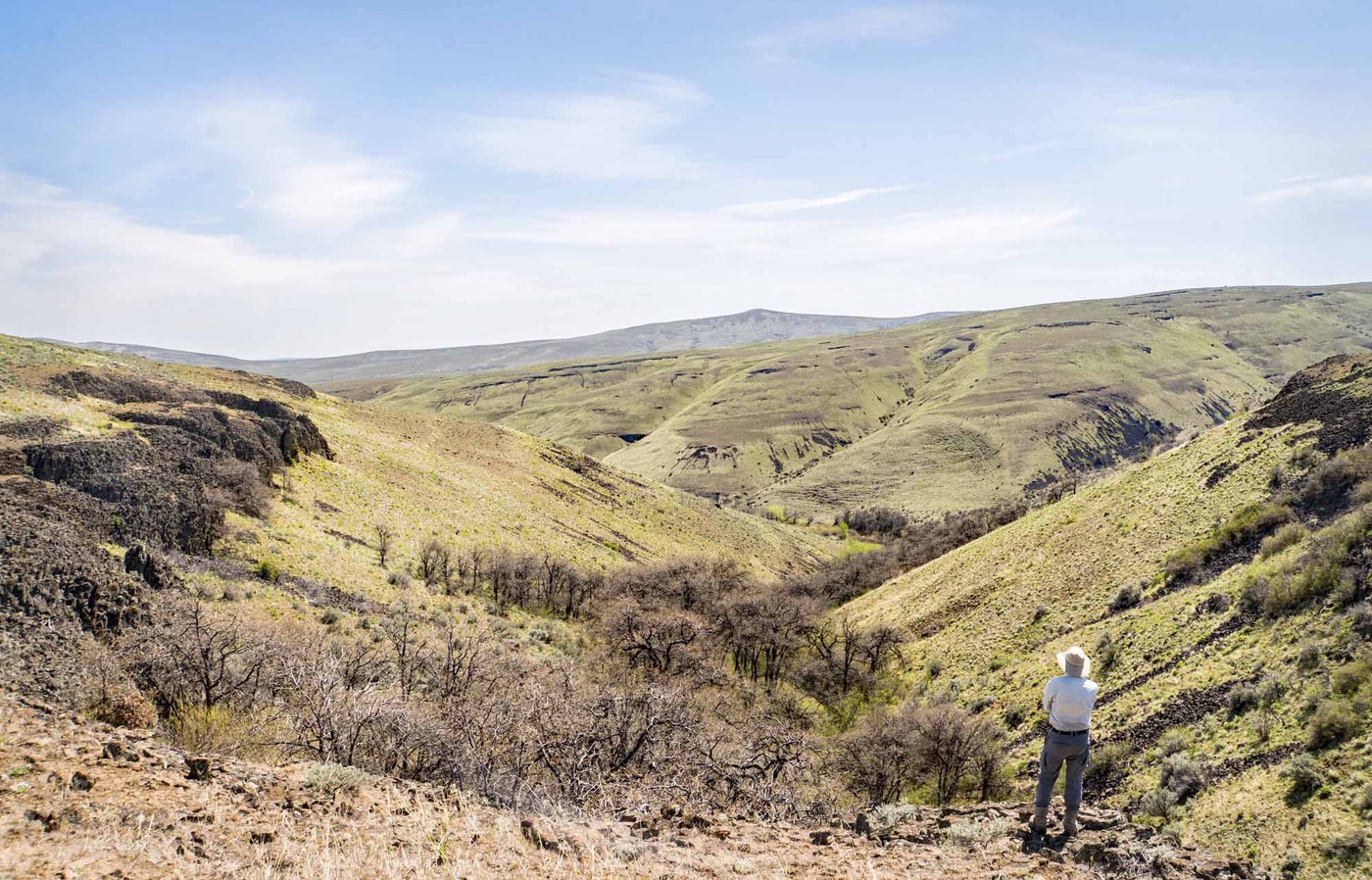
Moses Coulee Preserve sits in a massive basalt canyon carved by Ice Age floods, managed by The Nature Conservancy to protect one of the largest intact shrub-steppe ecosystems in the Columbia Basin. The preserve holds Dutch Henry Falls, a seasonal waterfall that flows strongest in spring when snowmelt feeds it from the plateau above. The short trail to the falls takes about a quarter mile of walking.
Beyond the falls, the coulee opens into a wide canyon with 400-foot basalt walls, sagebrush flats, and bunchgrass meadows. Established trails are short and sometimes peter out, so much of the exploring happens on faint two-tracks and creek beds along the canyon floor. Spring brings waves of bitterroot, lupine, and balsamroot across the steppe. Doves, swallows, and bats inhabit the cliff faces.
This is a fragile landscape. Biological soil crusts cover the ground between plants and take decades to recover from a single footprint. Stay on established paths. No dogs, no fees, and very few other visitors. Carry all water needed; shade does not exist here.
Astronomy
Trail Conditions
“I easily found the trail to Dutch Henry Falls, and it's only a quarter mile long.”
Last report: May 1, 2025
Scorecard
Safety & Considerations
Today's Hazard
- Strong sun — sunscreen, hat, and sunglasses recommended; water reflection adds glare near the lake
Persistent Hazards
- Rattlesnakes throughout the preserve
- No shade or water sources
- Fragile biological soil crusts - stay on trails
- Informal trails may dead-end
Getting There
Roadside pullout on Jameson Lake Road. No fee required. Small sign marks the trailhead. No facilities at trailhead; vault toilets at Jameson Lake public access area (Discover Pass needed there).
Two trailheads along Jameson Lake Road. The north trailhead (4 miles from Highway 2) leads directly to Dutch Henry Falls via a short quarter-mile path. The south trailhead (2 miles from Highway 2) accesses the broader canyon floor. Trails are informal and may dead-end at cliff bases.
Morning starts give the best light on the canyon walls and cooler temperatures. The waterfall flows strongest in early spring.
Recent Reports
It was a lovely day to explore a new-to-me coulee. I easily found the trail to Dutch Henry Falls, and it's only a quarter mile long.
Based on the current description, we expected to find a trail of length 2 miles for a total 4 mile roundtrip trek. There are trails here, but they are much shorter, often leading to the intermittent waterfalls on the canyon walls, and often petering out before you get there.
Such beauty to be experienced in the cold quiet vastness.
Similar Hikes


.jpg)