
Mission Peak
Central WashingtonBest Jul–Oct
A 6,876-foot summit above Wenatchee with Cascade panoramas and fall larches, if you can handle the road to get there.
About This Trail
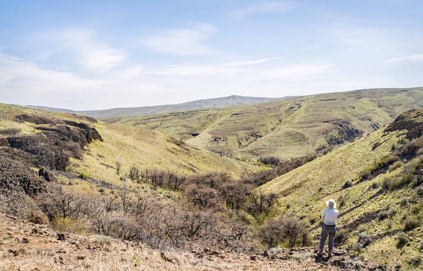
Mission Peak stands at 6,876 feet above the Wenatchee Valley, offering one of the more accessible high-elevation viewpoints in Central Washington. The standard route follows an old abandoned road (USFS Road 330) from the Liberty-Beehive Road, gaining elevation gradually through open terrain with expansive sightlines. To the west, the Cascades line up in full parade. To the east, Wenatchee and the Columbia River valley spread out far below.
The catch is getting there. The Beehive Road (USFS 9712) deteriorates significantly past Devil's Gulch, and most trip reports recommend high clearance. Some hikers park at the rough section around mile 5.5 and walk the extra road distance to the trailhead at mile 7. An alternate approach starts from the Mission Ridge ski area parking lot, hiking up through the ski runs and then going cross-country to the summit. This option avoids the road hassle entirely but adds significant distance and route-finding.
One hiker described it as "the scariest trail I've ever done," though others find it straightforward. The difference seems to come down to comfort with exposed ridgeline terrain and unmarked trail sections. Navigation skills matter here, especially if you take the ski area approach. Larch trees color up beautifully in October and early November, making late fall a particularly rewarding time to visit. Snow lingers well into May at this elevation.
Astronomy
Trail Conditions
“Perfect visibility and views of Mount Hood, Mount St.”
Last report: May 29, 2026
Scorecard
Safety & Considerations
Today's Hazard
- Strong sun — sunscreen, hat, and sunglasses recommended
Persistent Hazards
- rough access road may require walking extra distance
- unmarked trail sections require navigation skills
- exposed ridgeline terrain
- snow lingering into late spring at summit elevation
Getting There
No pass required. Primary trailhead is on USFS Road 9712 (Beehive/Liberty Road) at mile 6.9, behind a berm. Road deteriorates past Devil's Gulch. Many hikers park at a wide turnout around mile 5.5 and walk the remaining road. Alternate: park at Mission Ridge ski area lot for the cross-country approach.
From Wenatchee, take S Mission St and follow Squilchuck Road toward Mission Ridge Ski Area for 7 miles. Turn right onto USFS Road 9712 (Beehive Road) and continue 6.9 miles. The unmarked trailhead for abandoned road 330 is on the left behind a berm. High clearance recommended past Devil's Gulch. Alternate route: start from Mission Ridge ski area parking lot, hike up through the ski runs, and traverse cross-country to the summit.
Start early enough to be off the exposed ridgeline before afternoon weather builds. Allow extra time if you need to walk the road from a lower parking spot. The larch window is typically mid-October through early November.
Recent Reports
A lot of fallen down trees throughout the trail, not super difficult to get around. Perfect visibility and views of Mount Hood, Mount St.
I did the mission peak loop, ascending via Clara and Marion lakes trail and descending via the ridge/ski resort. This route involves route finding, bushwhacking and a very faint boot path so be warned.
The views from Mission Peak and Mission Ridge were incredible. However, this was probably the scariest trail I’ve ever done (didn’t help that I was alone and my phone was dead).
Similar Hikes


.jpg)