
Manastash Ridge
Central WashingtonBest Jun–Sep
A demanding ridge traverse with Rainier and Stuart views, wildflower meadows, and real backcountry solitude near Ellensburg.
About This Trail
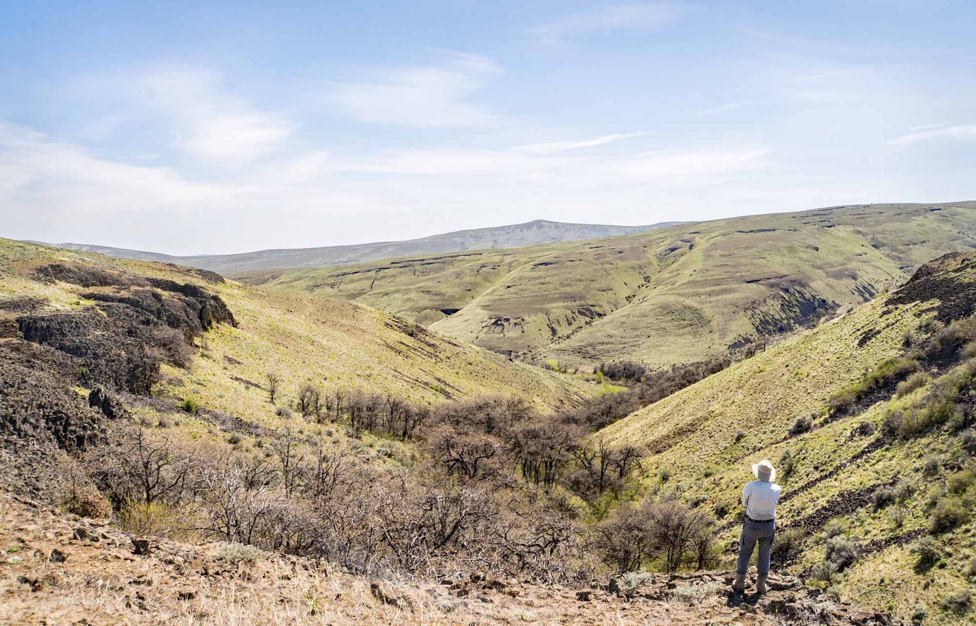
Manastash Ridge is a long, rugged traverse across a basalt plateau south of Ellensburg that delivers some of the best mountain views in Central Washington. The full route runs nearly 17 miles one-way from Quartz Mountain to Blowout Mountain, gaining over 4,600 feet of cumulative elevation along the way. Mount Clifty at mile 7 marks the high point at 6,245 feet, where the Little Naches River valley drops away to the south and Mount Rainier fills the western sky. Mount Stuart stands out clearly to the northeast.
The ridge sits at the meeting point of east-side forests and alpine terrain. Douglas fir, larch, mountain hemlock, and Engelmann spruce form the canopy, opening into meadows thick with arnica, lupine, paintbrush, and buckwheat during peak season. The Wildcat Trail approach is particularly noted for wildflower variety. Expect rocky, gravelly footing throughout, with some sections shared with motorbike traffic. There are "most difficult" and "easy" route variants around Mount Clifty, though neither option is casual.
Water is nonexistent on the ridge itself, so carry everything you need. The Quartz Mountain trailhead fits only 2-3 vehicles at the summit and requires a long gravel road approach. A Northwest Forest Pass is needed. Early season hikers can access the southwest side while the north face holds snow well into June. This is a trail that rewards committed hikers willing to cover ground for sustained, honest views rather than a single postcard viewpoint.
Astronomy
Trail Conditions
“Views are spectacular and rocks are incredibly interesting.”
Last report: Jun 13, 2024
Scorecard
Safety & Considerations
Today's Hazard
- Strong sun — sunscreen, hat, and sunglasses recommended
Persistent Hazards
- no water on ridge
- shared trail with motorbikes
- long remote traverse
- rough access road
Getting There
Quartz Mountain trailhead summit has room for only 2-3 vehicles. No facilities. The approach road (FR-31) is 10+ miles of gravel. Total drive from I-90 exit 101 is about 18.5 miles from the pavement end.
From Quartz Mountain, the ridge trail heads southeast through Panther Ridge at 1.1 miles, then continues to Mount Clifty at 7.1 miles. Route options around Clifty add about half a mile without making things much easier. The full traverse to Blowout Mountain at 16.7 miles requires a car shuttle or very long out-and-back. Most day hikers turn around at Clifty or earlier.
Early start is essential given the distance and the long access road. Budget extra time for the drive in. For the full traverse, consider an overnight camp or car shuttle.
Recent Reports
Recommend continuing past lake up to ridge to Funny Rocks. Views are spectacular and rocks are incredibly interesting.
This is an excellent route to get up to Manastash Ridge high point in early season, while the north side of the ridge is still snowed in. Excellent early season hike as I came in from the Little Naches River side, as most of the SW side of the ridge is melted out.
A wildflower update for Manastash Ridge (summary, this area has lovely flowers right now): The Wildcat trail has very varied and pretty displays (photo 2), from showy phlox, large-flower triteleia, grounsel, and lupine down low, thick arnica and springbeauties in the woods, balsamroot, paintbrush, and larkspur towards the top, and buckwheats and Gairdner's penstemon in the lithosol areas, with many others mixed in. There are lots of buckwheats and penstemon in bloom along the ridge road with so
Similar Hikes


.jpg)