
Horse Heaven Hills
AQI 117 · unhealthy-sensitiveCentral WashingtonBest Mar–May
Quiet plateau climb above the Tri-Cities with big steppe views and spring wildflowers.
About This Trail
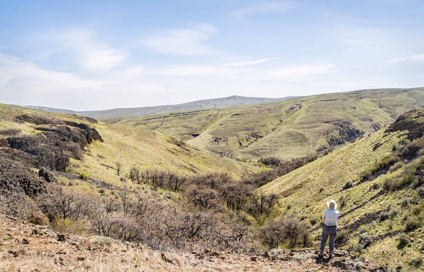
Horse Heaven Hills is a shrub steppe climb near Benton City that puts you on top of the plateau south of the Tri-Cities. The trailhead off McBee Road offers two routes up: a steep direct line and a longer, well-graded traverse. Take the longer route. It swings across the slope for about three-quarters of a mile, picks up an old road bed, then switchbacks through 600 feet of gain before a final rocky road push to the summit cairn.
From the top, the plateau drops away to the south and Rattlesnake Mountain fills the northwest horizon. On a clear day the Tri-Cities spread out toward Wallula Gap. The whole landscape feels enormous and empty. Wind is a constant companion up here, so pack a layer even on warm days.
The best window is April through early May, when the slopes turn green and wildflowers bloom across the otherwise brown steppe. By midsummer the heat and sun make this a punishing outing. There are no facilities at the trailhead, which has room for about eight cars. No pass is required. This is a quiet trail that rarely draws crowds, and several trip reporters have had the entire route to themselves.
Astronomy
Trail Conditions
Scorecard
Safety & Considerations
Today's Hazard
- Strong sun — sunscreen, hat, and sunglasses recommended
Persistent Hazards
- persistent wind exposure
- no water sources
- extreme summer heat
Getting There
Gravel parking area off McBee Road with space for about 8 cars. No facilities. From I-82 exit 96, take Weber Canyon Road and turn right onto McBee Road for half a mile.
Two routes leave the trailhead. The longer, graded trail to the left is the better choice. It traverses the slope, joins an old road bed, then switchbacks up to the summit cairn. The steep direct route gains elevation fast but is loose and unpleasant, especially on descent.
Start early in spring and avoid entirely in summer heat. Carry more water than you think you need. Wind can be fierce on the upper section.
Similar Hikes


.jpg)