Hex Mountain
Snoqualmie RegionBest Jun–Oct
A quiet ridge hike above the Cle Elum valley with a windswept summit and sweeping Teanaway views.
About This Trail
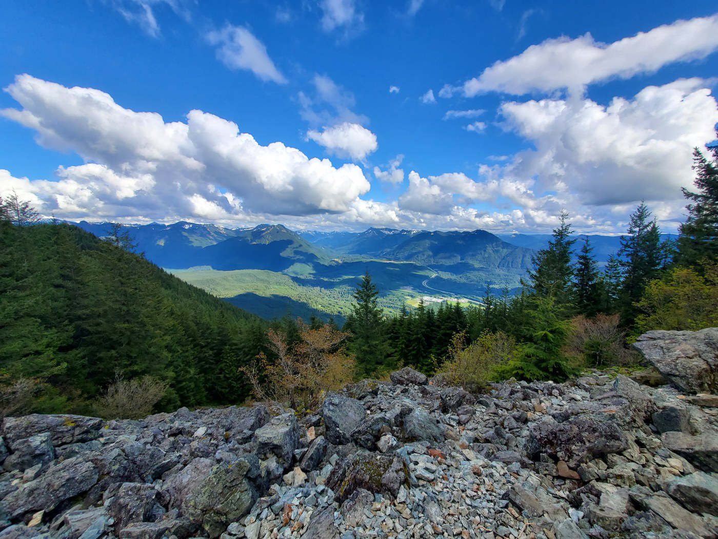
Hex Mountain rises above Lake Cle Elum in the Salmon La Sac area of the Snoqualmie Region, reaching a 5,034-foot summit after a steady 2,900-foot climb. The route follows an old woods road before joining a forested ridge, then narrows as trees thin and the trail pushes toward a bare, windswept top. Wildflowers fill the upper meadows in early summer.
From the summit, the horizon opens onto the Teanaway peaks, Mount Stuart, and the broad basin of Cle Elum Lake. The ridge is exposed and holds cornices into late spring, so early-season hikers should approach the summit ridge with caution. Winter access via NF-116 is closed, and the lower trail now crosses private land that is inaccessible to vehicles.
Few people visit compared to the popular Teanaway summits nearby. Roadside parking at the trailhead is limited. Park along the shoulder before the trail or use the pullout about 0.6 miles south; the fire station 0.2 miles south does not allow hiker parking.
Seasonal Highlights
Astronomy
Trail Conditions
Scorecard
Overshadowed by Teanaway and Alpine Lakes destinations nearby. Summer weekends see a handful of parties at most.
Safety & Considerations
Today's Hazard
- Strong sun — sunscreen, hat, and sunglasses recommended
Persistent Hazards
- Cornices persist along the summit ridge into late spring
- Summit is exposed and windswept with no shelter
- Lower trail crosses private land — stay on the posted route
Getting There
Limited roadside parking at the trailhead. Additional pullout roughly 0.6 miles south. Parking prohibited at the fire station 0.2 miles south.
The trail begins as an old woods road, switchbacks through forest, then gains the ridge. Push through thinning trees to reach the open summit.
Similar Hikes