
Dusty Lake
Central WashingtonBest Mar–May, Sep–Oct
Remote coulee lake behind basalt cliffs, a quieter alternative to Ancient Lakes.
About This Trail
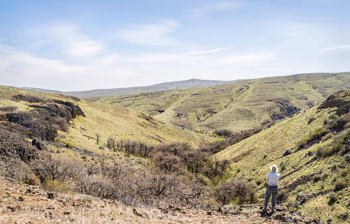
Dusty Lake sits at the far end of the Quincy Lakes Wildlife Area, tucked behind 200-to-300-foot basalt cliffs in a coulee carved by the Missoula Floods. Getting there requires more effort than the popular Ancient Lakes next door, which keeps the crowds away. The upper approach drops through cataracts with handrails into a deep alcove; the lower approach follows old two-tracks across Babcock Bench past Ancient Lakes and around a basalt rib.
The landscape is pure Columbia Basin scabland: basalt columns, sagebrush benches, and alkaline lakes with no established water source. A 160-foot waterfall in the North Alcove runs seasonally. The lake itself stretches long and narrow between cliff walls, with camping spots at both ends. Bridges along the lower route can be overgrown with vegetation in late summer.
This is exposed desert hiking. There is no shade, no reliable water, and temperatures climb rapidly after mid-morning in warm months. The gate on Quincy Lakes Road locks October through December, adding 3 miles of road walking. Carry a minimum of 2 liters of water per person.
Astronomy
Trail Conditions
“Conditions: Excellent — dry trail, no mud Hike Summary: Our group headed out to Ancient Lakes today for what turned out to be a spectacular early March day.”
Last report: Apr 26, 2026
Scorecard
Safety & Considerations
Today's Hazard
- Strong sun — sunscreen, hat, and sunglasses recommended; water reflection adds glare near the lake
Persistent Hazards
- No shade or water sources - carry minimum 2 liters per person
- Seasonal gate closure adds 3 miles of road walking (Oct-Dec)
- Basalt surfaces slippery when wet
- Overgrown bridges on lower route in late summer
- Rattlesnakes in rocky areas
Getting There
Upper trailhead has a large parking area with kiosk, yellow gate, and toilet. Discover Pass required. The gate locks October through December, forcing a 1.5-mile road walk to start. Lower trailhead at the end of Ancient Lakes Road on Babcock Bench.
Two approaches: the upper trailhead drops through cataracts (some with handrails) to the east end of the lake. The lower trailhead follows old two-tracks past Ancient Lakes and around a basalt rib to the west end. Both routes cover roughly 3 miles one way. The upper route is steeper but more direct.
Start early in warm months. The route has zero shade, and temperatures in the coulee exceed ambient by midday. Morning light on the basalt cliffs is worth the early alarm.
Recent Reports
This used to be our favorite place to come hike and fish in the shoulder seasons. Very few people, pristine land and lakes.
The trail running alongside the north edge of Dusty Lake is covered by a rock slide. Significant scrambling is required.
Conditions: Excellent — dry trail, no mud Hike Summary: Our group headed out to Ancient Lakes today for what turned out to be a spectacular early March day. Despite forecasts calling for 20+ mph gusts, we enjoyed calm, warm conditions with temps pushing close to 70°F — nearly fully exposed terrain, so pack at least 2 liters of water on warm days.
Similar Hikes


.jpg)