
Dog Creek
Central WashingtonBest Jun–Oct
Quiet subalpine spur in the William O. Douglas Wilderness below Rattlesnake Peaks.
About This Trail
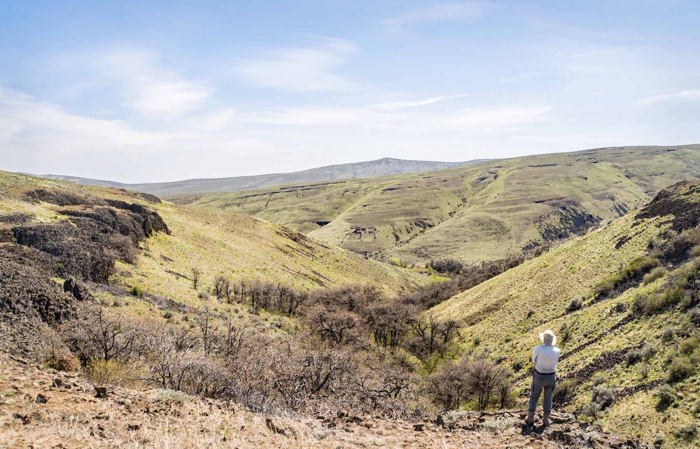
Dog Creek is a short spur trail in the William O. Douglas Wilderness that branches off the Richmond Mine Trail and follows its namesake creek into a quiet basin below the Rattlesnake Peaks. At 5,671 feet, the high point puts you well into subalpine territory on the east side of the Cascades, with views that feel far more remote than the 1.4-mile walk would suggest.
The trail sees very few visitors. Trip reports are sparse, and the ones that exist describe genuine solitude in a pocket of wilderness that most hikers pass through on longer routes connecting Mount Aix, Nelson Ridge, and Richmond Mine. For experienced hikers, Dog Creek works as a short detour on a much bigger day or as a standalone walk for anyone already camped in the area.
A recent wildfire has significantly impacted this trail. A 2025 trip report describes the route as difficult to follow through burned terrain. The access road is rough and remote, ending at a small pullout that fits four vehicles and a horse trailer. A Northwest Forest Pass is required. This is not a beginner-friendly destination due to the road access and current trail conditions, but for solitude seekers comfortable with route-finding, it rewards with alpine scenery and near-total quiet.
Astronomy
Trail Conditions
“Enjoyed a bit of overnight solitude in the east side of Justice Bill's Wilderness.”
Last report: Jun 19, 2025
Scorecard
Safety & Considerations
Today's Hazard
- Strong sun — sunscreen, hat, and sunglasses recommended
Persistent Hazards
- fire-damage
- route-finding
- rough-road-access
Getting There
Small pullout at the trailhead fits four vehicles and one horse trailer. No restroom. Northwest Forest Pass required.
From Naches, west on Highway 12 for 4.4 miles, continue on Highway 410 for 7.9 miles, left onto Nile Road, follow FR 1500 for 7.7 miles, FR 1502 for 5.2 miles, then FR 1509 for 1.9 miles to the trailhead. Pavement ends about 4 miles from the trailhead. The trail branches off the Richmond Mine Trail as a dead-end spur along Dog Creek.
No particular timing constraints for the short walk itself, but the long drive on rough forest roads means planning for the full day. Check road conditions before committing.
Recent Reports
This trail is pretty much toast, literally and figuratively. A recent burn has made the trail very difficult to follow.
This is a trip report for a lollipop route that starts at the Mount Aix Trail and utilizes that trail as well as Dog Creek Trail, Richmond Mine Trail and Nelson Ridge Trail to form a 25 mile route with nearly 10,000’ of cumulative gain. This route has a trip report from last September that I probably should have read prior to starting… Pavement ends about four miles from the trailhead.
Enjoyed a bit of overnight solitude in the east side of Justice Bill's Wilderness. The Mt.
Similar Hikes


.jpg)