Coyote Wall - The Labyrinth Loop
Southwest WashingtonBest Mar–Nov
Eastern Gorge wildflower loop through basalt labyrinths, oak groves, and a 300-foot cliff overlook.
About This Trail
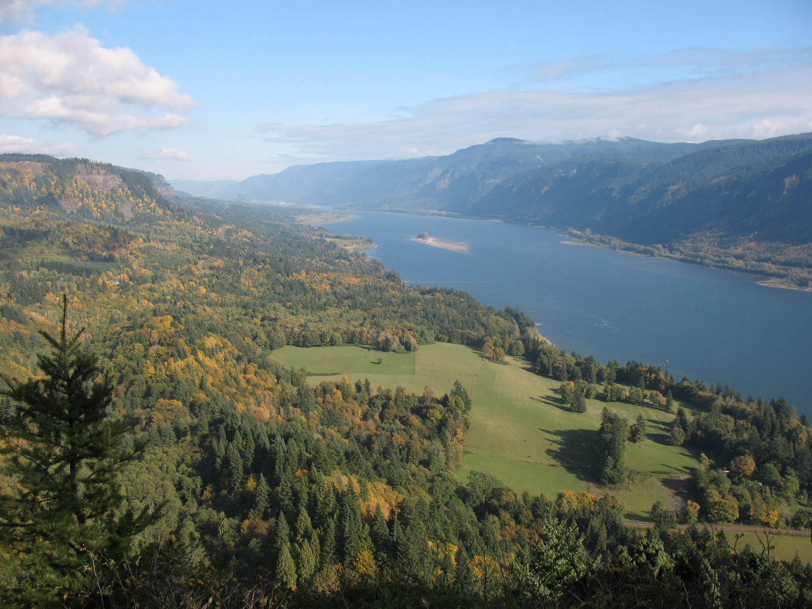
The Labyrinth Loop threads through one of the Gorge's premier wildflower corridors, combining basalt formations, oak woodlands, cascading waterfalls, and open grassland plateaus on the Washington side east of Bingen. The route stitches together multiple trails: Labyrinth Trail, Upper Labyrinth, Atwood Road, Old Jeep Road, Little Moab, and Maui Falls Trail.
Spring transforms this landscape. Grass widows appear first in February, followed by prairie stars, yellow bells, camas, and fields of balsamroot that peak in April and May. The terrain shifts constantly from grassy slopes to rocky outcrops to shaded oak groves. Labyrinth Falls provides a cascading waterpoint partway through the loop.
This stretch of the eastern Gorge sits in the rain shadow, staying dry and sunny when Portland and Vancouver get soaked. That makes it a go-to shoulder-season destination when west-end trails are waterlogged. The Coyote Wall viewpoint delivers a 300-foot cliff overlook of the Columbia. Watch for poison oak along the Labyrinth Trail sections. No restrooms at the trailhead, and no parking pass required.
Astronomy
Trail Conditions
Scorecard
Safety & Considerations
Today's Hazard
- Strong sun — sunscreen, hat, and sunglasses recommended; water reflection adds glare near the lake
Persistent Hazards
- Poison oak along Labyrinth Trail sections
- 300-foot cliff at Coyote Wall viewpoint with no guardrails
- Rattlesnakes in warm months
- Ticks in tall grass during spring
Getting There
Trailhead parking on Highway 14 between mileposts 69 and 70 at Courtney Road. No parking pass or fee required. No restroom facilities. Can also be accessed via I-84 on the Oregon side with a Hood River bridge crossing (toll).
The loop combines six named trail segments. Start on the Labyrinth Trail (CO7) heading uphill. The route is well-signed at major junctions. The counter-clockwise direction gives the best progression from shaded forest to open viewpoints.
Morning starts get the best wildflower light and avoid afternoon wind that funnels through the Gorge. The eastern location means clear skies arrive earlier than at western Gorge trailheads. Plan 3 to 5 hours for the full loop with photo stops.
Similar Hikes