Bear Canyon
Central WashingtonBest Apr–Jun, Oct
A creekside canyon hike through recovering burn country where Cascade forests meet the steppe.
About This Trail
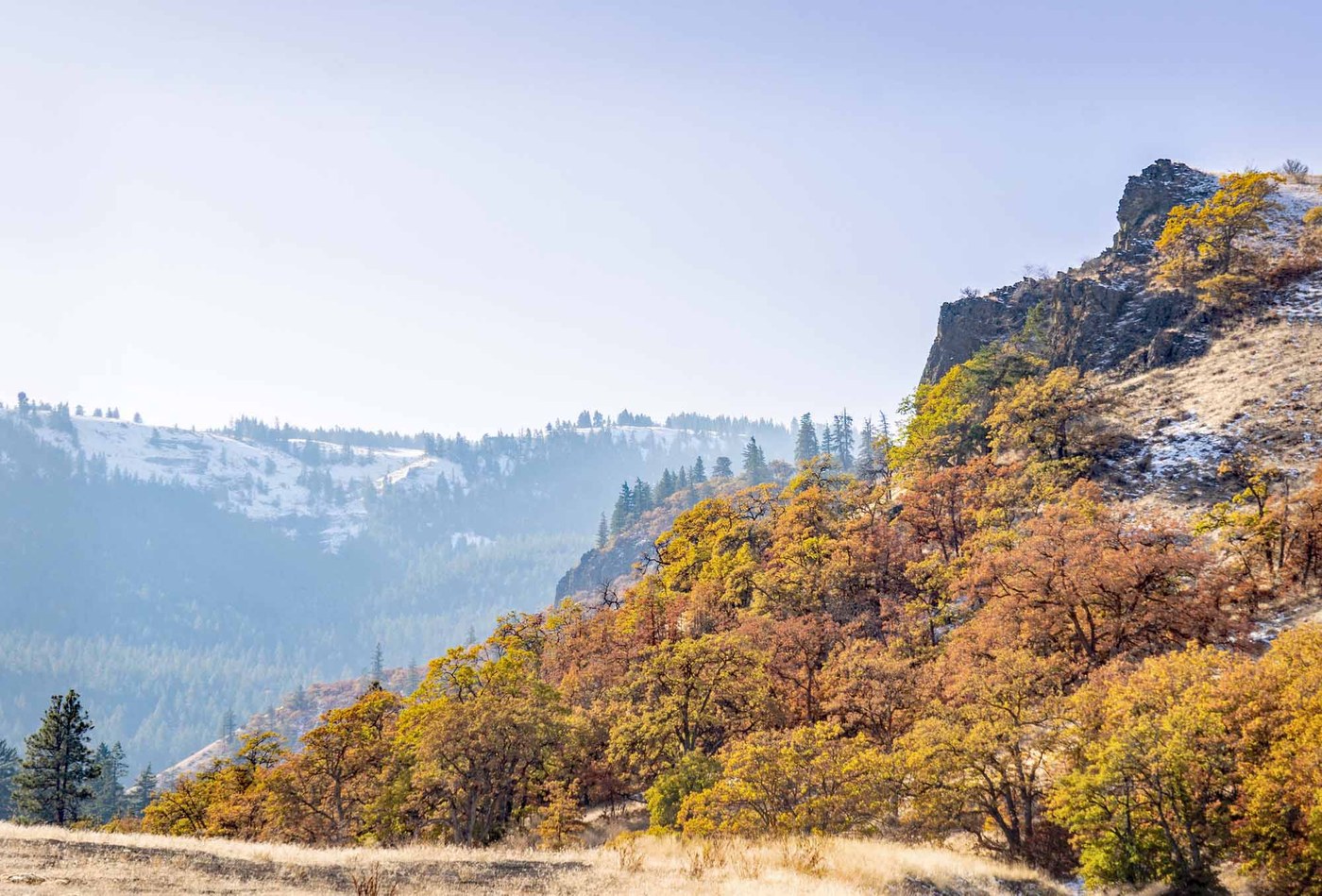
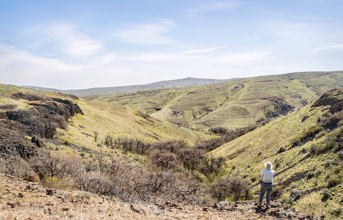
Bear Canyon follows a creek between steep basalt walls in the Oak Creek Wildlife Area, sitting right at the transition zone where the Cascades give way to eastern Washington's shrub steppe. The route starts on a short gravel road, then turns to single track with about seven unbridged creek crossings on rocks and logs. A stretch of washed-out trail around the halfway point needs careful footing. Past the rough section, an old roadbed carries you to the NF-275 junction. A half-mile side trip up that road rewards with better canyon views.
The ecosystem here is unusually varied for a low-elevation hike. Sagebrush gives way to white oak, black cottonwood, aspen, and ponderosa pine as you move up-canyon. Elk, deer, mountain goats, and bighorn sheep all use this drainage seasonally. The area burned in 2024, and recent trip reports note that while the landscape shows fire damage, wildflowers are already pushing through the burned ground, lending the canyon a stark, recovering character.
Rattlesnakes are common here in warmer months, so watch your step and keep dogs close. The canyon is quiet and rarely crowded. Cell coverage is unreliable, so save your directions before heading out. A Discover Pass is required. Fall color from the aspens and cottonwoods makes this a worthwhile October visit as well.
Astronomy
Trail Conditions
“Found this trailhead after driving by the nearby elk feeding station.”
Last report: Oct 28, 2025
Scorecard
Safety & Considerations
Today's Hazard
- Strong sun — sunscreen, hat, and sunglasses recommended; water reflection adds glare near the lake
Persistent Hazards
- rattlesnakes in warm months
- unbridged creek crossings
- washed-out trail section
- 2024 fire damage
- no cell service
Getting There
Gravel parking area near the Oak Creek elk feeding station off Highway 12. No facilities. Discover Pass required. From Naches, 10.8 miles west on Highway 12, turn right at the Bear Canyon sign.
Follow the gravel road for half a mile, then transition to single track. Seven creek crossings on rocks and logs. About 0.3 miles of washed-out trail requires careful navigation. At the NF-275 junction, the optional half-mile side trip up the road gives better canyon views.
Morning hours are cooler and reduce rattlesnake encounters. Save GPS directions before losing cell signal on Highway 12.
Recent Reports
It is too bad about the burn, would have been a marvelous canyon. However with that said, I would recommend this as fantastic Halloween hike!
Recently moved to the Yakima area so have been doing some exploring, scouting, etc. Found this trailhead after driving by the nearby elk feeding station.
The landscape surrounding the trail is burned from the fire in 2024; however the wildflowers are pushing through. The creek was peaceful to walk by.
Similar Hikes


.jpg)