Badger Mountain - Canyon Trail
AQI 117 · unhealthy-sensitiveCentral WashingtonBest Mar–May, Oct–Nov
The Tri-Cities' backyard summit, where 64 steep steps and a sagebrush climb earn you rivers, volcanoes, and Ice Age geology on a clear day.
About This Trail
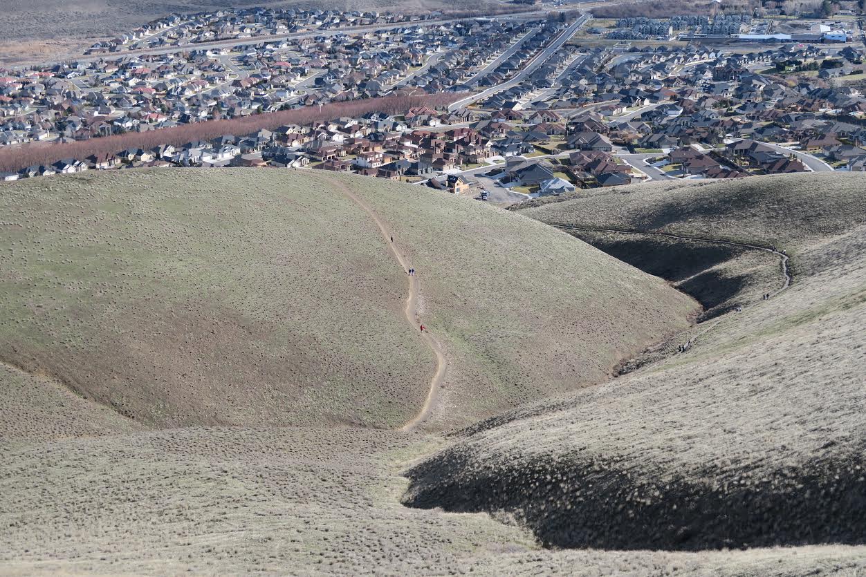
Badger Mountain is the go-to summit hike for Tri-Cities residents, and the Canyon Trail is the most direct route up. It starts with a set of 64 steep steps that serve as an honest preview of what follows: a steady, no-nonsense climb through open sagebrush hillside to the 1,579-foot summit. Benches along the way give you a reason to pause and look around as the views open up behind you.
From the top, the panorama takes in the Tri-Cities sprawl, the Columbia and Yakima Rivers, Hanford Reach, White Bluffs, and the Horse Heaven Hills. On clear days, Mount Rainier and Mount Adams stand on the western horizon. A monument near the summit marks the high-water line of ancient Lake Lewis, the massive glacial flood lake that covered this landscape 11,000 years ago to roughly 1,250 feet of elevation. It puts the geology of the place in perspective.
This is an urban-fringe trail that serves as the daily workout loop for a lot of locals. You will share it with dog walkers, runners, and families. Wildflowers brighten the hillsides in spring. The trail connects to the Sagebrush Trail and other routes on the mountain, so you can mix and match distances. No pass required, and the trailhead is right off Queensgate Drive in Richland with a proper parking lot.
Astronomy
Trail Conditions
“It's not to steep and has nice view of vineyards and the valley.”
Last report: Nov 14, 2025
Scorecard
Safety & Considerations
Today's Hazard
- Strong sun — sunscreen, hat, and sunglasses recommended
Persistent Hazards
- fully exposed with no shade
- steep initial staircase
Getting There
Free parking at Trailhead Park, 525 Queensgate Dr, Richland. No pass required. Well-maintained lot with good access.
From westbound I-182, take exit 3 and turn right on Queensgate. Continue to Keene Road at the stoplight, turn left, then right on Shockley Road. Trailhead Park is 0.3 miles ahead. From eastbound I-182, take exit 3A and follow the ramp curving right to merge with Queensgate, then follow the same directions.
Early morning or late afternoon to avoid heat. This trail gets direct sun all day. Spring and fall are the comfortable seasons. Popular with the before-work crowd.
Recent Reports
Short trail, with only about 1,000 feet of gain, but I repeated it a couple of times, then wandered over to the smaller but prominent hill to the south, where a few homes are being built. I used a connecting trail that dropped me off on the street, close to a small water tower, then hoofed it over to Small Badger, or whatever it might be called.
A simple and easy hike with a well-maintained trail. There isn't a ton to say.
It's not a road trip without a hike thrown in. First time in the Tri-Cities area on my way to Utah.
Similar Hikes


.jpg)