Augspurger Trail
Southwest WashingtonBest May–Oct
The quiet side of Dog Mountain, with the same wildflower show and bigger views for hikers willing to earn them.
About This Trail
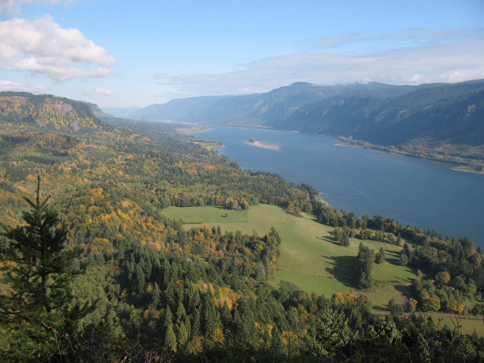
Augspurger Trail shares a trailhead with the wildly popular Dog Mountain but heads west instead of east, climbing steadily through mixed forest to a 3,000-foot summit ridge. The route gains 4,400 feet over 15.5 miles, making it one of the more demanding day hikes in the Columbia River Gorge. Views open up along the ridge to include Mount Adams, Mount Hood, and the Gorge itself.
Peak season runs May through June when balsamroot and lupine carpet the upper meadows. A 1.5-mile connector trail links Augspurger to Dog Mountain, allowing a full traverse for those with the legs for it. The free Dog Mountain Shuttle from Stevenson provides a useful workaround for weekend permit requirements during wildflower season.
The trailhead sits right on Highway 14 with limited parking and no restroom facilities. Weekend permits are required roughly April through June. An NW Forest Pass covers parking year-round. The trail sees far fewer people than its famous neighbor, which makes it a strong option for hikers who want Gorge wildflowers without the crowds.
Astronomy
Trail Conditions
“Early flowers are out, although the balsamroot is not really blooming at the top yet.”
Last report: Apr 8, 2026
Scorecard
Permits / Passes
Safety & Considerations
Today's Hazard
- Strong sun — sunscreen, hat, and sunglasses recommended; water reflection adds glare near the lake
Persistent Hazards
- High-speed traffic on Highway 14 near trailhead
- Exposed ridgeline with high winds possible
- No water sources along upper trail
Getting There
Small pullout trailhead directly on Highway 14. Do not park on the highway shoulder. Free shuttle from Stevenson available during peak wildflower season weekends. Weekend permits required approximately April through June.
From the shared trailhead with Dog Mountain, take the westbound fork. The trail climbs through forest with switchbacks before opening onto the ridge. A connector trail at the top links to Dog Mountain for a possible traverse. Return the same way or arrange a shuttle for the point-to-point option.
Early start recommended for this long day. Summer heat makes the exposed upper sections uncomfortable by midday. Plan 6 to 8 hours for the full out-and-back.
Recent Reports
I hiked up the 'difficult' Dog Mountain trail then came down the Augspurger Trail for a quieter descent, beautiful day and steep but well maintained trail. Early flowers are out, although the balsamroot is not really blooming at the top yet.
Checked Augspurger off yesterday. It was harder than I anticipated, and the summit was reeeeally cold and windy.
Trail: The main trail loop (Augspurger to Dog and back to the trailhead) is in good shape. There were some muddy spots higher up the trail, but they were minimal and easily navigated.
Similar Hikes