Picket Range Traverse
North CascadesBest May–Jul
A seven-day expedition through the most remote and rugged mountains in Washington, linking Fury, Luna, and Challenger on skis.
About This Trail
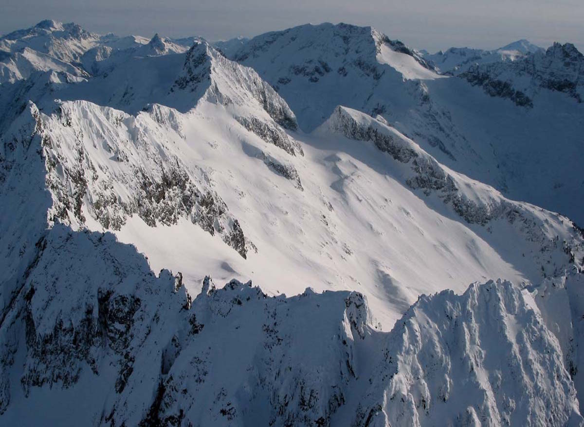
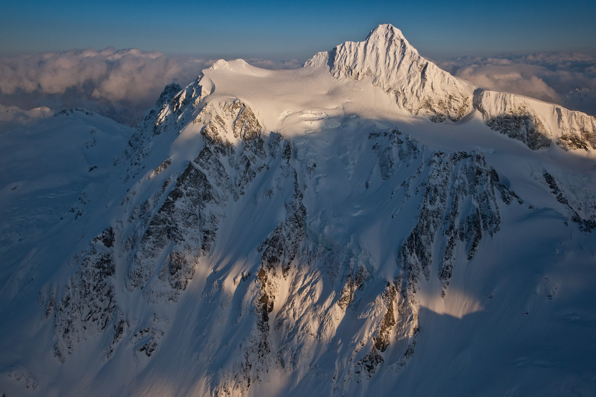
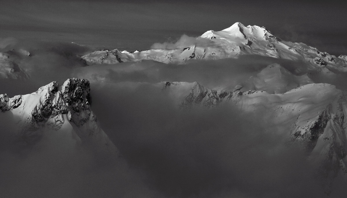
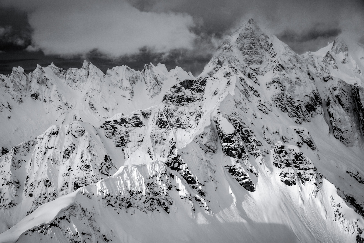
The Picket Range traverse is one of the most committing ski objectives in the Lower 48. Over seven days, the route links the southern and northern Pickets through terrain that sees almost no human traffic, crossing glaciers, threading cliff bands, and summiting Mount Fury, Luna Peak, and Mount Challenger along the way. This is expedition-grade ski mountaineering in a compact but ruthlessly complex range.
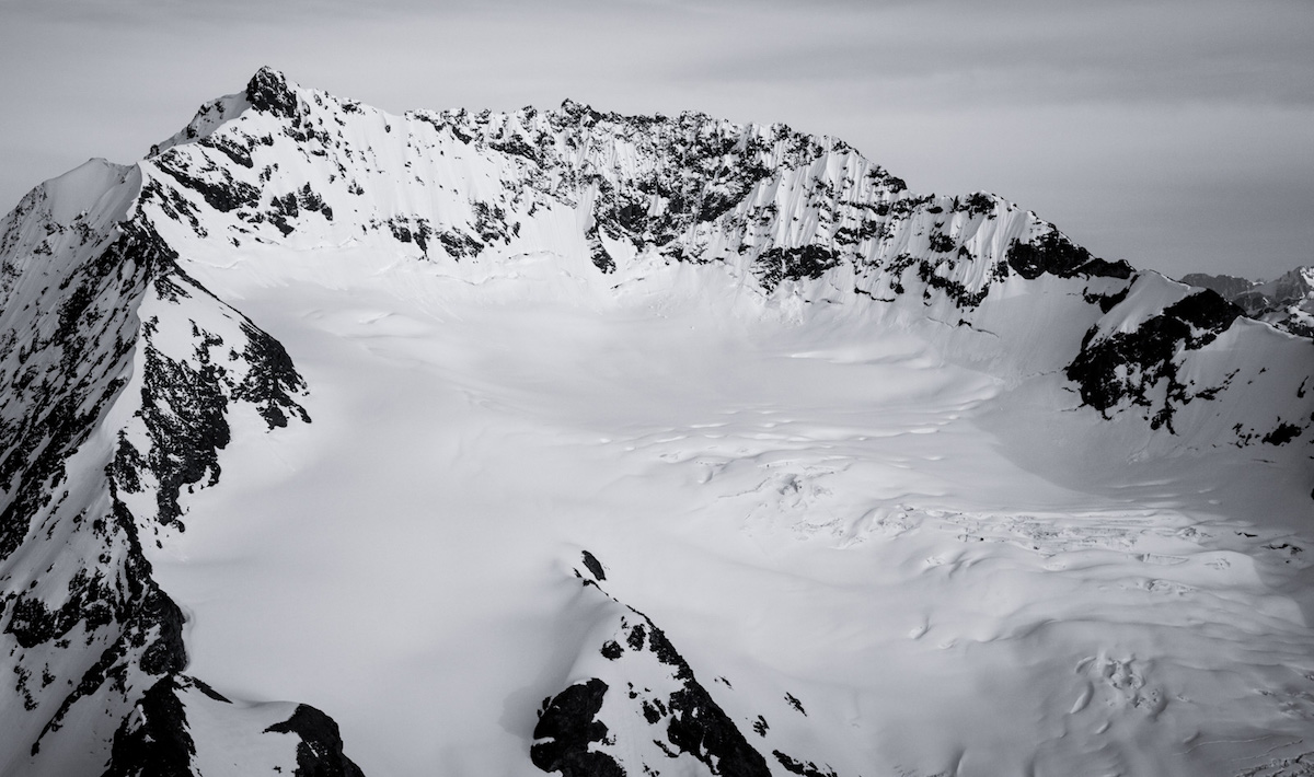
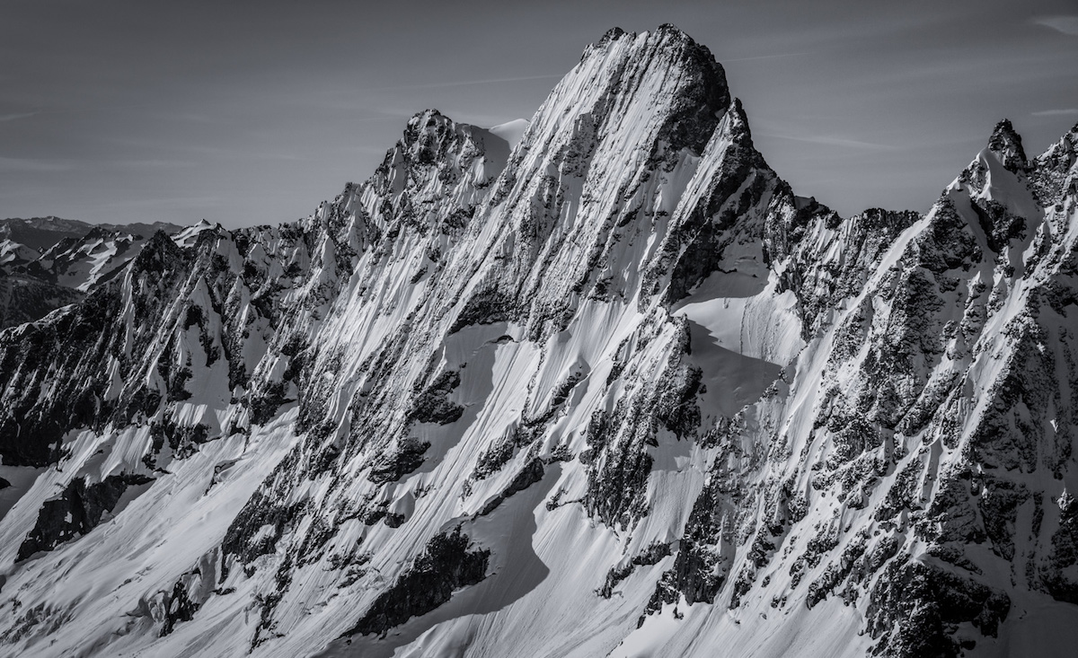
The traverse begins at the Sourdough Ridge trailhead off Highway 20 with a 3,500-foot trail approach before snow begins. McMillan Col serves as the crux of the route, requiring careful navigation through cliff bands that have turned back previous attempts. Beyond the col, the terrain opens into the heart of the Pickets, with massive glaciers connecting the major peaks and providing long ski descents between camps.
Bushwhacking through slide alder and devil's club fills the gaps between snow-covered sections, particularly on approaches and exits. Route-finding in whiteout conditions across the glaciated terrain presents serious navigation challenges. Previous attempts have been turned back by wet slab avalanches, and the remoteness means any injury or equipment failure creates a genuine emergency.
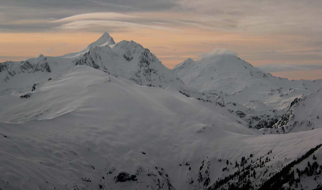
The payoff is total immersion in the wildest mountain terrain Washington has to offer. Views stretch from Ross Lake to Colonial Peak to Mount Baker. The Pickets see fewer visitors per year than most Cascade peaks see in a weekend, and skiing through this landscape delivers an experience closer to Alaska than anything else in the state.
Forecast
Astronomy
Trail Conditions
Scorecard
Safety & Considerations
Persistent Hazards
- Multi-day commitment with no easy bailout options
- Wet slab avalanche risk on glacier approaches
- Cliff bands at McMillan Col requiring downclimbing
- Extensive crevasse fields on glaciers between peaks
- Dense slide alder and devil's club bushwhacking
- Route-finding complexity in whiteout conditions across glaciated terrain
- Extreme remoteness with no cell coverage or rescue access
- Mosquito exposure in July
Getting There
Sourdough Ridge trailhead off Highway 20. Standard North Cascades trailhead parking. Highway 20 must be open, which typically occurs mid-to-late April but varies by year. Check WSDOT for opening status.
3,500 vertical feet of trail hiking from the Sourdough Ridge trailhead before reaching consistent snow. First camp at Stetattle Ridge. The route traverses south through McMillan Col (the crux), then connects Mount Fury, Luna Peak, and Mount Challenger. Significant bushwhacking through slide alder and devil's club between snow sections. Expect mixed climbing, downclimbing cliff bands, and glacier travel throughout.
Seven-day commitment minimum. Weather windows are critical; launching into a deteriorating forecast in this terrain has no good bailout options. Pre-position food caches if possible. Start at first light daily to maximize corn snow windows and travel time.
Similar Hikes