Eldorado Peak
North CascadesBest May–Jun
A 14-mile car-to-car glacier ski linking Eldorado and Inspiration Glaciers to an 8,868-foot summit.
About This Trail
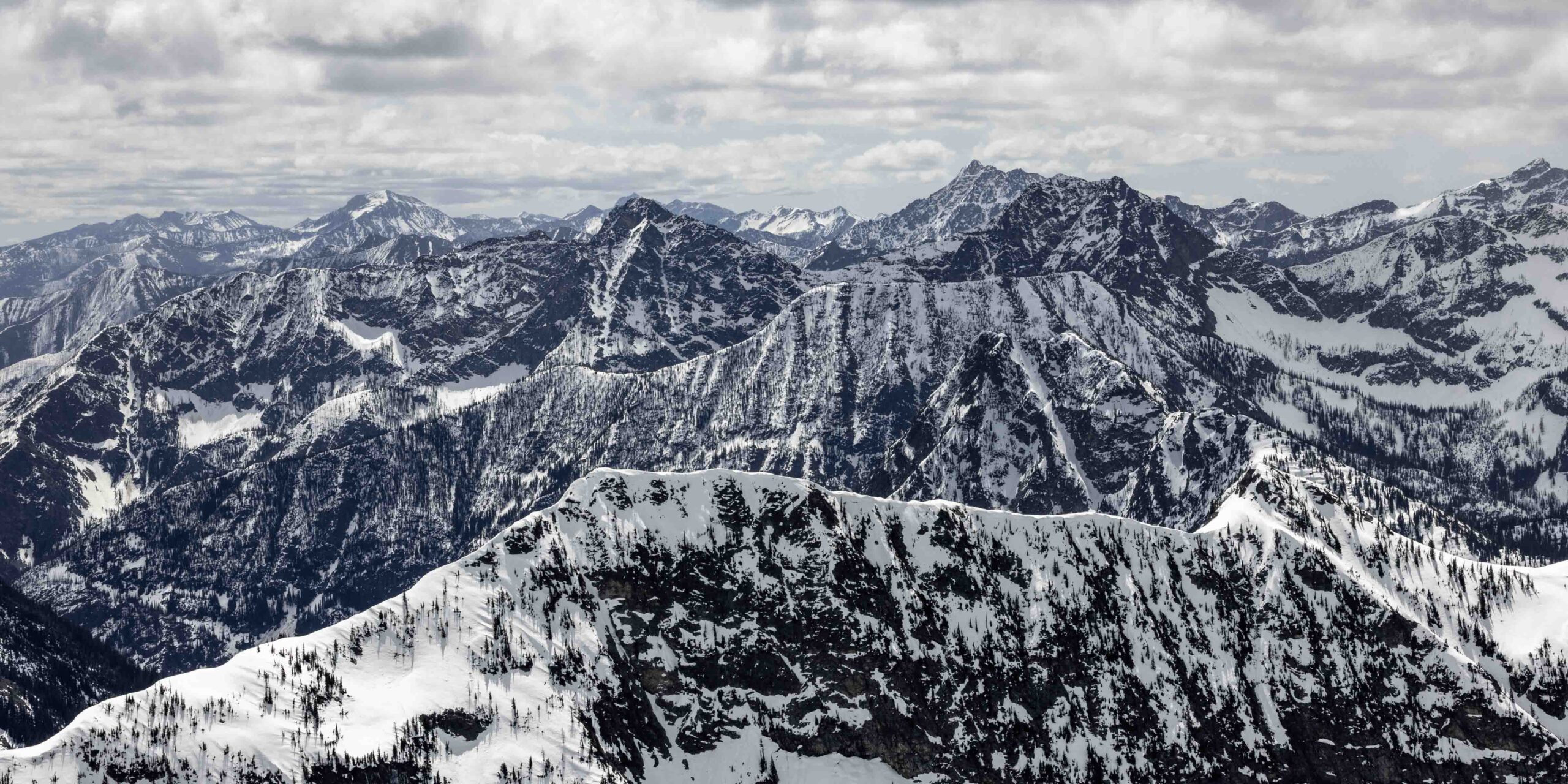
Eldorado Peak stands at 8,868 feet and offers one of the most direct glacier summit ski descents in the North Cascades. This car-to-car tour covers 14 miles with 7,300 feet of gain, starting from the Cascade River Road gate closure. A 2-mile bike approach on the closed road saves time before the real work begins: a brushy climber's trail with a river crossing on bound logs, then relentless vertical through alder before the terrain opens up.
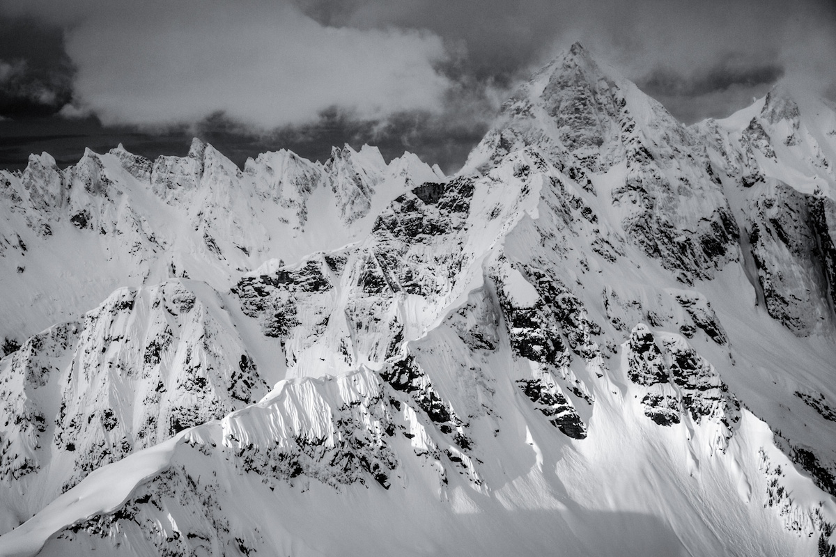
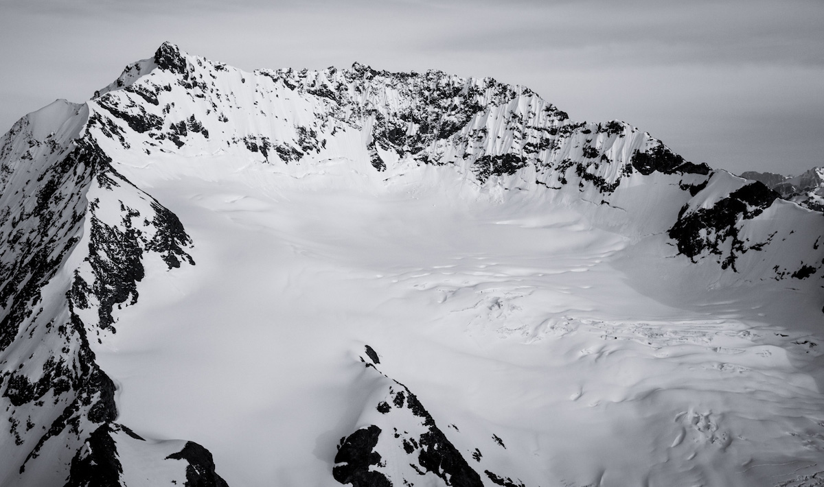
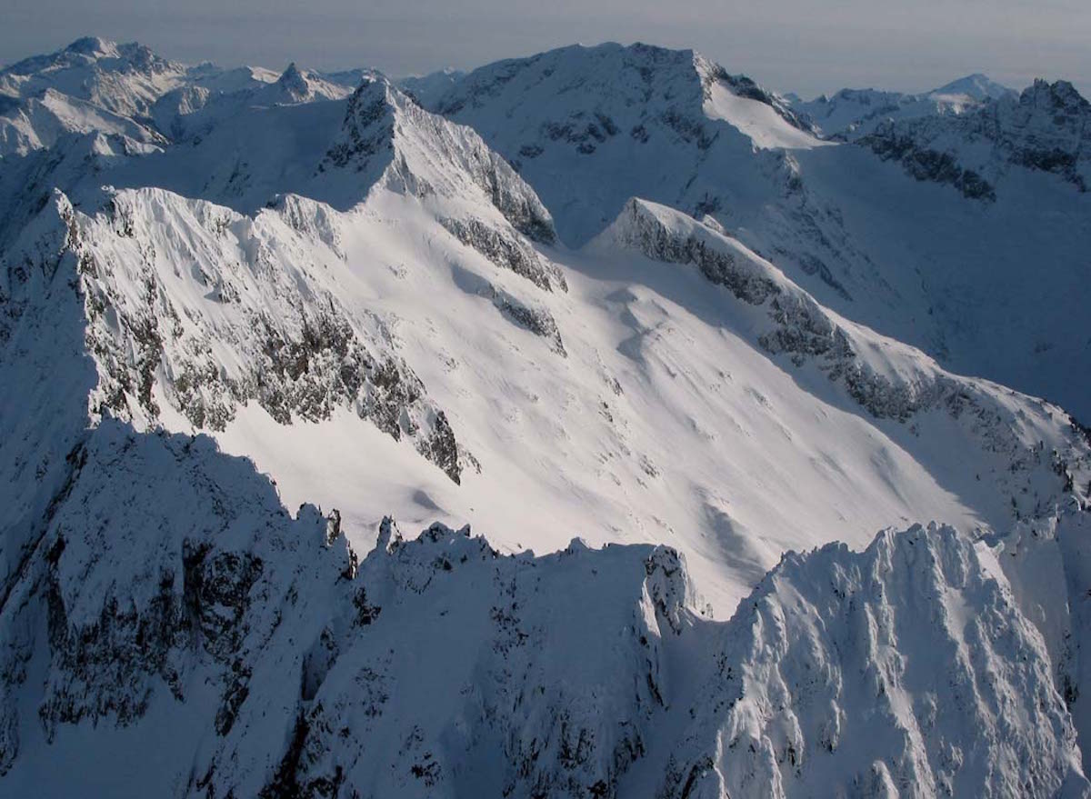
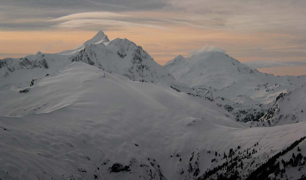
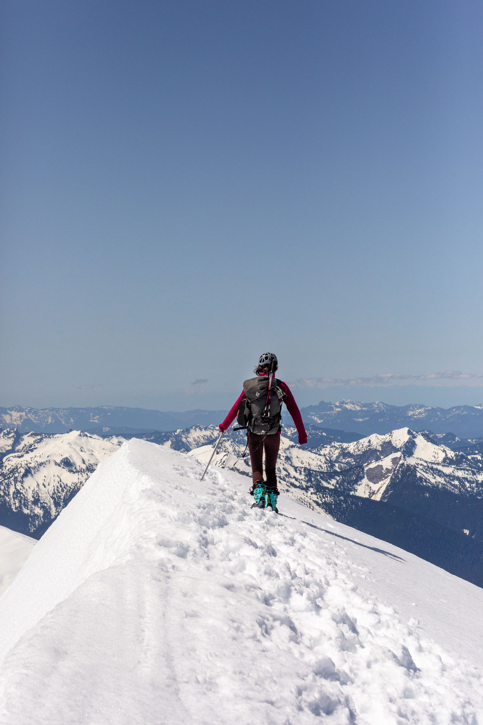
Above the brush, the route climbs through Eldorado Creek Basin gaining roughly 4,000 feet of sustained snow climbing, then traverses into Roush Creek Basin for another 1,400 feet to the Eldorado and Inspiration Glaciers. The final summit push crosses relatively flat glacier terrain before a steep knife-edge section to the top. Views from the summit span the full North Cascades skyline including Johannesburg Mountain.
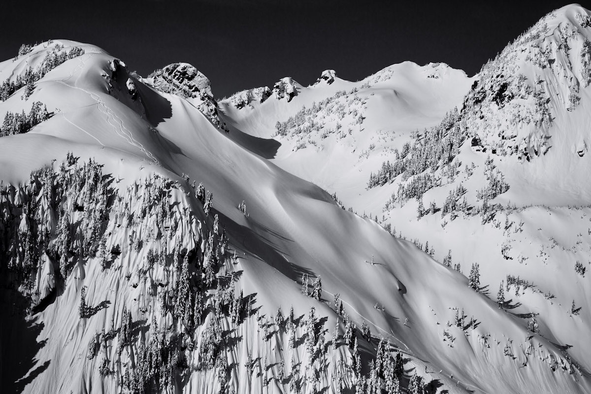
The descent skis at blue-run difficulty through the glacier sections, with conditions deteriorating to slushy breakable crust in the lower basins as the day warms. The brushy exit and bike-out round off a full day. This route works well as an introduction to glacier mountaineering for parties with basic crevasse rescue skills, though the sheer vertical and distance demand strong fitness.
Forecast
Astronomy
Trail Conditions
Scorecard
Safety & Considerations
Persistent Hazards
- Crevasses on Eldorado and Inspiration Glaciers
- Knife-edge summit ridge with exposure
- River crossing on bound logs (spring flow)
- Dense alder bushwhack on lower trail
- Afternoon breakable crust in lower basins
Getting There
Park at the Cascade River Road gate closure. The road closes seasonally, adding a 2-mile approach. Biking this section saves significant time. No parking fee required at the gate.
Bike 2 miles on closed Cascade River Road to the standard trailhead. Cross the river on bound logs, then climb the climber's trail through dense alder (first 300 vertical feet are the worst). Route opens into Eldorado Creek Basin, then Roush Creek Basin, before reaching the glaciers. Glacier travel requires crevasse awareness and rope for safe passage.
Pre-dawn start essential. Budget 7-10 hours for the ascent to allow descent while snow conditions hold. Morning firm snow in the basins turns to breakable crust by afternoon.
Similar Hikes