Mission Ridge
Central CascadesBest Apr–Jun, Sep–Oct
A long dry-side ridge walk shared with bikes, connecting to Devil's Gulch for a loop through the Wenatchee Mountains.
About This Trail
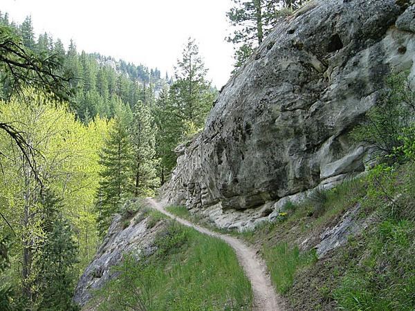
Mission Ridge Trail follows a long ridgeline south of Cashmere through the Wenatchee Mountains, climbing 3,200 feet over 7 miles along a route shared with mountain bikes and dirt bikes. The motorized use has compacted the trail surface in places and created narrow, cupped sections that can be tough on knees and ankles, especially with a pack. About a third of the route passes through burnt forest where fireweed and wildflowers have taken over, opening up long views of the surrounding dry-side landscape.
The ridge connects with Devil's Gulch Trail, enabling a popular loop. Many hikers go up Devil's Gulch and descend Mission Ridge, or vice versa. The ridge is largely open and dry, matching the character of the eastern Cascades foothills. Established camping spots are scarce; a semi-established site sits about 0.1 miles south of the Devil's Gulch junction with valley views. Water is equally hard to find, with the nearest source about half a mile south of that junction.
The trailhead access off Number 2 Canyon Road south of Wenatchee involves several turns onto forest roads. An early start helps on hot days since the exposed sections bake in afternoon sun. Old-growth ponderosa pine and Douglas fir characterize the unburned stretches. Birding is reportedly good in the transitional zones between forest and burn.
Seasonal Highlights
Astronomy
Trail Conditions
Trail surface compacted from motorized use, with narrow cupped sections. No recent trail issues reported. The dry-side location means the trail is accessible earlier in spring and later in fall than most Cascade trails. Snow-free by April in most years.
“I started at the North Tronsen Ridge Trailhead atop 5 mile road.”
Last report: Jun 25, 2024
Scorecard
Shared with mountain bikes and dirt bikes. Foot traffic is generally light. Moto traffic varies but is more common on weekends.
Safety & Considerations
Today's Hazard
- Strong sun — sunscreen, hat, and sunglasses recommended
Persistent Hazards
- Shared trail with motorized bikes
- Very limited water on the ridge
- Hot and exposed in summer afternoon
- Cupped trail surface hard on ankles
Getting There
Small trailhead off NF-7100. No facilities at the trailhead.
From Wenatchee, south on Number 2 Canyon Road. Left on NF-7101, continue to Peavine Canyon Road, then NF-7100 for 3.1 miles to trailhead on left. Several turns through forest roads; navigation app recommended.
Start early on hot days. The exposed burn sections and south-facing slopes bake in afternoon sun.
Recent Reports
I ventured to the Wenatchee Mountains for a big ol' loop utilizing a bunch of trails. I started at the North Tronsen Ridge Trailhead atop 5 mile road.
Beautiful scenery and a nice escape from the rainy west side of the Cascades! We made a loop starting at Devil’s Gulch trailhead, took Devil’s Gulch out and up, and came back down on Mission Ridge.
This hike starts about 10 miles south from Cashmere. I combined the 2 trails and did a loop hike.
Similar Hikes


