Merritt Lake and Lost Lake
Central CascadesBest Jun–Oct
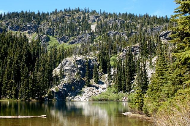
Steep climb to a forested alpine lake on Nason Ridge with early-season access and good huckleberries.
About This Trail
Merritt Lake sits at 5,000 feet on the Nason Ridge east of Stevens Pass, reached by a 5.5-mile round trip that front-loads most of its 2,100 feet of gain in steep switchbacks alongside Highway 2. The initial 1.75 miles climb relentlessly through forest before the grade eases and the trail opens into huckleberry meadows. The lake fills a forested basin below the ridge with eastern brook trout and good swimming on warm days.
The south-facing approach melts out early for its elevation, making this accessible before many other alpine lakes in the area. The forest keeps the trail shaded in summer, which offsets the steep lower section. An extension to Lost Lake adds another 3.5 miles and 1,100 feet of gain along the Nason Ridge for parties wanting a longer day. Late August brings prime huckleberry picking on the upper trail.
The trailhead access road is rough for the last half mile, with rocky, steep sections that make high-clearance vehicles a strong recommendation. The trail sees moderate use but rarely feels crowded. Bugs can be bad at the lake in early summer.
Seasonal Highlights
Astronomy
Trail Conditions
South-facing slopes melt out early for the elevation. Trail is in good shape with some rocky and rooty sections. Access road is rough in the last half mile. Huckleberries ripen in late August. Bugs worst in July at the lake.
“A nice workout for the amount of elevation gain and distance.”
Last report: May 28, 2026
Scorecard
Quieter than comparable lake hikes near Stevens Pass. Moderate use on summer weekends. Rarely crowded.
Safety & Considerations
Today's Hazard
- Strong sun — sunscreen, hat, and sunglasses recommended; water reflection adds glare near the lake
Persistent Hazards
- Steep switchbacks with unstable rocks and roots on lower trail
- Bugs heavy at lake in early summer
Getting There
High-clearance vehicle recommended
Last half mile of access road is rocky and steep. High clearance recommended. Small parking area at trailhead.
From Stevens Pass, continue 11.5 miles east on Highway 2 and turn left onto Forest Service Road 657 for 1.5 miles. Last half mile is rough. No pass required.
Recent Reports
This is a gem that could use some WTA crosscut saw love! It's a beautiful lake with a pit toilet, a trail that continues to the ridge above, a big camping area with lots of places to explore, and good water access.
We hiked to Merritt Lake only. The road is rough but passible for the first mile, then the last half mile is very rocky and steep, drive your Prius at your own risk and leave the low rider in the garage.
Trail is front-loaded with elevation gain, but eventually levels out. Some unstable rocks and roots on the trail but very doable.
Similar Hikes


