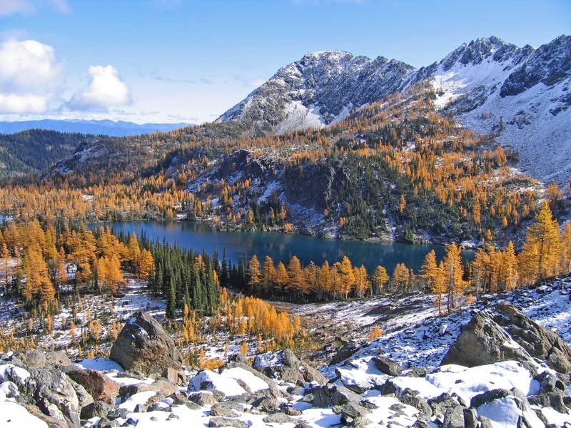
Larch Lake
Central CascadesBest Jul–Oct
A remote alpine lake ringed by subalpine larch, glowing gold in October above the Chiwaukum Creek valley.
About This Trail
Larch Lake sits at 6,413 feet in the Alpine Lakes Wilderness, surrounded by the golden subalpine larch trees that give it its name. Two approaches exist: the long Chiwaukum Creek Trail (12 miles one way, 4,591 feet of gain) or through Alpine Lakes High Camp, a private backcountry lodge that requires reservations and offers a shorter, maintained route.
The Chiwaukum Creek approach follows the creek through a significant burn area from fires roughly five years ago. The burn zone is hot, exposed, and overgrown with brush in places. Blowdown remains a persistent problem. Rattlesnakes have been reported in the lower sections. Beyond the burn, the trail enters intact forest and climbs to the lake basin where larch trees ring the shoreline.
The lake glows golden in October when the larches turn. The basin is remote and quiet, rarely seeing more than a handful of parties even during larch season. The Chiwaukum Creek trailhead sits at 1,850 feet off Highway 2 west of Leavenworth. A privy is available. Northwest Forest Pass and self-issued wilderness permit required.
Seasonal Highlights
Astronomy
Trail Conditions
“Day 1: Hiked up Chiwaukum Creek through the burn area, which was hot and exposed and quite brushy in spots.”
Last report: Oct 18, 2025
Scorecard
Remote and difficult access keeps this trail very quiet. Even larch season sees only a handful of parties. Alpine Lakes High Camp guests have easier access but numbers are limited by lodge capacity.
Permits / Passes
Safety & Considerations
Today's Hazards
- Strong sun — sunscreen, hat, and sunglasses recommended; water reflection adds glare near the lake
- Trees Down
Persistent Hazards
- Extensive blowdown through burn area
- Rattlesnakes reported in lower Chiwaukum Creek sections
- Overgrown brush in burn zone, head-high in places
- Long remote approach with no easy bail-out
Getting There
Chiwaukum Creek trailhead has a privy. Off Highway 2 west of Leavenworth via FR 7908. Northwest Forest Pass required.
Recent Reports
We hiked to Larch Lake from High Camp. Hike was moderate with a little snow near Larch Lake.
Today I hiked to the Larch Lake from the Alpine Lakes High camp. The trail starts on a private property, either you need reservation to stay at the camp or take the weekly shuttle up to the camp.
Our objective was to hike up Chiwaukum Creek, camp at Chiwaukum Lake and then visit Larch Lake. We failed due to extensive dead-fall following the fires about 5 years ago.
Similar Hikes


