Lake Serene
Central CascadesBest May–Oct
A steep forest climb to a dramatic alpine lake beneath the 900-meter vertical cliffs of Mount Index, with a waterfall spur along the way.
About This Trail
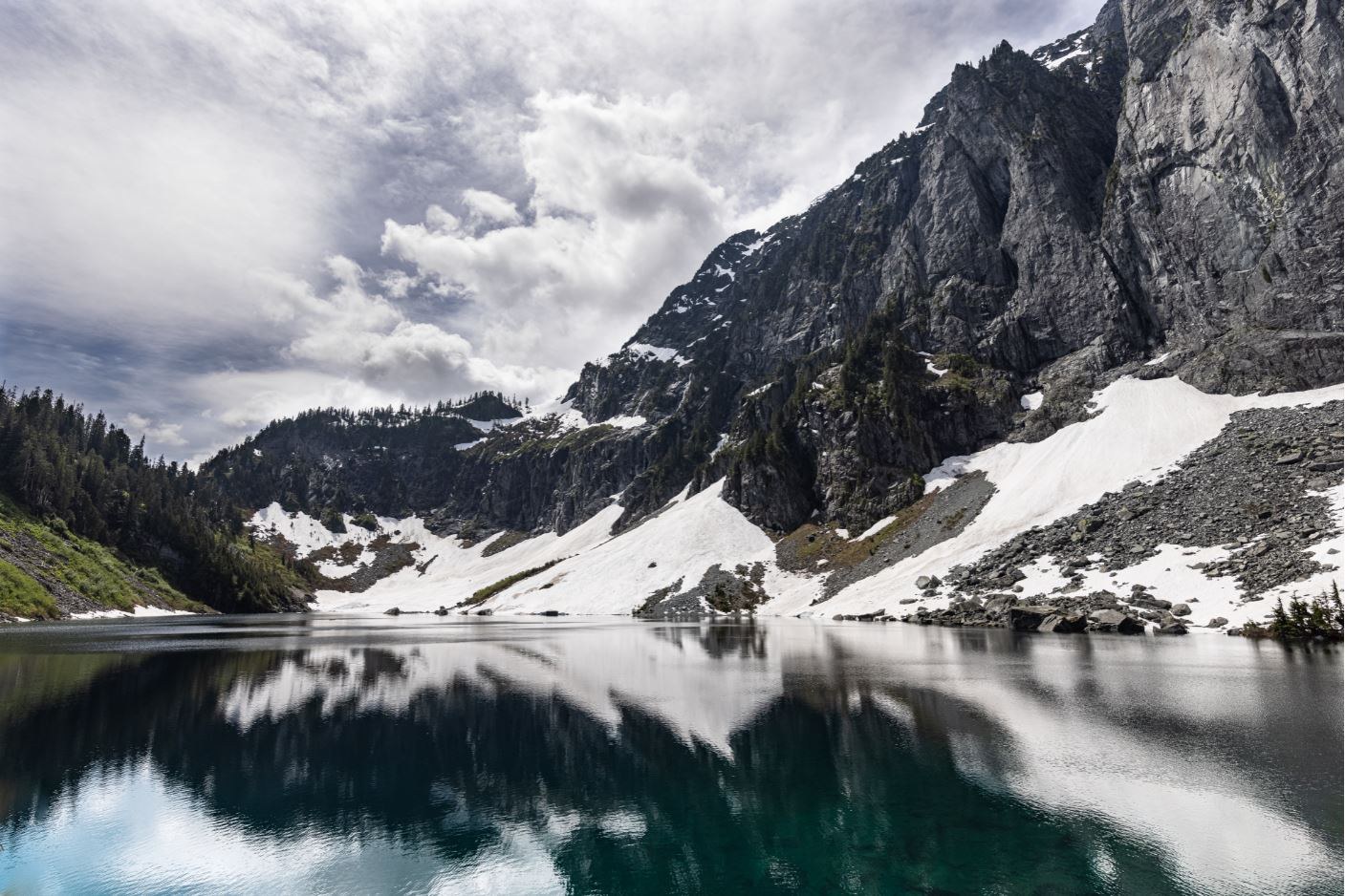
Lake Serene sits in a granite basin directly beneath the north face of Mount Index, one of the most imposing cliff faces in the Cascades. The lake reflects nearly 900 meters of vertical rock wall. At 13.2 km round trip with 610 meters of gain, it packs serious visual impact into a moderate-length day hike accessible from Highway 2.
The trail follows an old road through salmonberry thickets and mixed forest for the first few kilometers. At 2.7 km, a signed spur breaks right toward Bridal Veil Falls. That half-kilometer detour climbs steeply on stairs to multiple viewpoints of the falls cascading down rock slabs. The lower viewpoint gives the best full perspective; stairs lead up for a closer look. Use caution near the water, especially with children.
Past the falls junction, the main trail crosses the creek and begins climbing in earnest. The final 2.4 km gain roughly 400 meters via wooden stairs, rock steps, and root ladders through dense forest that opens at the lake basin. The staircase sections are well-built but relentless. The payoff arrives abruptly as the forest drops away and the full cliff face of Mount Index fills the sky above the lake.
Dogs on leash are welcome. No permit beyond a Northwest Forest Pass. The trailhead on Mount Index Road sits just off Highway 2, making this one of the most accessible alpine lake hikes on the Highway 2 corridor. Expect company on weekends year-round.
Mountain Weather
Astronomy
Trail Conditions
“got there about 9am on sunday morning, parking lot was maybe 75% full.”
Last report: Jun 21, 2026
Scorecard
Safety & Considerations
Today's Hazard
- Strong sun — sunscreen, hat, and sunglasses recommended; water reflection adds glare near the lake
Persistent Hazards
- Slippery wooden stairs when wet
- Creek crossing near falls spur
- Blowdowns reported on lower trail sections
- Snow and ice patches above falls junction in spring
Getting There
Large parking lot off Mount Index Road, just off Highway 2. Fills by mid-morning on summer weekends. Weekday visits avoid the worst crowding. Toilet at trailhead.
From Everett, take Highway 2 east through Gold Bar and continue 7 miles. At the curve revealing a large bridge over the Skykomish River, turn right onto Mount Index Road. After a quarter mile on dirt, turn right following Lake Serene Trail 1068 signs. Parking lot is 150 meters ahead.
No pre-dawn start needed. The trail stays in forest cover so midday heat is manageable. Morning starts beat the parking crunch on weekends. Sunrise hikers report excellent solitude.
Recent Reports
absolutely gorgeous trail. got there about 9am on sunday morning, parking lot was maybe 75% full.
Overall trail is mostly easy until turn off to fall. Hike to falls is steep with stairs in between.
Trail conditions: For the most part the trail looks good! This hike definitely earns its classification as moderate/hard given just how rocky the trail is in the second half, but the elevation gain is moderate-ish and there aren't any threatening drop-offs, etc.
Similar Hikes


