Lake Sally Ann
Central CascadesBest Jul–Sep
A backcountry basecamp lake on the PCT with three approach routes and peak-bagging in every direction.
About This Trail
Lake Sally Ann is a small alpine lake tucked into a cirque just off the Pacific Crest Trail, and getting there is half the adventure. Three approach routes offer very different experiences. Cady Ridge is the most direct but steepest, with open views the whole way. Cady Creek winds through a forested valley for 9 miles with more shade and a gentler grade, though the trail is exceptionally brushy with shoulder-high devil's club and thistle in places. The Little Wenatchee approach from the north crosses large avalanche chutes and passes through Meander Meadow before reaching the PCT.
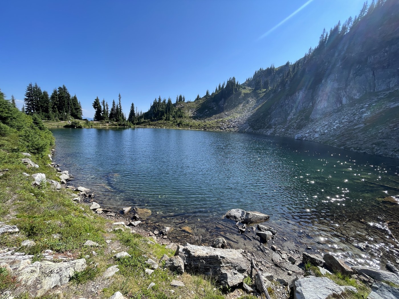
The lake itself sits at 5,528 feet with several established campsites and a backcountry toilet. It fills up on summer weekends, so have a backup plan or arrive early. Swimming is possible if you do not mind cold water. The surrounding country is rich with huckleberries and blueberries from late July into September, and the ridgelines above the lake offer easy side trips to broader views of Glacier Peak and the northern Cascades.
Most people treat Lake Sally Ann as a basecamp for a multi-day trip. The classic itinerary is three or four days: approach via Cady Creek, camp at the lake, explore Kodak Peak and upper Cady Ridge, then loop out through Meander Meadow. Day hikers occasionally reach the lake via Cady Ridge, but it is a long push.
Mountain Weather
Astronomy
Trail Conditions
“Got to the little Wenatchee trailhead around 9am.”
Last report: Sep 12, 2025
Scorecard
Safety & Considerations
Today's Hazard
- Strong sun — sunscreen, hat, and sunglasses recommended; water reflection adds glare near the lake
Persistent Hazards
- Cady Creek approach is severely brushy with devil's club and stinging nettle
- Campsites at lake fill on summer weekends
- Multiple approach routes involve rough forest roads with potholes and occasional closures
- Mosquitoes can be intense in July
Getting There
Access via Little Wenatchee Ford trailhead (north approach) or via Beckler Road to the North Fork Skykomish trailhead (west approaches). Both involve long drives on forest roads with potholes. FS Road 65 has had flood closures. Northwest Forest Pass required.
From Coles Corner, take Highway 207 north, cross the Wenatchee River bridge at 4 miles, and continue to the Little Wenatchee Ford trailhead at roughly 25 miles. The final 3 miles are unpaved but typically passable. Three trail options branch from this area: Cady Ridge (steep, direct, exposed), Cady Creek (long, shaded, brushy), or Little Wenatchee/Meander Meadow (moderate, scenic).
This is almost always a backpacking destination. If you are day-hiking via Cady Ridge, the most direct route, start very early and budget a full day. Most hikers take 2-4 days for the full loop experience.
Recent Reports
Got to the little Wenatchee trailhead around 9am. There is a road detour in the unpaved section but you don't have many options so it's easy to figure out.
For Labor Day Weekend, I did a one-night lollipop loop from the North Fork Skykomish River -> Pass Creek -> PCT -> North Fork Skykomish River trails, camping at Lake Sally Ann. 21.
I took a fall a few weeks ago and cracked some ribs. Going a bit stir crazy after cancelling a previous backpack trip, I had to get out and test em.
Similar Hikes


