Klonaqua Lakes
Central CascadesBest Jul–Sep
A long valley approach through old-growth forest rewarded by a hidden cirque of alpine lakes beneath Granite Mountain.
About This Trail
The walk to Klonaqua Lakes is a study in patience. You spend the first eight miles on gentle trail through the Icicle Creek and French Creek drainages, passing old-growth cedar groves, berry patches, and established campsites with a privy at 1.8 miles. The forest keeps you company, the creek keeps you cool, and the grade barely registers. Then the trail turns uphill and the real work begins.
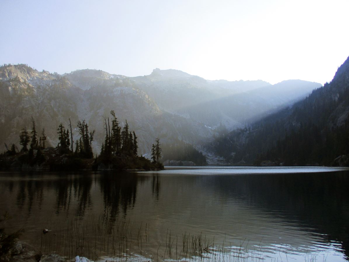
The final two miles gain 1,600 feet to Lower Klonaqua Lake, parked in a granite cirque at the foot of Granite Mountain. Upper Klonaqua sits a mile beyond over a land bridge, and Bob Lake hides on an unmarked spur at the 9.4-mile mark. All three lakes have campsites and good swimming. This is proper backcountry, not a day hike destination for most people.
Expect a knee-deep creek ford around mile 7.9 where no bridge exists. The French Creek corridor gets brushy in sections due to limited maintenance funding, so long pants earn their keep. Car break-ins have been reported at the Icicle Creek trailhead, so don't leave valuables visible. Dogs are welcome on leash.
Forecast
Astronomy
Trail Conditions
“A few notes: -French Creek trail was pretty brushy for stretches.”
Last report: Aug 2, 2025
Scorecard
Safety & Considerations
Today's Hazard
- Strong sun — sunscreen, hat, and sunglasses recommended; water reflection adds glare near the lake
Persistent Hazards
- bridgeless creek ford at mile 7.9 (knee-deep in summer, potentially impassable in spring)
- car break-ins reported at Icicle Creek trailhead
- brushy trail sections on French Creek corridor
Getting There
About 20 spaces at the Icicle Creek trailhead with a picnic table. No water or privy at the lot itself, but the campground 1.8 miles in has both. Northwest Forest Pass required. Self-issue wilderness permit at the trailhead (free).
From Highway 2, take Icicle River Road just west of Leavenworth. Follow pavement then gravel about 16.7 miles, veer left at a fork crossing the Icicle Creek bridge, then continue 1.8 miles to the trailhead. Start on Icicle Creek Trail, then turn left at the French Creek junction at 2.0 miles. Stay on French Creek Trail past the French Ridge and Snowall Creek junctions. At 7.9 miles, ford the bridgeless creek, then take the Klonaqua Lakes spur for the final steep 2-mile push.
Plan this as a backpacking trip. The 10-mile one-way distance and 2,700 feet of gain make a day hike punishing for most parties. An early start helps if you want to secure a lakeside campsite on summer weekends.
Recent Reports
Hiked to Upper Klonaqua Lake for some weekend fishing with the dogs. A great time!
Arrived at the Icicle Creek Trailhead at 1pm. We found a car with the windows smashed out.
This is part of a longer itinerary from Lake Ingalls to Stevens Pass. The previous segment is -- Jack Creek to Meadow Creek.
Similar Hikes


