Iron Bear - Teanaway Ridge
Central CascadesBest Jun–Sep
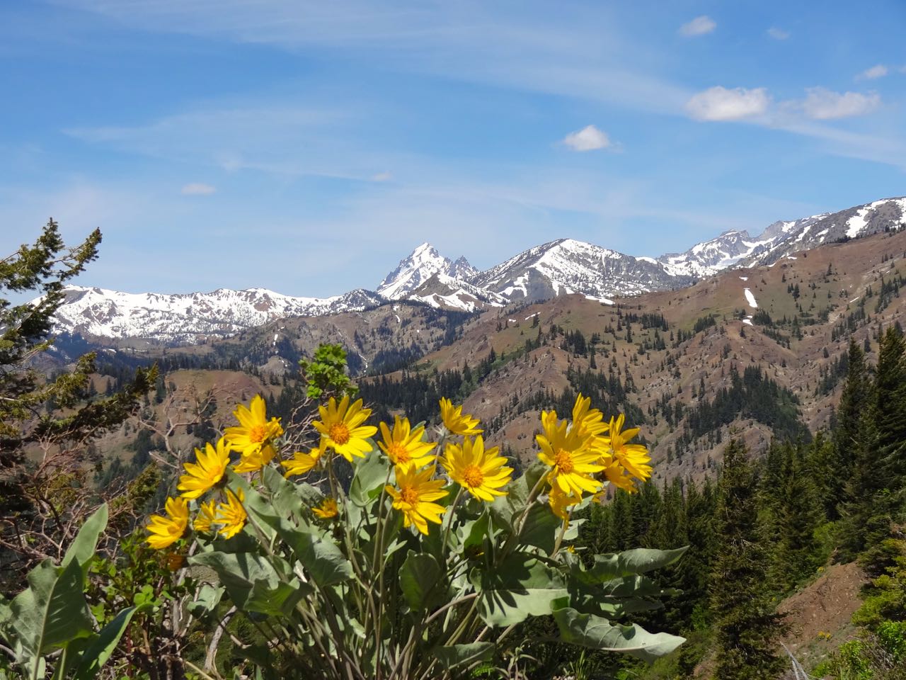
A wildflower-drenched ridge walk with Stuart Range views that earns every foot of its climb.
About This Trail
The Iron Bear trail starts in open forest on the east side of the Cascades and wastes no time gaining elevation through slopes thick with balsamroot, lupine, and penstemon. By the time you reach Iron Bear Pass at around 4,500 feet, the Teanaway country opens up in every direction. From there, the Teanaway Ridge Trail heads north along the crest, climbing another 1,000 feet over rolling ridgeline to an unnamed summit where Mount Stuart and Mount Rainier both fill the skyline.
This is a multi-use trail, so expect the occasional dirt bike or horse, particularly after the Forest Service lifts the motorized closure in mid-June. The route faces south and east, which means it dries out fast in spring but can cook you in midsummer. Morning starts pay off here. The trailhead access road (FR 9714) has a stream ford near the end that can run high during snowmelt, so clearance matters early in the season.
The wildflower display from late June through mid-July is genuinely exceptional. People compare this stretch to a planted garden, and they are not exaggerating. If you want east-side ridge walking with big views and fewer bodies than the Enchantments corridor, this is the ticket.
Astronomy
Trail Conditions
“The road to the trailhead is far better than it was at the beginning of the month when this first opened back up.”
Last report: Jun 27, 2026
Scorecard
Safety & Considerations
Today's Hazard
- Strong sun — sunscreen, hat, and sunglasses recommended
Persistent Hazards
- motorized vehicles on multi-use trail
- stream ford at trailhead access road
- exposed ridgeline with lightning risk
- no water sources on ridge
Getting There
Small lot at the Iron Creek trailhead. Not heavily used on weekdays, but fills on summer weekends. No fee.
From Highway 97, turn onto FR 9714 and follow it 2.7 miles to the Iron Creek trailhead. The last stretch includes a stream ford that can be tricky during high water. No pass required at this trailhead. The alternate Bear Creek/Miller Peak trailhead does require a Northwest Forest Pass.
Start early in summer to beat the heat on the exposed south-facing slopes. Morning shade helps on the climb but disappears on the descent.
Recent Reports
Arrived to the official lot at 0800. Lots of cars parked in the lot below and before the small puddle in the road.
There were just a couple cars parked before the creek when we arrived at the trailhead around 8am, and no one else parked at the trail head. Road was generally in good condition, a few rough spots near the creek and for the last little stretch, but were able to make it with care, even without high clearance.
The road to the trailhead is far better than it was at the beginning of the month when this first opened back up. The trail is in great shape and there are still some flowers, but most of the early blooms are already gone.
Similar Hikes


