Frog Mountain
Central CascadesBest Jun–Oct
A community-built trail to a quiet Skykomish summit with big views of Glacier Peak, Sloan, and Kyes from open meadows.
About This Trail
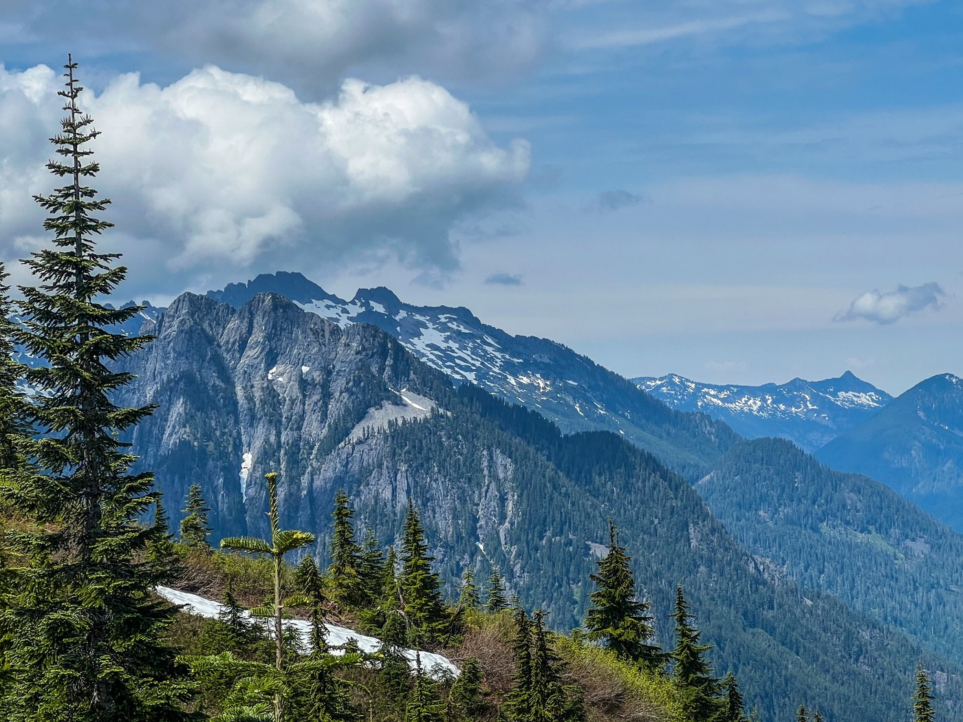
Frog Mountain is one of the newer trails in the Skykomish Ranger District, built through years of WTA volunteer work parties. The 7.4-mile round trip gains about 2,166 feet through lush forest before breaking into open terrain with views stretching west to Glacier Peak, Sloan, and Kyes. The upper meadows are the real draw, with wildflowers in summer and a sense of space that feels earned for the effort.
The trail starts from a parking area near Jack's Pass, reached via the Index-Galena Road. Recent trip reports (late 2025 and early 2026) warn that Beckler River Road (FR 65) is washed out past the end of pavement, and the Index-Galena road approach has its own washout near Troublesome Creek. High-clearance vehicles may be able to get through, but most cars will be stopped. Check current road conditions before committing.
When access is open, this is a solid moderate-to-hard day hike that rarely feels crowded. Dogs are welcome on leash. There is a pit toilet at the trailhead (about 100 feet up the trail) and a backcountry privy further along. The trail sees year-round use from determined locals, with snow travel required from roughly November through May.
Astronomy
Trail Conditions
“No snow, no bugs and flowers are starting to bloom.”
Last report: Jun 4, 2026
Scorecard
Safety & Considerations
Today's Hazard
- Strong sun — sunscreen, hat, and sunglasses recommended
Persistent Hazards
- road washouts on Beckler Road and Index-Galena Road (check current status)
- snow on upper trail through early summer
- potholes and debris on access road
Getting There
Good-sized parking lot at the trailhead. No fee required. Pit toilet located about 100 feet up the trail.
From Highway 2, take the Index turnoff. Follow Index-Galena Road north about 14 miles to where it becomes gravel, then continue 2.4 miles uphill to Jack's Pass (unsigned intersection). Turn left onto a narrow gravel spur for 0.1 miles to the parking area. As of early 2026, road washouts may block access. Verify conditions before driving.
No particular rush needed. The trail holds shade well in the lower section, so afternoon starts work fine in summer.
Recent Reports
This is a very pleasant time of year to hike here. No snow, no bugs and flowers are starting to bloom.
Trail is fabulous. Such great condition and fabulous views.
This is a great spring hike as it melts out pretty fast and you get great access to stunning views of still snow clad peaks. We drove to the trail head via the Beckler Road, good condition with the exception of a marked ten foot or so piece that's missing from the south bound travel lane quite near the turn off from High Way 2.
Similar Hikes


