Deception Pass
Central CascadesBest Jul–Oct
A long valley-to-pass route through the heart of the Alpine Lakes Wilderness, linking Deception Creek to the PCT and some of the best lake basins in the range.
About This Trail
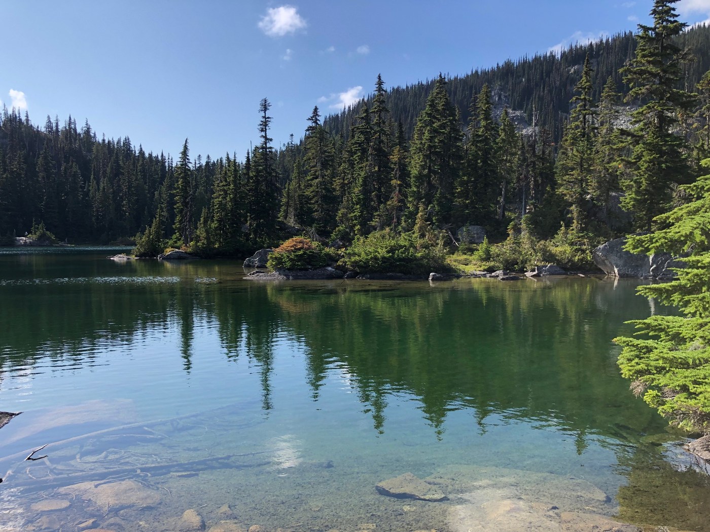
Deception Pass is a through-route connecting the Deception Creek drainage on the north side to the Cle Elum River valley on the south, crossing the Cascade crest at 4,500 feet. The full out-and-back from the north side is 28 miles, but most people use it as a connector to build multi-day loops through the Alpine Lakes Wilderness. The pass sits at the junction of several high routes and the Pacific Crest Trail, making it a crossroads for backpackers.
From the Deception Creek trailhead off Highway 2, the first five miles follow the creek through deep mossy forest with established camps at regular intervals. The Tonga Ridge Trail junction appears at 4.8 miles. Beyond that the trail climbs gradually for another 2.5 miles before splitting: one mile uphill to the PCT, or 3.4 miles continuing south to Deception Pass proper. From the pass you can drop into Hyas Lake, reach Marmot Lake, push south to Lake Clarice, or connect to Tuck and Robin Lakes via the Tucquala Meadows approach.
The southern approach from Tucquala Meadows is shorter but the road in from Salmon la Sac is rough. Either way, plan on at least two days. Trail conditions are generally good thanks to regular WTA work parties, though snow can linger at the pass into July. Northwest Forest Pass required at the Deception Creek trailhead.
Forecast
Astronomy
Trail Conditions
“Lots of wildflowers out-blue camas lily, stonecrop, white fawn lily, purple sanicle.”
Last report: May 23, 2026
Scorecard
Safety & Considerations
Today's Hazard
- Strong sun — sunscreen, hat, and sunglasses recommended; water reflection adds glare near the lake
Persistent Hazards
- Snow lingers at the pass into July
- Creek crossings may be difficult during high water
- Long distance between trailhead and pass with limited bail-out options
Getting There
Deception Creek trailhead: from Highway 2 at mile marker 56.6 between Skykomish and Stevens Pass, turn south onto FR 6088 and drive one mile. Northwest Forest Pass required. Trailhead can be packed on summer weekends. Tucquala Meadows trailhead: accessible from Salmon la Sac via FR 4330, rough road for the last 12 miles.
North side: Highway 2 to FR 6088 at mile marker 56.6, one mile to trailhead. South side: I-90 exit 80, north on SR-903 through Roslyn to Salmon la Sac, then FR 4330 for 12 rough miles to Tucquala Meadows. Most parties start from the north for better road access.
Early start recommended. From the north trailhead, the pass is a full day of hiking each way. Most people camp at established sites along Deception Creek on night one. Summer weekends see heavy use at the popular lake basins.
Recent Reports
Updated 5/23, I was able to scout the the Deception Pass Trail #1376 all the way to the junction with Tuck and Robin Lakes. The trail is in rough shape after winter storms.
I started from the parking lot on Bowman Bay and because of the low tide I got to skip going over the headland and walked straight to Reservation Head. Lots of wildflowers out-blue camas lily, stonecrop, white fawn lily, purple sanicle.
Our work party focused on the trail between the Tucquala Meadows trailhead and the junction to Tuck and Robin Lakes. The trail is now in good shape from the trailhead to Deception Pass.
Similar Hikes


