Camas Meadows
Central CascadesBest May–Jun
A protected Teanaway meadow where native camas lilies put on one of the best wildflower shows east of the Cascade crest, but you will need a DNR permit to walk in.
About This Trail
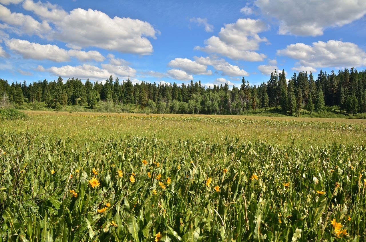
Camas Meadows is a DNR-managed natural area in the Teanaway basin south of Highway 97, protecting one of the largest remaining camas lily populations in the state. The meadow also harbors rare endemic species including Wenatchee larkspur and checker mallow. During peak bloom in late May through mid-June, the meadow turns a deep blue-purple that is genuinely striking.
Here is the catch: the meadow itself is closed to foot traffic without a special permit from DNR. Multiple trip reports confirm that entry is by permit only, and the parking area has been used as a staging zone for road work. You can still view the meadows from the logging roads that ring the perimeter, and DNR typically offers guided walks in June. Check with the Southeast Region DNR office before making the drive.
The surrounding logging roads offer their own exploration. Some hikers use the road network to attempt Camas Mountain, though the routes are unmarked and require bushwhacking above the road ends. The area is quiet and rarely visited outside of bloom season. A Discover Pass is required for parking.
Astronomy
Trail Conditions
“I drove to the parking area for the meadows and it's currently a staging area for some road work nearby.”
Last report: Nov 3, 2025
Scorecard
Permits / Passes
Safety & Considerations
Today's Hazard
- Strong sun — sunscreen, hat, and sunglasses recommended
Persistent Hazards
- Meadow access requires DNR permit
- Unmarked logging road network is easy to navigate wrong
Getting There
Small pulloff at the meadow trailhead off Camas Creek Road. Discover Pass required. The lot has been used as a road work staging area, so conditions vary. Confirm access before driving out.
From the junction of Highway 97 and Highway 2 east of Leavenworth, head south on Highway 97 about 5 miles. Turn left onto Camas Creek Road and drive 3.1 miles to a fork marked with mailboxes. Take the left fork; parking is on the right. Carry a map for the spur roads.
Best visited during DNR guided walks in June. If going on your own, morning light is best for wildflower viewing. Plan 1 to 2 hours for the road walk around the meadow perimeter.
Recent Reports
I drove to the parking area for the meadows and it's currently a staging area for some road work nearby. It's not possible to visit the meadows anyway without a special permit.
We attempted to reach the Camas Mountain summit but fell short due to a lack of trail and minimal desire to bushwack. Starting from the yellow gate near the Camas meadow parking area, we walked road 1000 to a sharp right turn onto road 1200.
Super nice trip up to the summit of Camas Mountain. Camas Meadows is still closed, and entry to the meadows is only by permit per the DNR sign posted at the trailhead.
Similar Hikes


