Basalt Peak via Basalt Pass
Central CascadesBest Jul–Oct
A steep climb through old growth to open ridge walking and a 360-degree Entiat Mountains summit.
About This Trail
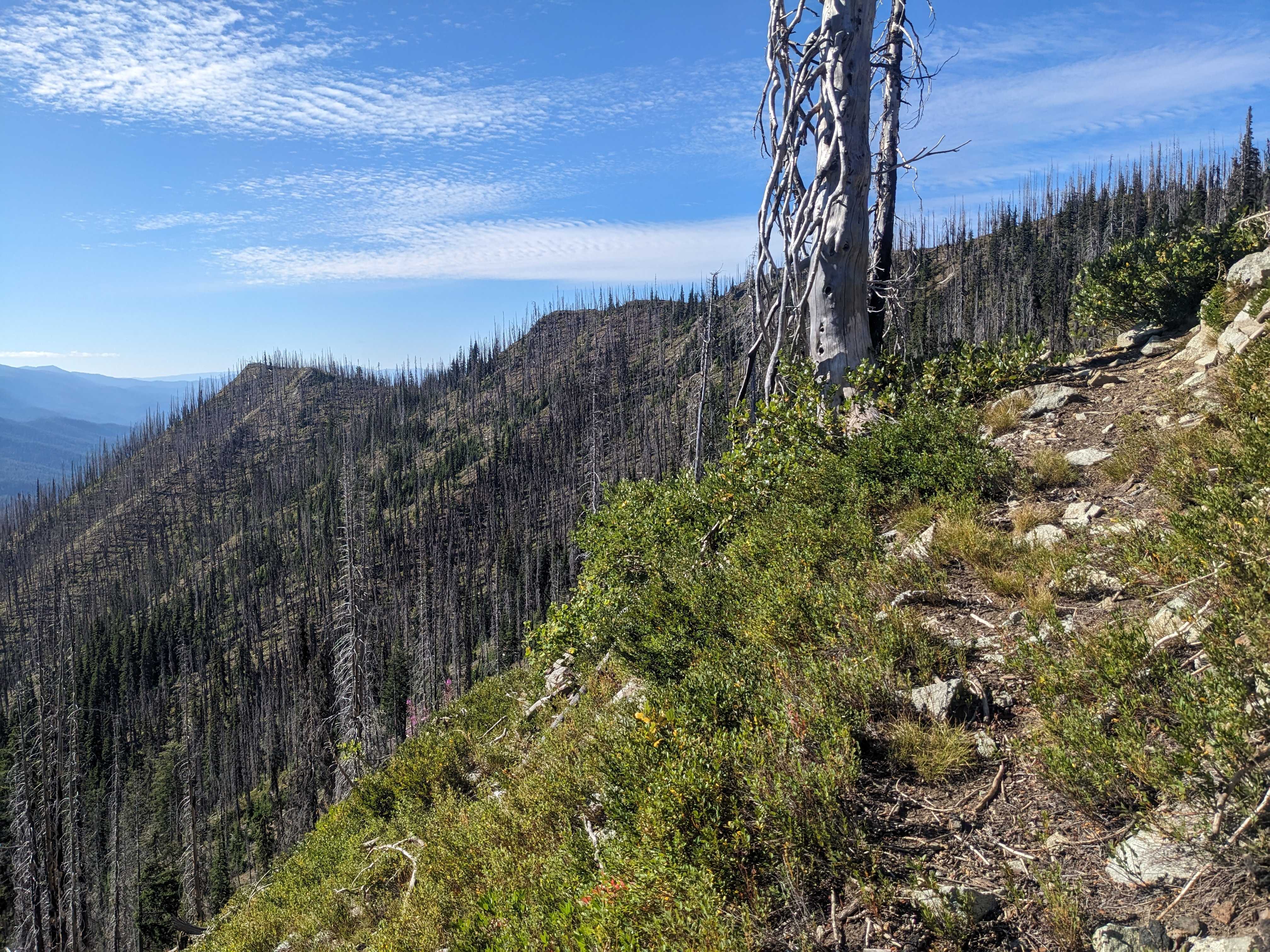
Basalt Peak delivers 360-degree views of the Entiat Mountains and surrounding wilderness areas from its 6,000-foot summit, reached via one of the steepest approach trails in the region. The route begins with the punishing Basalt Pass climb -- over 1,200 feet in the first mile through old-growth forest -- before turning north onto the unsigned but visible Basalt Ridge trail.
Above the pass, the character shifts dramatically. The trail emerges from forest into open ridgeline walking through a substantial burn area, exposing views of the Henry M. Jackson and Glacier Peak Wildernesses. About 0.3 miles past where the ridge fully opens, a faint spur branches left toward the true summit. The final approach requires some routefinding and scrambling on exposed terrain. A helmet is recommended for the summit push.
The Chiwawa River Road area was affected by the Pomas Fire in summer 2025, and access may be impacted. Check with the Wenatchee River Ranger District for current road and trail status before heading out. Parking at the trailhead is minimal -- plan to arrive early or accept a narrow roadside pullout.
Astronomy
Trail Conditions
“Thank you to those who put in a ton of hard work to get the road cleared!”
Last report: Jun 28, 2026
Scorecard
Very few visitors. The steep approach and limited parking keep crowds away. Expect solitude on the ridge.
Safety & Considerations
Today's Hazard
- Strong sun — sunscreen, hat, and sunglasses recommended
Persistent Hazards
- Loose rock near the summit
- Exposed ridgeline walking through burn area
- Routefinding required for final summit approach
- Pomas Fire (2025) may have impacted access road and trail
Getting There
Extremely limited. One pull-out before the trailhead fits 1 car, another area past the trailhead fits several. About 9.5 miles of gravel road on Chikamin Ridge Road to reach the trailhead. No restrooms.
From the Basalt Pass trailhead on Road 6510, climb steeply to Basalt Pass. At the pass, turn left (north) onto the unsigned Basalt Ridge trail. Follow the ridge to where it opens up, then look for a faint spur branching left about 0.3 miles past the opening for the summit.
Recent Reports
The road is in great shape-- just watch for a few surprise dips. Thank you to those who put in a ton of hard work to get the road cleared!
I gave it a shot and today was not the day for Basalt Peak. Plan A was to hike Basalt Peak via Basalt Ridge.
These trails and the chiwawa river road are now closed due to the Pomas Fire. https://www.
Similar Hikes


