Barclay Lake
Central CascadesBest May–Oct
An easy walk through old-growth forest to an alpine lake beneath Baring Mountain's towering north face.
About This Trail
The trail follows Barclay Creek through a narrow valley hemmed by Gunn Peak (6,240 ft), Merchant Peak, and Baring Mountain. Old-growth Douglas fir, western hemlock, and red cedar line the first mile, their canopy dense enough to keep the understory damp year-round. Maidenhair ferns, trillium, and queen's cup carpet the forest floor in late spring. At mile 1.2, a log bridge with a single railing crosses Barclay Creek.
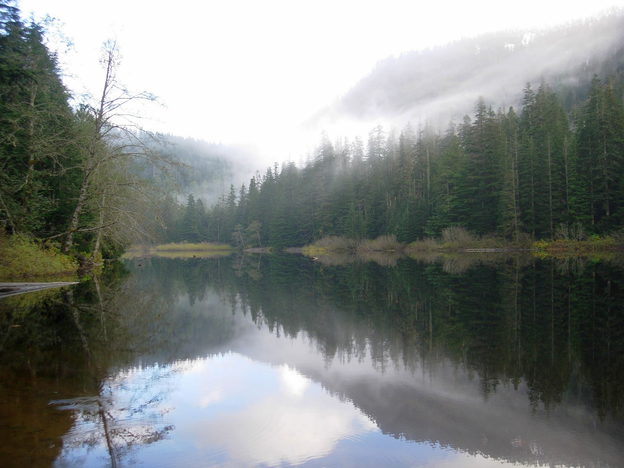
The lake sits at 2,423 feet in a glacially carved basin. Baring Mountain's north face rises 3,000 vertical feet directly from the water, one of the steepest faces in the Cascades visible from a trail this easy. On calm mornings the reflection is near-perfect. Established campsites ring the eastern shore, and the lake supports brook trout.
The valley receives 150 to 200 inches of precipitation annually. Turnpikes and drainage structures manage the worst sections, but mud is a constant companion, particularly in the final half mile. The trail gains only 500 feet over 2.2 miles, making it one of the most accessible alpine lake hikes near Stevens Pass.
Seasonal Highlights
Astronomy
Trail Conditions
FR-6024 access road suffered a landslide in late 2025, approximately 0.7 miles from Highway 2. Road remains partially collapsed and impassable to vehicles. USFS actively working on restoration as of April 2026. The trail itself is in typical condition once reached.
“The only part the was a little steep was the up hill after the small river crossing.”
Last report: Jul 7, 2026
Scorecard
One of the most popular easy hikes near Stevens Pass. Summer weekends fill the 20-space lot early. Quieter on weekdays and in shoulder seasons.
Safety & Considerations
Today's Hazard
- Strong sun — sunscreen, hat, and sunglasses recommended; water reflection adds glare near the lake
Persistent Hazards
- Mud is persistent year-round, especially the final half mile
- Log bridge at mile 1.2 has a single railing and can be slippery when wet
Getting There
Small lot holds roughly 20 vehicles. Privy available. No overflow lot; cars line the road when full.
Recent Reports
The trail was pretty easy and not too steep. The only part the was a little steep was the up hill after the small river crossing.
Nice easy hike for Sky who is recovering from knee surgery. We arrived about 9 am and there were about 30 cars at the TH.
We had a late morning start from Seattle. Traffic was surprisingly smooth on Hwy 2; we got to the trailhead at 1:30pm to some cars leaving.
Similar Hikes


